Stage 07 From Glacier to Wine North Route Wörschach - Lassing

Kirándulás

© Steiermark Tourismus/bigshot.at - bigshot.at

© Steiermark - Das Grüne Herz

© Steiermark Tourismus/Harry Schiffer - Harry Schiffer

© Steiermark Tourismus/Gery Wolf - Gery Wolf

© Steiermark Tourismus/Harry Schiffer - Harry Schiffer

© (c) Steiermark Tourismus/Manfred Polansky - Manfred Polansky

© Steiermark Tourismus/Manfred Polansky - Manfred Polansky

- Rövid leírás
-
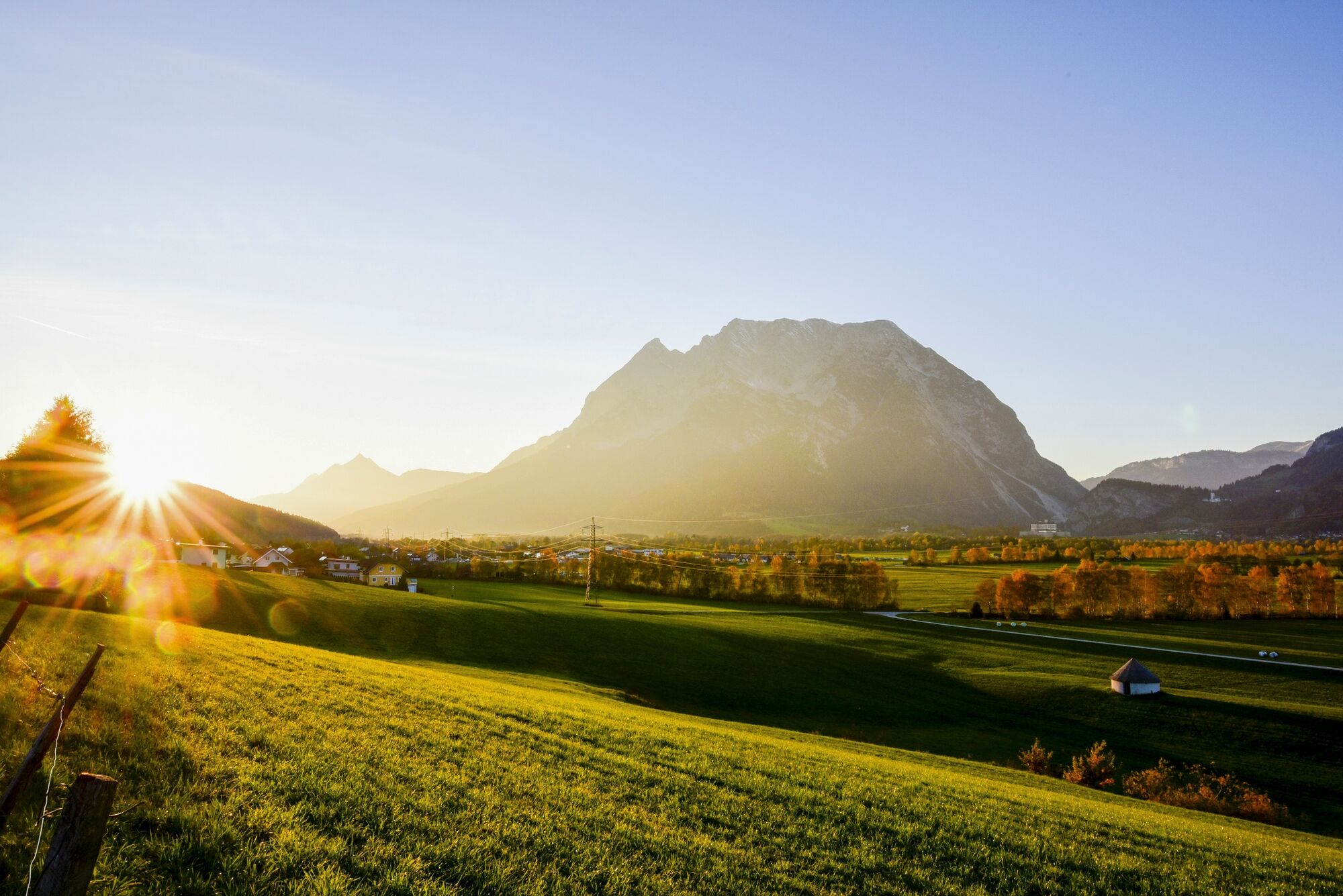
The first part of the tour leads through the middle Enns Valley, which is characterized above all by numerous Natura 2000 Europe protected areas such as the Wörschacher Moss in the immediate vicinity of the river. The Enns, which separates the limestone mountains in the north from the primeval mountains in the south, is not only a raging river in places here, but also harbors quiet side arms. Finally, the route climbs a bit to the stage town of Lassing, a high valley nestled between the Enns Valley and the Paltental Valley to the west of the imposing Strechau Castle.
- Nehézség
-
könnyű
- Értékelés
-
- Útvonal
-
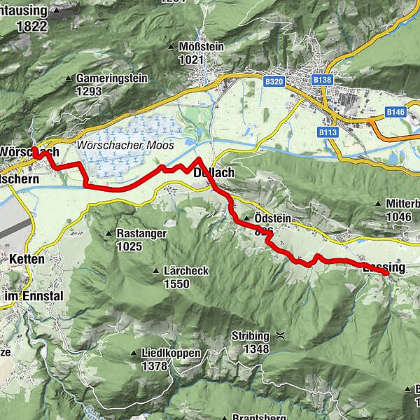
Wörschach0,2 kmDöllach5,8 kmStein7,1 kmUnterberg9,6 kmWieden10,2 kmTreschmitz11,2 kmPfarrkirche Lassing11,8 kmLassing12,0 km
- Legjobb szezon
-
janfebrmárcáprmájjúnjúlaugszeptoktnovdec
- Legmagasabb pont
- 801 m
- Úti cél
-
Lassing
- Magassági profil
-


-

-
SzerzőA túra Stage 07 From Glacier to Wine North Route Wörschach - Lassing a outdooractive.com feltéve, hogy.
GPS Downloads


Általános információ
Frissítő megálló
Flora
Fauna
További túrák a régiókban
-
Gesäuse
2225
-
Grimming - Donnersbachtal
976
-
Liezen
317


