Hirschenstein high-altitude hike - No. 53


- Rövid leírás
-
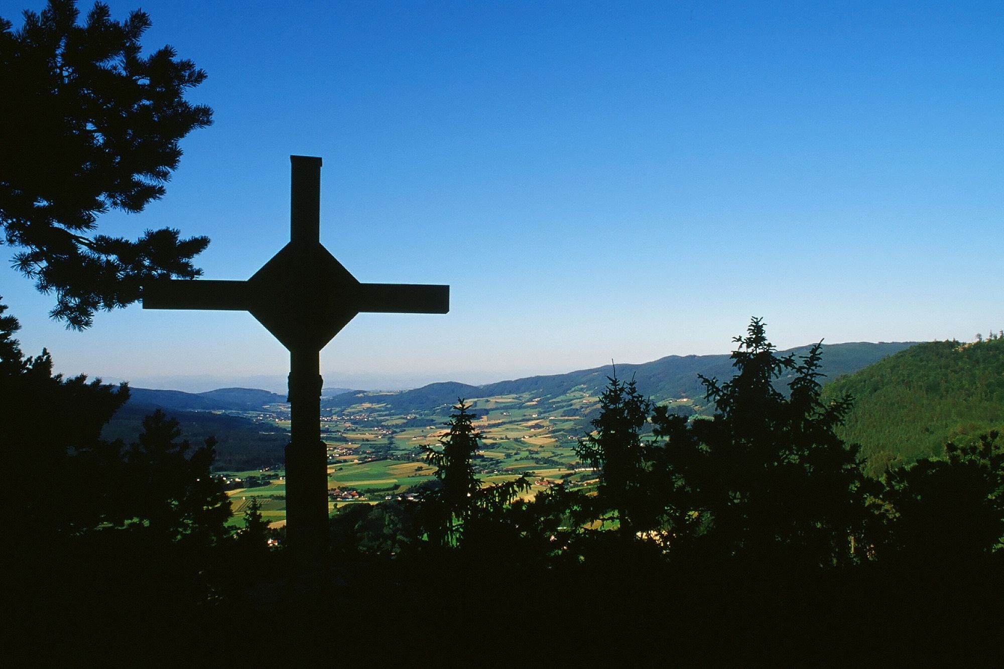
The Hirschenstein in the Weinsberg Forest is one of the most beautiful vantage points in the Southern Waldviertel hiking region. An extended walk that takes you to a real summit cross including a wonderful distant view.
- Nehézség
-
közepes
- Értékelés
-
- Kiindulópont
-
Laimbach/Ostrong, Parish Church
- Útvonal
-
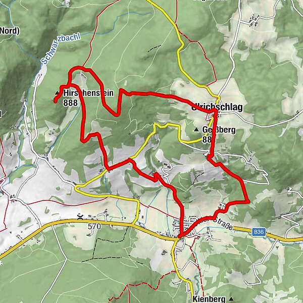
Pfarrkirche LaimbachSchreinersLaimbach am Ostrong0,1 kmPyhra2,3 kmHirschenstein (888 m)5,1 kmUlrichschlag9,0 kmGasthaus Ballwein9,1 kmEggathon9,9 kmGrünbach11,5 kmWögring11,9 kmLaimbach am Ostrong12,4 kmPfarrkirche Laimbach12,5 kmSchreiners12,5 km
- Legjobb szezon
-
janfebrmárcáprmájjúnjúlaugszeptoktnovdec
- Leírás
-
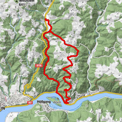
The hike to Hirschenstein is a delicacy of the hiking region Southern Waldviertel. From there you can enjoy a wonderful view over the Yspertal and even further beyond. In clear weather conditions, the view reaches as far as the Gesäuse mountains, the Haller Mauern and the Phyrgas - Pre-Alps. One of the starting points to this vantage point begins in Gutenbrunn in the Weinsberg Forest. The second and more challenging option to climb the 884-metre Hirschenstein starts in Laimbach am Ostrong.
- Útvonalterv
-
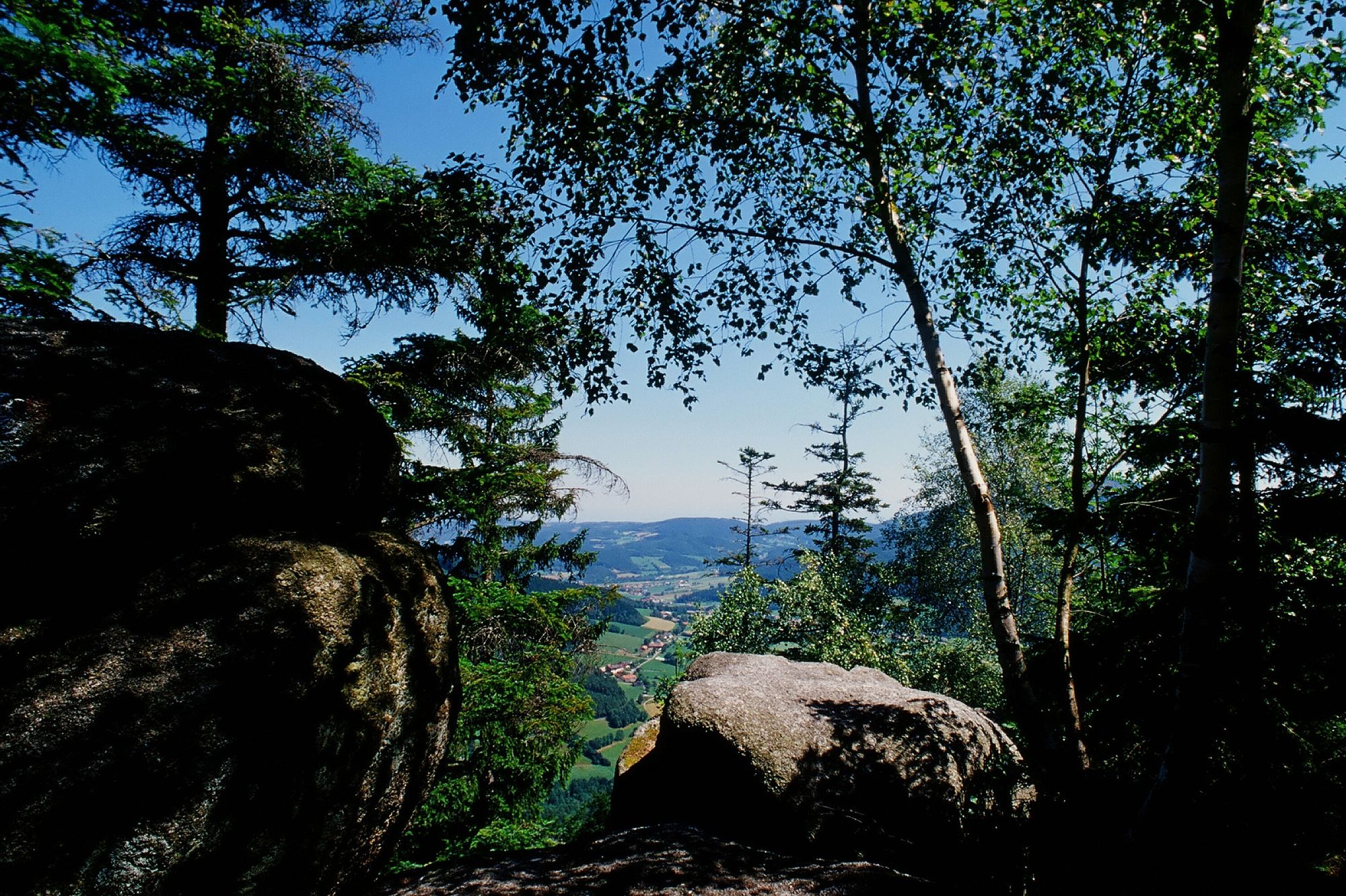
The starting point of the hike is the Laimbach parish church. This trail leads past the Hubertus Chapel and the sports field to Grubhof and Dörfles to the main road to Gutenbrunn (Grubhof - ideal photo and vantage point). Walking 200 m on the main road in the direction of Pyhra, the hike branches off to the right. Following an old path, you reach the Voglhof through a hollow path. From there, the hiking trail leads along a well-maintained fort road, past a shrine, to Ödhof - a vantage point and photo point in the Yspertal valley. Now walk along the spur trail to Hirschenstein (884 m) with a fantastic view into the Yspertal - in clear weather conditions views as far as the Gesäuse mountains, the Haller Mauern and the Phyrgas - Voralpenblick. Take the same path back to Ödhof and then continue through a beech and spruce forest before you reach open terrain (Ulrichschläger Höhe) shortly before Ulrichschlag. In the village itself, the Ballwein Inn invites you to stop for refreshments. With good visibility, you can enjoy a magnificent Alpine panorama from the Schneeberg to the Salzkammergut. Via Eggathon and Grünbach you return to the starting point of the hike.
- Legmagasabb pont
- 945 m
- Úti cél
-
Laimbach/Ostrong, Parish Church
- Magassági profil
-

- További információk
- Odautazás
-
A1 exit Ybbs - Donaubrücke Persenbeug - B36 into Yspertal to Laimbach
- Szerző
-
A túra Hirschenstein high-altitude hike - No. 53 a outdooractive.com feltéve, hogy.


Általános információ
-
Donau Niederösterreich
2286
-
Südliches Waldviertel
935
-
Gutenbrunn
282