


Natrun-Jufen route (Route 3)


Start at the Service Center in Maria Alm and get going right away! Roll over the cemetery to the main road B164. At the bus stop on the village side, it goes steeply up to the TOM Almhütte – here you can...
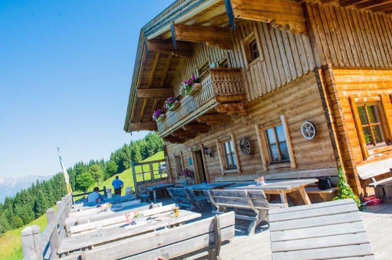
Start at the Service Center in Maria Alm and get going right away! Roll over the cemetery to the main road B164. At the bus stop on the village side, it goes steeply up to the TOM Almhütte – here you can already feel your pulse! From the hut, turn right and cruise on over the Grammlergut to Jufenalm. This is the perfect spot for some cool pics and a short breather! Now comes the fun: a wide path through the Enterwinkl that takes you back to the starting point. Here you can show off your bike skills and enjoy the curves! The route is ideal for everyone who is up for some adrenaline!


Start at the Maria Alm Service Center and follow the signs for MA 03 Natrun - Jufen route. Take the street behind the church to the main road. After 50 m, turn left and ride up the Natrun farm road to the Natrun hut and continue towards the Grammlergut snack station. After the Grammlergut snack station, follow the gently descending Sonnberg farm road. At the Sonnberg fork, turn left uphill towards Jufenalm. Then it's a leisurely ride back to Maria Alm.
Igen
Checked bike equipment with helmet
Sunglasses
Sunscreen
Rain protection
Drinks and a small snack
Necessary medication
First aid kit
Bike map
Fair play!
Ride only on marked paths! Close all gates, barriers, and pasture gates! Observe the traffic regulations! Overtake only at walking pace! Behave respectfully towards other nature users and forestry and hunting staff! Consider animals! Do not leave any litter in nature! Act responsibly! Inform yourself about the weather forecast. Fog and bad weather can come unexpectedly quickly.
Emergency numbers: Alpine emergency: 140, International emergency: 112, Rescue: 144
Arrival from Salzburg: Take the A10 motorway to the Bischofshofen exit, then on the B311 towards Bischofshofen. Follow the Hochkönig federal road/B164 to Maria Alm.
Arrival from Innsbruck/Kufstein: Take the Loferer road/B178 towards St. Johann i.T., then via the Hochkönig federal road/B164 via Saalfelden to Maria Alm.
A valid vignette is required to use the Austrian motorway and expressway network. It is also mandatory to carry a first aid kit, warning triangle, and safety vest. More information at Asfinag.
ÖBB-Scotty: Timetable information
Bus line 620: Timetable information
Hiking bus: Timetable information
Free parking is available at the Natrunbahn
More information about bike routes and activities in the Hochkönig region:
For detailed information about hiking maps, opening hours of the mountain lifts as well as huts and alpine pastures in summer, we recommend visiting the Service Center on site. There, you will not only get the hiking map, but also valuable tips on the best hiking routes and current conditions.
Summer opening hours of the mountain lifts: The mountain lifts offer various opening hours during the summer months, which can vary depending on the weather and season. Please check the current operating hours in advance.
Opening hours of huts and alpine pastures in summer: The huts and alpine pastures in the region are ideal resting places for hikers. Here too, opening hours may differ depending on the season and weekday. Let the friendly hosts advise you about the offers and specialties on site.
For more information, please visit our website: www.hochkoenig.at.
If you have any questions or need specific information, feel free to contact us:
Email: region@hochkoenig.at
Phone: +43 (0)6584 20388
We look forward to helping you and wish you lots of fun exploring the beautiful hiking region Hochkönig!
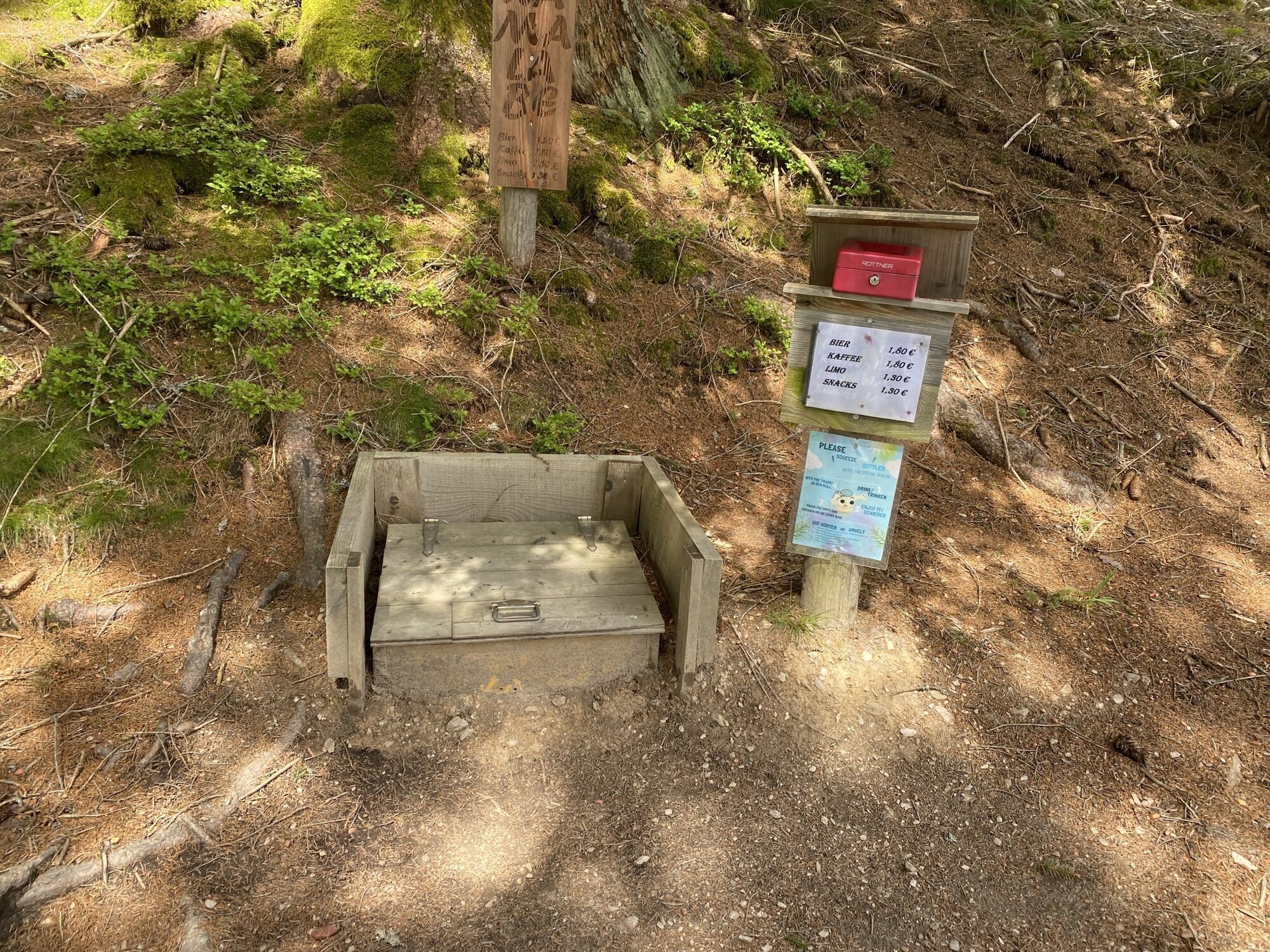
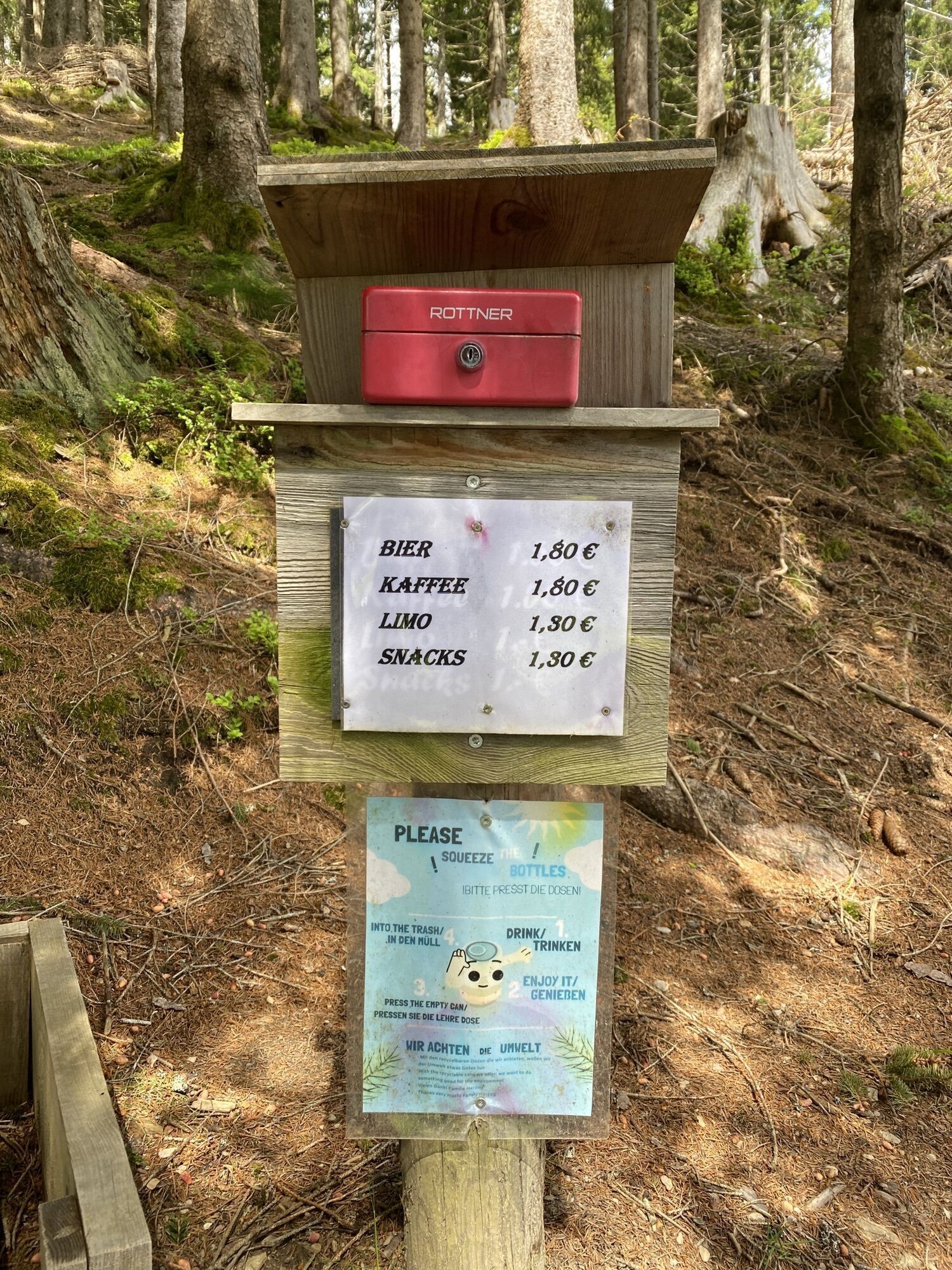
Stop at the Prinzensee platform and enjoy the breathtaking view! After the ride, you deserve a small break. Visit the TOM Almhütte for a hearty snack, or treat yourself to a break at Grammlergut – here you can expect delicious snacks and refreshing drinks. The Jufenalm is also an absolute insider tip for regional specialties. Treat yourself well and recharge your energy for the next stage!
Népszerű túrák a környéken
-
4,8
Summit storming route Taghaube
nehézKirándulás 6,25 km -
4,9
Hochkönig - Gipfel der Gefühle - Matrashaus
nehézKirándulás 20,9 km -
3,8
Hochkönig summit route - main ascent
nehézKirándulás 18,1 km -
4,8
Summit stormer route Lauskopf
nehézKirándulás 8,16 km -
4,7
About the "Four Huts circular route" to Windraucheggalm
közepesKirándulás 10,1 km -
5,0
Königssee - Kärlinger-Haus
Kirándulás 10,1 km -
4,4
Riemannhaus
nehézKirándulás 3,69 km -
4,5
Birnbachloch Leogang, Österreich
közepesKirándulás 5,18 km -
3,9
Mühlbacher Höhenweg
közepesKirándulás 11,2 km -
4,3
Peter-Wiechenthaler Hut
közepesKirándulás 4,32 km
Túrázás & nyomkövetés


Ne maradjon le az ajánlatokról és az inspirációról a következő nyaralásához!
Az Ön e-mail címe hozzá lett adva a levelezőlistához.