© Salzburger Saalachtal Tourismus - Maximilian Nikelski
- Rövid leírás
-
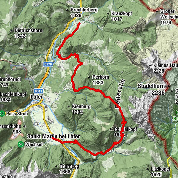
Hiking on the Route of the Gorges: 4th Hiking Day
From Reith via Au and the Obermayrberg over several mountain pastures to St. Martin.
- Nehézség
-
közepes
- Értékelés
-
- Útvonal
-
Reith0,0 kmAuer Wiesen5,0 kmHubertuskapelle6,2 kmHundsalm10,5 kmGasthaus zum Steinerwirt18,2 kmSankt Martin bei Lofer18,4 km
- Legjobb szezon
-
janfebrmárcáprmájjúnjúlaugszeptoktnovdec
- Legmagasabb pont
- 1.350 m
- Úti cél
-
St.Martin
- Magassági profil
-


-

-
SzerzőA túra Route of the Gorges - Hikingday no. 4 a outdooractive.com feltéve, hogy.
GPS Downloads


Általános információ
Ígéretes
További túrák a régiókban