


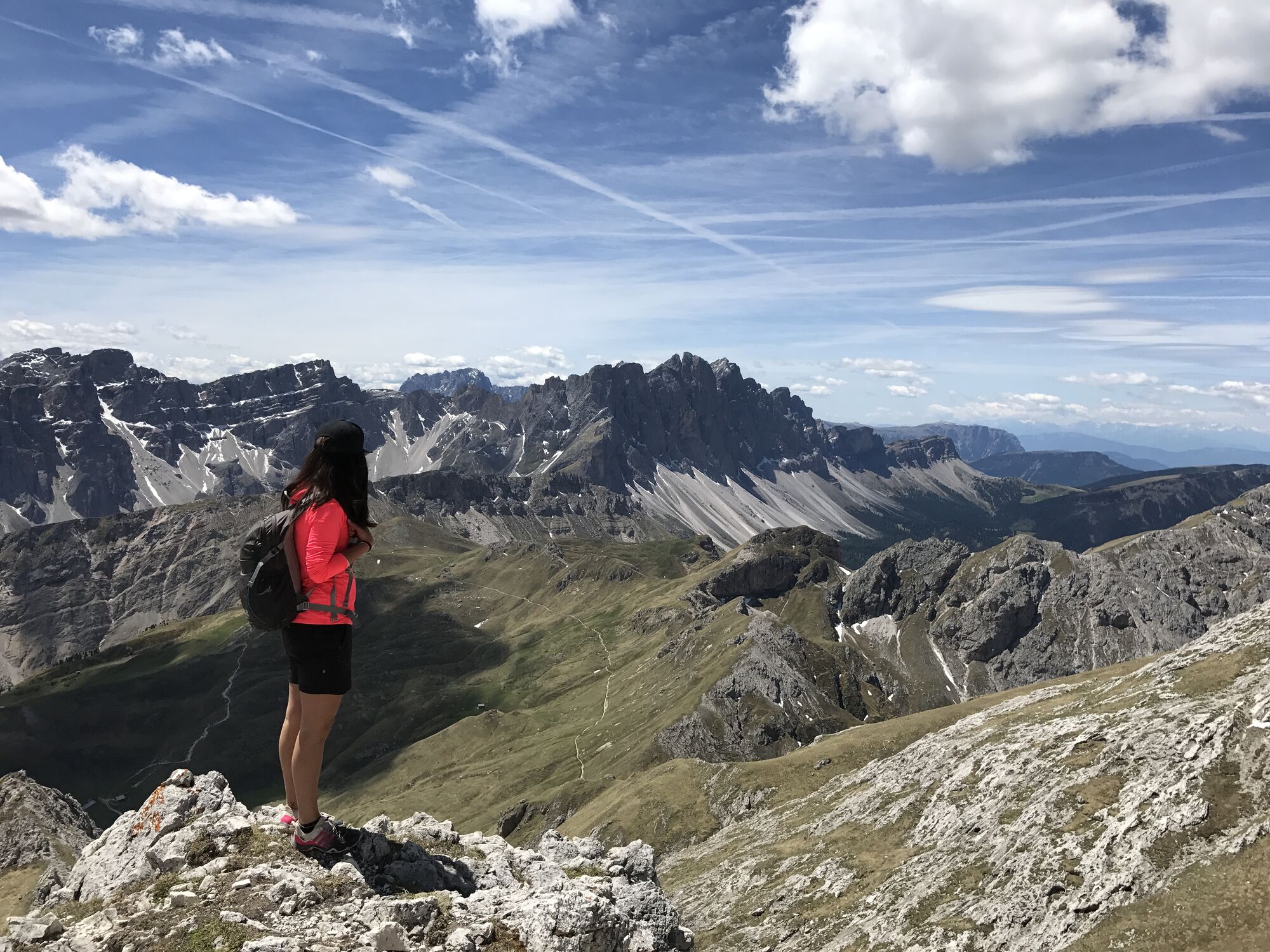
Hike from Würzjoch ridge to the Peitlerkofel mountain


The Peitlerkofel lies amidst a picture postcard Alpine setting on the high alpine pastures. From its summit, there is probably the best panoramic view of the Dolomites. Start at the parking area on the...
The Peitlerkofel lies amidst a picture postcard Alpine setting on the high alpine pastures. From its summit, there is probably the best panoramic view of the Dolomites.
Start at the parking area on the Würzjoch (2,008 m) – which can be reached from Brixen/Bressanone via Lüsen/Luson or via Afers/Eores – and take forest trail no. 8/A to the Munt-de-Fornella-Alm mountain hut (2,067 m). Keep right and follow the signs to Peitler-Rundweg Trail (marking no. 8/A) over the Peitlerwiesen meadows up to the fork at Schartenbach brook. Here trail no. 8/A joins trail no. 4, leading to the Peitlerscharte ridge (2,363 m). Ascend up the dirt track to the ridge. At this lookout point (with bench) there’s a split in the track. Keep left, and cross over the meadows and climb up a number of sharp bends to the ridge separating the Kleine and Große Peitlerkofel mountains. Use the steel cables to pass along the short, exposed passage to the steep summit of the Große Peitlerkofel. Then continue along the final stretch on the easy path to its highest point (2,875 m). To return, follow the same track back to the starting point. As an alternative, you can also climb the Kleine Peitlerkofel from the ridge.
Igen
Népszerű túrák a környéken
-
4,7
The Munkelweg trail beneath the Geisler peaks
közepesKirándulás 9,11 km -
4,0
The Brixen High Mountain Trail on the Plose Mountain
közepesKirándulás 10,9 km -
4,8
Peitlerkofel hiking circuit
közepesKirándulás 12,9 km -
4,4
Three summits tour on the Plose above Brixen
közepesKirándulás 12,8 km -
4,9
Raschötz Umrundung
könnyűKirándulás 14,2 km -
4,5
Vom Col Raiser über die Seceda und Pieralongia zur Regensburger Hütte
közepesKirándulás 10,4 km -
4,0
St.Christina - St.Jakob - St.Ulrich
közepesKirándulás 5,42 km -
4,4
Rif. Pisciadú - Grödner Joch über Mittagstal (676)
könnyűKirándulás 7,61 km -
4,0
Gröden St. Christina, Silvester Scharte, Steviola, Mont de Stevia, Pizascharte, retour 21.06.2016
közepesKirándulás 13,2 km -
4,9
Pisciadùsteig Sella Gruppe
közepesVia ferrata 7,15 km
Túrázás & nyomkövetés


Ne maradjon le az ajánlatokról és az inspirációról a következő nyaralásához!
Az Ön e-mail címe hozzá lett adva a levelezőlistához.