© Warth-Schröcken Tourismus - Sebastian Stiphout

© Warth-Schröcken Tourismus - Medialounge

- Rövid leírás
-
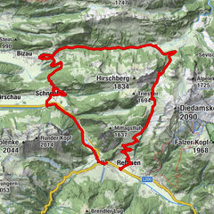
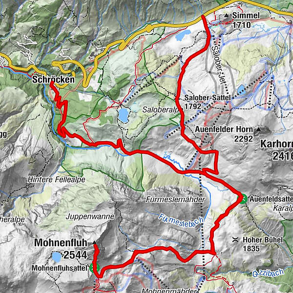
From Warth or Schröcken to the Hochtannbergpass, a wide gravel road leads you over the Salobersattel in Auenfeld. At the Auenfelder hut you pass the Auenfeldsattel to the Geisbühel Alpe. On foot it goes right to the Mohnensattel. Here the ascent to the Mohnenfluh awaits you. Back to the Auenfeld follow the same path. Just take a short rest at the Auenfelder hut before the path leads to Schröcken.
- Nehézség
-
nehéz
- Értékelés
-
- Útvonal
-
Alpekörb0,2 kmSB-Restaurant Salober0,3 kmS10,4 kmSalober-Sattel (1.792 m)1,7 kmAuenfelder Hütte2,7 kmUntere Auenfeldalpe4,0 kmMohnenfluh (2.544 m)9,9 kmUntere Auenfeldalpe15,6 kmMaterialseilbahn Körbersee20,8 kmSchröcken (1.269 m)21,0 km
- Legjobb szezon
-
janfebrmárcáprmájjúnjúlaugszeptoktnovdec
- Legmagasabb pont
- 2.528 m
- Úti cél
-
Hochtannbergpass/Village square Schröcken
- Magassági profil
-


-

-
SzerzőA túra Bike & Hike Mohnenfluh (2.542 m) a outdooractive.com feltéve, hogy.
GPS Downloads


Általános információ
Bennfentes tipp
Ígéretes
További túrák a régiókban