

© Warth-Schröcken Tourismus - Sebastian Stiphout

- Rövid leírás
-
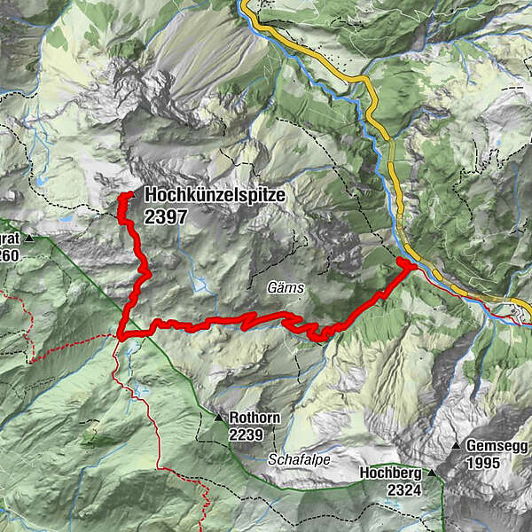
From the Landsteg the path leads along the Schandelstobel to the Schadonapass. The closer you get to the Schadonaalp, the louder you hear the hundred sheep grazing on the lush green alpine meadows. Ca. 100 meters in front of the Biberacher Hütte, which invites you to stop after the descent, the path leads you towards the summit, which is already at 2.112 meters and offers a gigantic view. On the increasingly rocky substrate you will reach the summit of the Hochkünzelspitze. Don’t forget to sign up for the summit book before returning on the same path.
- Nehézség
-
nehéz
- Értékelés
-
- Útvonal
-
Rothenplatz4,8 kmSchadonapass (1.836 m)5,0 kmHochkünzelspitze (2.397 m)7,3 kmSchadonapass (1.836 m)9,6 kmRothenplatz9,8 km
- Legjobb szezon
-
janfebrmárcáprmájjúnjúlaugszeptoktnovdec
- Legmagasabb pont
- 2.366 m
- Úti cél
-
Landsteg
- Magassági profil
-

-

-
SzerzőA túra Hochkünzelspitze (2397 m) a outdooractive.com feltéve, hogy.
GPS Downloads


Általános információ
Frissítő megálló
Ígéretes
További túrák a régiókban


