


Ospizio Sottile


Follow trail 11 that starts from the hamlet of Ondrò Verdebiò/Valdobbia from Regional Road 44 in Gressoney Saint Jean. The trail begins passing between a group of houses and climbs a steep and wooded slope....
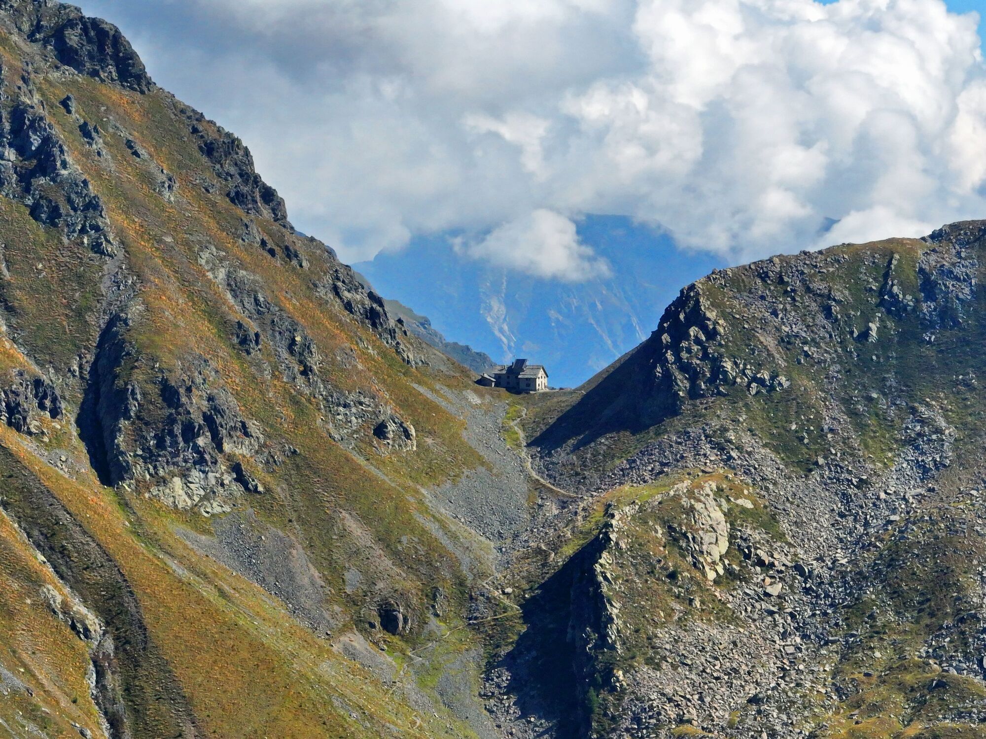
Follow trail 11 that starts from the hamlet of Ondrò Verdebiò/Valdobbia from Regional Road 44 in Gressoney Saint Jean. The trail begins passing between a group of houses and climbs a steep and wooded slope. After about 90 minutes of walking, the slope decreases and the larches become sparser. The valley opens up becoming less steep and very long, at the end of the valley after pastures and some alpine farms you arrive at the Ospizio Sottile refuge, founded in 1823 by a canon on a preexisting structure to host travelers who traded between Valsesia in Piedmont and the Aosta Valley.
The route extends for 4557 m with a total positive elevation gain of 1081 m. The estimated time for the ascent is 3h12. The trail is classified as difficulty E.


You need to reach the hamlet of Valdobbia, you must reach the entrance of the road that leads towards Castel Savoia, here you can park wherever there is space.
The beginning of the trail is beyond the regional road.
The trail climbs steeply and after about twenty minutes you reach the fork between trail 11 for the Sottile, on the left, and trail 11B for the Valle dei Principi, on the right. Obviously, follow trail 11.
Igen
Igen
Hiking boots, backpack, and poles to facilitate especially the descent.
Take Regional Road 44 which leads to Gressoney until reaching the Valdobbia hamlet.
Take the train from Milan or Turin and stop at Pont-Saint-Martin station, then continue by bus towards Gressoney and get off at the Valdobbia stop.
At the height of Valdobbia, turn left towards the road leading to Castel Savoia and in front of the Despar grocery store turn right; at this point there are parking spaces along the Lys river.
Népszerű túrák a környéken
-
4,5
Quintino Sella al Felik 16 08 22
közepesKirándulás 4,42 km -
5,0
Trail Running sulle 3 vette oltre i 3000m
nehézTrailrunning 16,7 km -
Monte Facciabella - Cresta SW - Ayas, Valle d'Aosta/Italia
közepesTéli kirándulás 7,68 km -
4,0
Monte Bieteron da Estoul
közepesHegyi túrázás 8,57 km -
4,0
Punta Gua
közepesHegyi túrázás 14,7 km -
Quintino Sella hut
nehézKirándulás 4,54 km -
Alpenzù Grande
közepesKirándulás 1,06 km -
Gnifetti hutte - pyramide vincent
könnyűKirándulás 4,08 km -
5,0
Corno Bussola
nehézHegyi túrázás 17,7 km -
Monterosa Walser Waeg - Tracciato 15 Km
közepesTrailrunning 15,1 km

Túrázás & nyomkövetés


Ne maradjon le az ajánlatokról és az inspirációról a következő nyaralásához!
Az Ön e-mail címe hozzá lett adva a levelezőlistához.