


Loop of the Évettes refuge


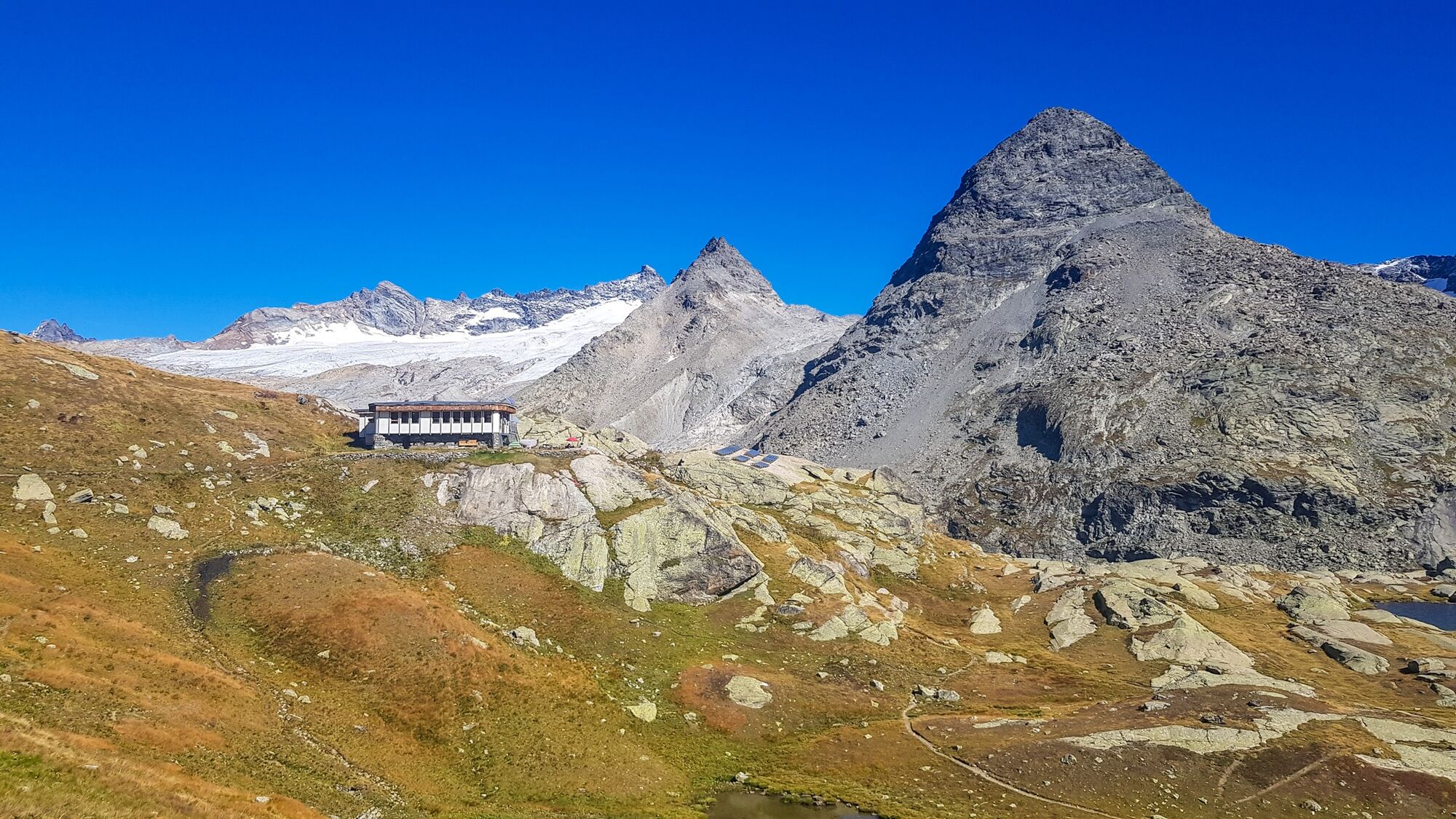
Starting from Écot, you eagerly leave along a well-marked and very promising path. After finding your rhythm, you enjoy the light breeze rising with the altitude. Insects and wildflowers give way to short...
Starting from Écot, you eagerly leave along a well-marked and very promising path. After finding your rhythm, you enjoy the light breeze rising with the altitude. Insects and wildflowers give way to short alpine grasses. Under the gaze of the Albaron and Grande Ciamarella glaciers, you proudly reach the refuge. It has aged, but still offers that precious gourmet stopover much appreciated by children. The high mountains then call you. To extend the change of scenery, the most experienced hikers can reach a little piece of Patagonia by crossing the inevitable Roman bridge. After a climb not to be underestimated, the glacial lake of Grand Méan offers you spectacular sights. Little icebergs in Haute Maurienne Vanoise? Simply fascinating!

To guide you on the ground, consult the "step by step" directional diagram provided in pdf.
Igen
The duration of hiking routes is calculated based on reference paces: 300 m/h ascent, 500 m/h descent, and 4 km/h on flat terrain.
Unexpected events can occur at any time on the routes; provided GPX tracks are non-contractual. They are given for guidance only. The user uses them at their own risk depending on their mastery of technological tools and understanding of the terrain.
Népszerű túrák a környéken
-
BALME Molino Bivouac Loop
közepesKirándulás 7,55 km -
PIALPETTA Val Grande Balcony Trail loop
közepesKirándulás 13,1 km -
5,0
BALME Green Lakes and Lago Paschiet
közepesKirándulás 7,51 km -
Lake Dres - Ceresole Reale
közepesKirándulás 7,24 km -
Goldtoni - Alpenbogen A120 Pialpette-Ceresole Reale
közepeshosszú távú sétaútvonal 18,2 km -
Goldtoni - Alpenbogen A121 Ceresole Reale-Maisonasse
közepeshosszú távú sétaútvonal 32,8 km -
Col de l'Iseran from Termignon
nehézOrszágúti kerékpározás 38,3 km -
Goldtoni - Alpenbogen A119 Balme-Pialpetta
közepeshosszú távú sétaútvonal 19,9 km -
Snowshoe hike to Serrù lake in Gran Paradiso park
közepesHótalpas túra 9,80 km -
5,0
The Grand Méan Lake via the Cirque des Evettes
nehézKirándulás 13,6 km

Túrázás & nyomkövetés


Ne maradjon le az ajánlatokról és az inspirációról a következő nyaralásához!
Az Ön e-mail címe hozzá lett adva a levelezőlistához.