


Circular route Schwändle-Sämelalpe


From the Festsaal Thalkirchdorf, pass the parking lot behind the building to the walking path that runs along the stream towards the sawmill. From there, take the paved Schwandweg or the shortcut up to...
From the Festsaal Thalkirchdorf, pass the parking lot behind the building to the walking path that runs along the stream towards the sawmill. From there, take the paved Schwandweg or the shortcut up to the mountain inn Schwändle (stopover). Continue along the alpine path to the Moosalpe (stopover), shortly thereafter the highest point is reached. We follow the slightly undulating signs towards the Alpsee mountain world. Along the way, pass the Alpen Bärenschwändle and Kuhschwand (stopover).
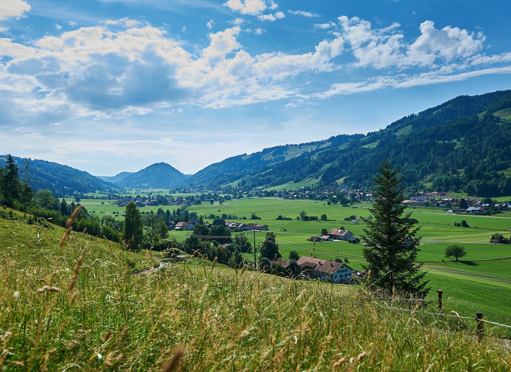
Continue over a beautiful meadow and hiking trail to the Alpe Leitenschwand. Shortly after, the descent follows via the paved Sämelalpweg into the valley. Through Osterdorf, we walk comfortably along the sidewalk by the road back to Thalkirchdorf.
Those who wish can stay after the Alpe Leitenschwand at this elevation and follow the signs to the Alpsee mountain world. From the valley station of the chairlift, return by bus line Immenstadt - Oberstaufen or on foot via Ratholz to the railway line and along the railway track back to Thalkirchdorf.

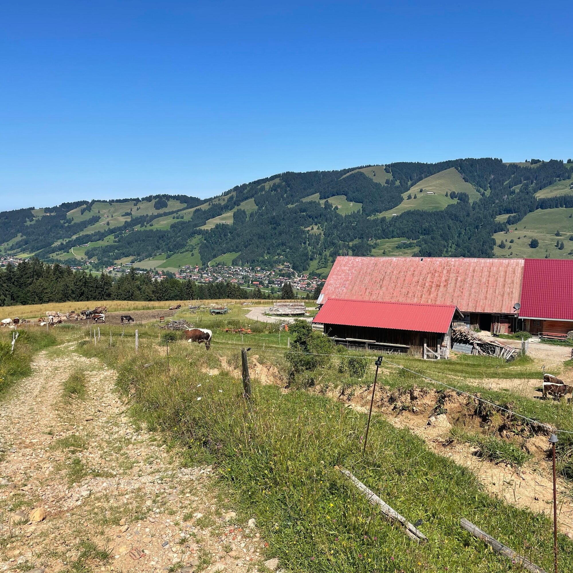
Festsaal Thalkirchdorf - Schwandweg - Schwändle - Moosalpe - Kuhschwand Alpe - Sämelalp - Osterdorf - Thalkirchdorf
Igen
Follow the B308 signs to Oberstaufen - Thalkirchdorf.
Festsaal Thalkirchdorf
A túra webkamerái
-
Oberstaufen
-
Oberstaufen - Biohotel Schratt
-
Oberstaufen - Biohotel Schratt
-
Oberstaufen
-
Alpe Hohenschwand
-
Oberstaufen
-
Oberstaufen
-
Oberstaufen
-
Oberstaufen
-
Oberstaufen
-
Thaler Höhe
-
Oberstaufen
-
Oberstaufen - Rosenalp
-
Hündlebahn Bergstation
-
Thaler Höhe
-
Oberstaufen
-
Ortsansicht Missen
-
Alpsee Bergwelt
-
Alpsee Bergwelt
-
Alpsee Bergwelt - Bärenfalle
Népszerű túrák a környéken
-
4,5
Rindalphorn und Hochgrat
közepesKirándulás 15,6 km -
4,5
Hittisau | Wasserwanderweg
könnyűTanösvény 7 km -
4,9
Hittisau | Über Brücken und durch die Schlucht
könnyűKirándulás 7,12 km -
4,0
Hochgrat
nehézKirándulás 12,2 km -
5,0
Hochgrat round via the Brunnenau
nehézKirándulás 12,2 km -
4,0
Nagelfluh-Überschreitung
nehézKirándulás 22,7 km -
4,7
Hittisau Wasserwanderweg (die richtige Reihenfolge)
könnyűKirándulás 7,06 km -
4,6
Steibis - Buchenegger Waterfalls
közepesKirándulás 6,47 km -
Hochgrat
közepesKirándulás 15,0 km -
5,0
Siedelalpe Runde von See - Immenstadt
könnyűKirándulás 10,3 km
Túrázás & nyomkövetés


Ne maradjon le az ajánlatokról és az inspirációról a következő nyaralásához!
Az Ön e-mail címe hozzá lett adva a levelezőlistához.