


Rough, wild, mystical - hike to Tuass


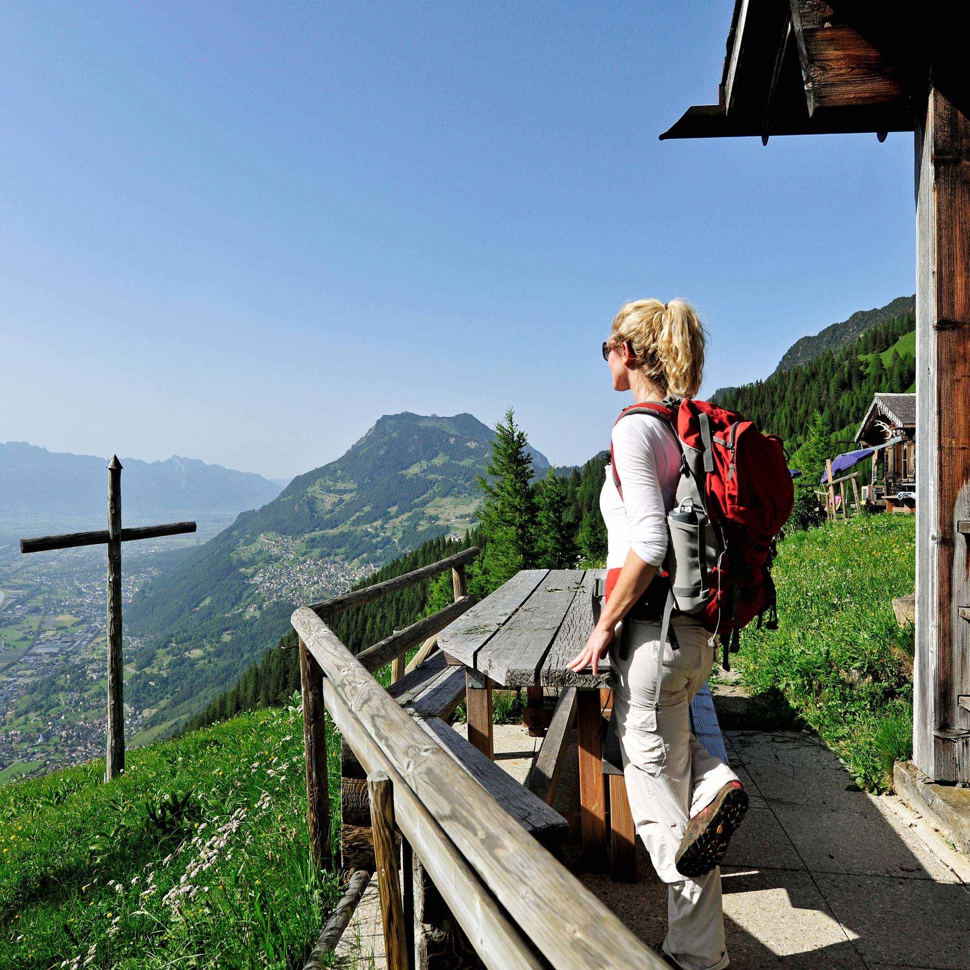
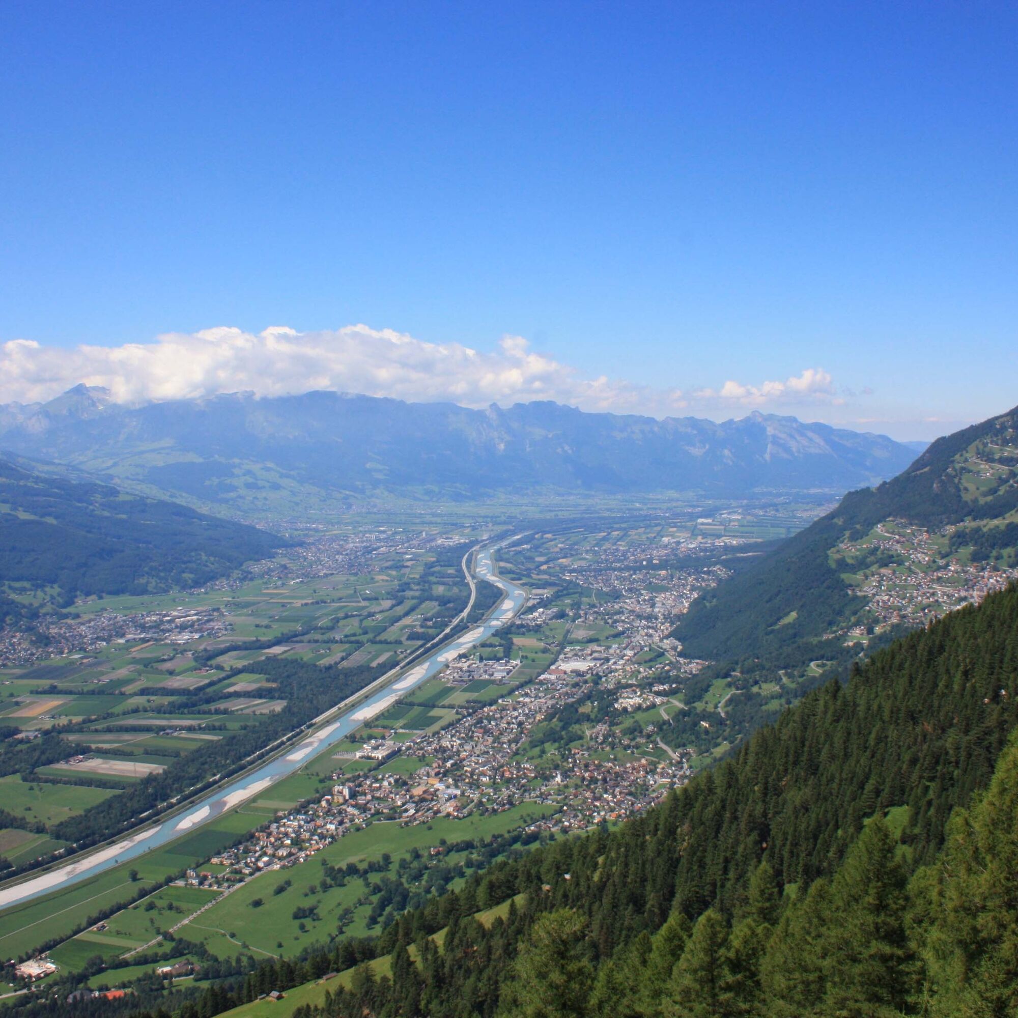
The hike up to Tuass starts at Neugrütt by the Mittagsspitze campsite in Triesen. After about 20 minutes, the hiking trail turns right and leads through the forest. The path then winds in switchbacks up...
The hike up to Tuass starts at Neugrütt by the Mittagsspitze campsite in Triesen. After about 20 minutes, the hiking trail turns right and leads through the forest. The path then winds in switchbacks up to the Maiensäss Magrüel and ends there at a farm track. Some old hay huts here recall the arduous hay harvests of earlier days. After a few steps, the hiker then has the choice between two paths. The more direct path leads over the Blüemlertobel to Tuass. Alternatively, it is possible to follow the longer, steep mountain path with many switchbacks through the beech forest towards Kemmi. Then it continues past Gorn and Platta. After Platta, the mostly flat hiking path continues until Tuass is reached. The return route first follows a hiking path towards Lawena. Once the wide farm track is reached, the path turns right and leads through the Lawenatobel to the Maiensäss Magrüel. From there, it goes down to the Mittagsspitze campsite.


Triesen (Neugrütt) - Magrüel - Blüemetertobel - Tuass - Triesen
To undertake a route, careful planning is required. We recommend that you exchange information with local information offices about the trails and weather conditions in advance. Depending on the season and weather conditions, this route may be closed or interrupted.
Parking spaces at Säga Triesen
Bus stop Säga (Triesen) on the Vaduz – Sargans line
Refreshments:
Alte Eiche at Säga (Triesen), none along the way
Overnight accommodation:
Népszerű túrák a környéken
-
4,6
To the Alpspitz summit cross
könnyűKirándulás 6,27 km -
4,6
Fürstensteig / Drei Schwestern
közepesKirándulás 12,2 km -
4,5
Fürstin-Gina-Weg
közepesKirándulás 12,0 km -
4,8
From Malbun to the Schönberg
közepesKirándulás 12,4 km -
4,8
Pizalun circular route
könnyűKirándulás 7,18 km -
4,6
Wanderung Malbun - Sass-Seeli - Sassförkle - Drei Kapuziner - Schönberg - und Talstation Täli wieder zurück nach Malbun
közepesKirándulás 10,8 km -
5,0
Schesaplana (15.07.2018)
nehézKirándulás 8,68 km -
3,7
Sassweg - von Malbun zum Sass-Seelein
Kirándulás 4,14 km -
4,7
Alvier
közepesKirándulás 3,33 km -
Schönberg - im Herzen der Liechtensteiner Alpen
Kirándulás 11,6 km

Túrázás & nyomkövetés


Ne maradjon le az ajánlatokról és az inspirációról a következő nyaralásához!
Az Ön e-mail címe hozzá lett adva a levelezőlistához.