


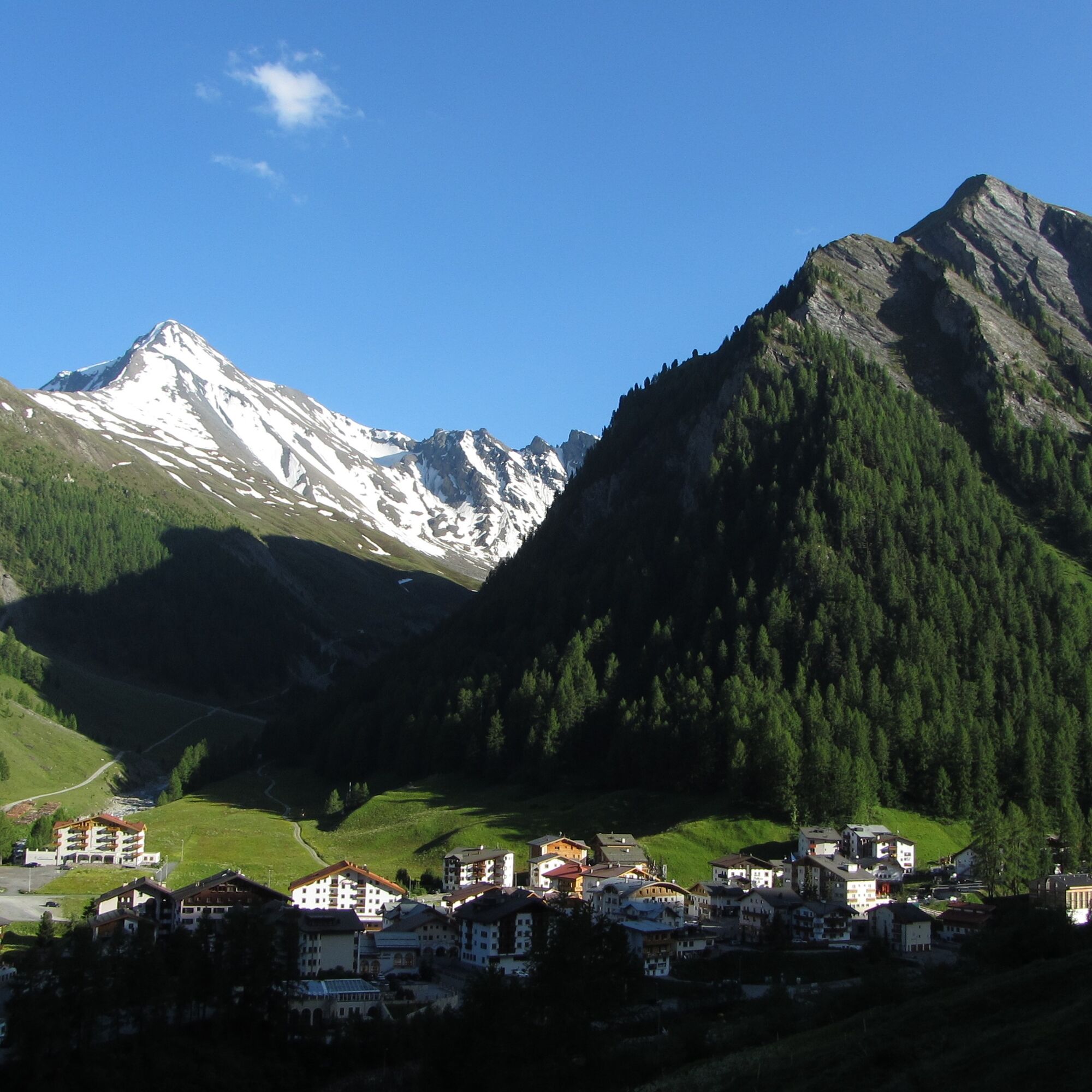
Samnaun Dorf – Musella (circular route)


At the entrance to Samnaun Dorf, cross the bridge over the Maisasbach towards Musella and after a few meters cross the Schergenbach on the right side. The path zigzags 100 vertical meters uphill. Then...
At the entrance to Samnaun Dorf, cross the bridge over the Maisasbach towards Musella and after a few meters cross the Schergenbach on the right side. The path zigzags 100 vertical meters uphill. Then the path runs along the slope above the small forest to the top station of the Musella lift. Then follows the descent back to the village. The walk ends with a stroll through the village street.

Samnaun Dorf Riva, Musellastrasse, zigzag path, Musella, Samnaun Dorf Riva
Igen
Good footwear, rain and sun protection, drinking bottle, first aid kit.
The route was rated under favorable weather conditions; the current weather conditions and forecasts must be strictly observed before starting the route. This hike requires basic alpine experience, orientation skills, hiking shoes are recommended.
Emergency numbers:
144 emergency, first aid
1414 Mountain rescue REGA
112 international emergency number
From the north: via Landquart – Klosters by car shuttle through the Vereina tunnel (Selfranga - Sagliains). Then on H27 via Scuol and Martina to Vinadi. At the Vinadi junction to Samnaun (approx. 1 hour from Vereina south portal)
From the east: via Inn valley road B180 via Landeck to Pfunds, Kajetansbrücke junction and via Spiss to Samnaun.
From the south: via Reschen Pass (Nauders) on B180 to Pfunds, Kajetansbrücke junction and via Spiss to Samnaun.
By the Rhaetian Railway (from Chur, Landquart/Prättigau or from the Upper Engadine) hourly to Scuol-Tarasp station
Further by PostAuto (from Scuol-Tarasp or Martina, Cunfin) hourly to PostAuto stop Samnaun Dorf, Riva
In Samnaun during the day hourly service with the Samnaun bus to PostAuto stop Samnaun Dorf, Riva
Parking lot Chasa Riva at the entrance of Samnaun Dorf
Additional parking lots at Musella or Votlas
Népszerű túrák a környéken
-
5,0
Menta Alm - Scheibenalm
könnyűKirándulás 11,4 km -
4,7
Jamtal lodge
közepesKirándulás 19,6 km -
4,0
Jamtalhütte
közepesKirándulás 19,1 km -
4,3
Sonnenkogel - Friedrichshafener lodge
közepesKirándulás 13,2 km -
5,0
Rundwanderung Berglisee, Mathon
nehézKirándulás 11,1 km -
5,0
Kappl, Diasbahn Bergstation, Niederelbehütte, Diasbahn, Österreich
közepesKirándulás 10,1 km -
Von Galtür zur Jamtalhütte mit Trail
közepesE-MTB 21 km -
5,0
Samnaun Dorf – Muttler
nehézKirándulás 14,8 km -
Suspension Bridge Trail Val Sinestra – Zuort – Griosch – Vnà
közepesKirándulás 11,0 km -
3,6
Bergstation Silvretta nach Patznauener Taja
könnyűKirándulás 11,6 km

Túrázás & nyomkövetés


Ne maradjon le az ajánlatokról és az inspirációról a következő nyaralásához!
Az Ön e-mail címe hozzá lett adva a levelezőlistához.