


3-Lakes Hike


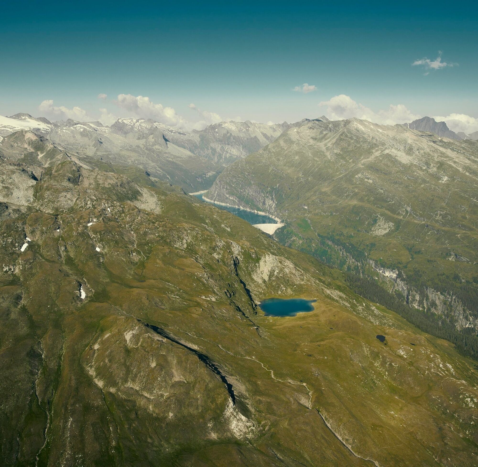
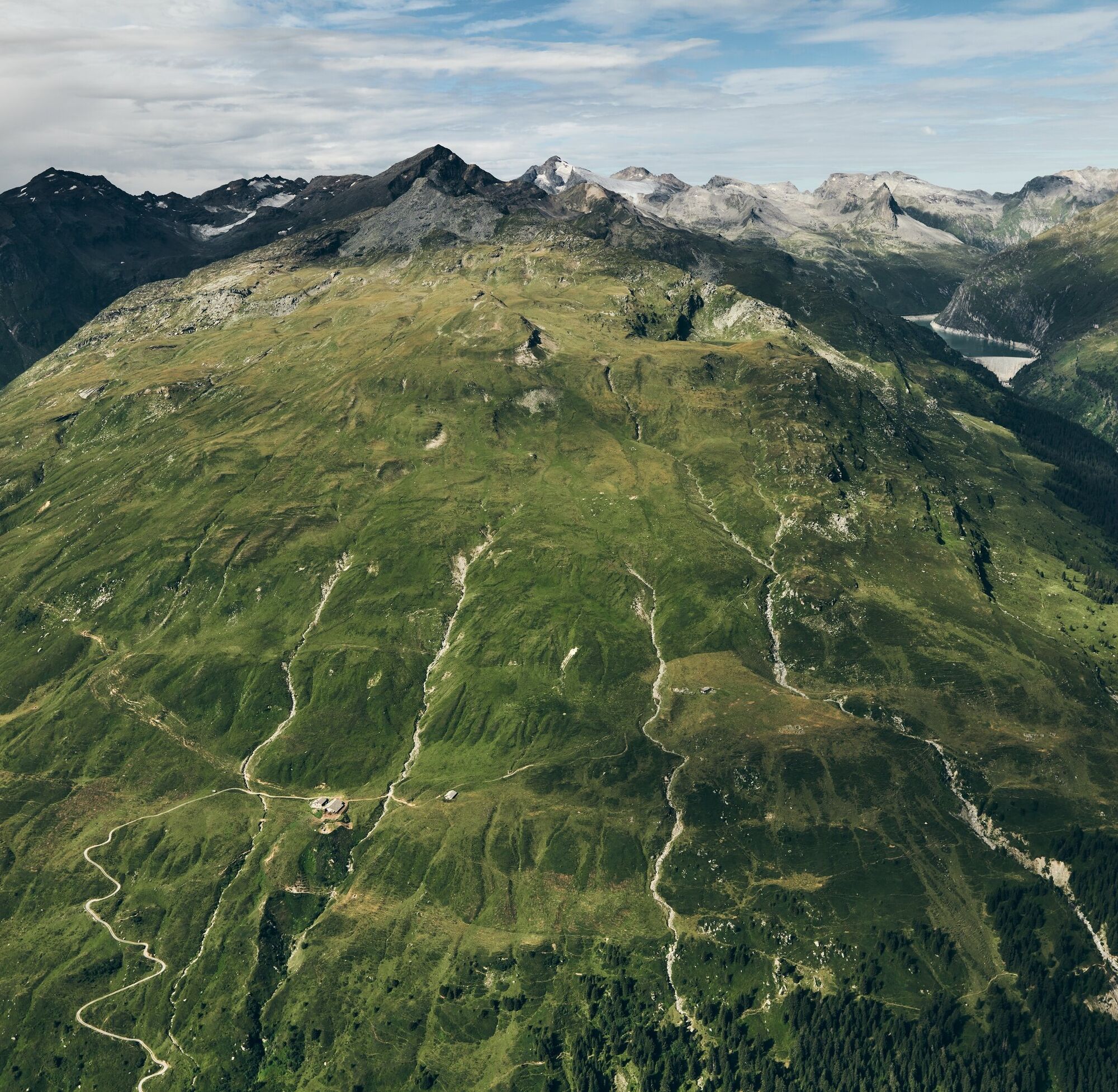
You look down at the Zerfreila Reservoir. South-west can be seen the impressing Zerfreilahorn. North-west to the north you can admire the Frunthorn, the roof mountain, the black and the Faltschonhorn,...
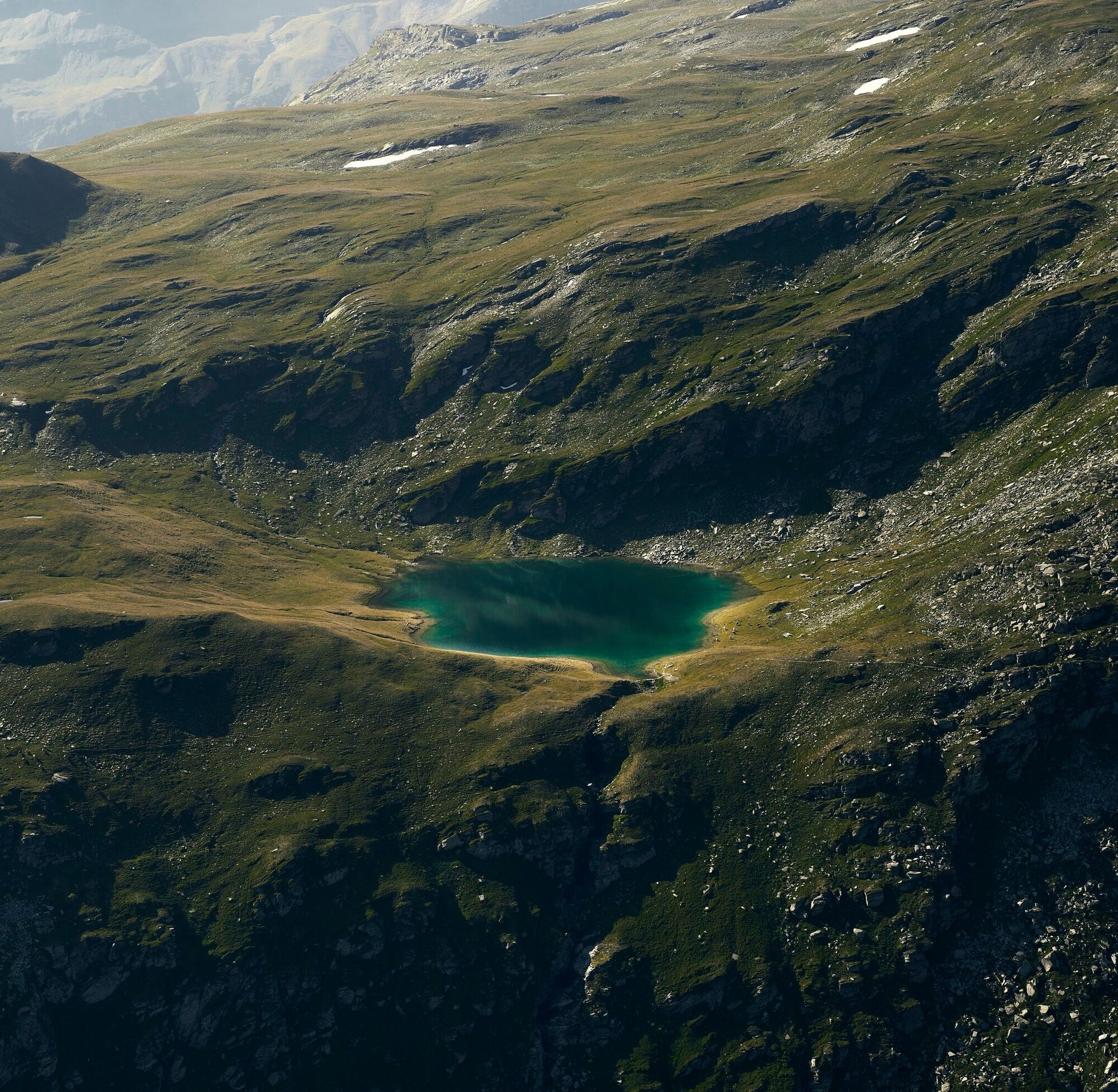
You look down at the Zerfreila Reservoir. South-west can be seen the impressing Zerfreilahorn. North-west to the north you can admire the Frunthorn, the roof mountain, the black and the Faltschonhorn, the Piz Aul and Piz Serenastga. Gorgeous scenery at Guraletschsee (2409 m), in the background the steep walls of the Fanellahorns. Both the Ampervreilasee (2377 m) and the Selvasee (2297 m) are fantastic "embedded" in the landscape. In the grasslands at Selvasee there are ideal places for a picnic. And at the Alp Selva cheese is offered, which has been awarded several times for the good quality.
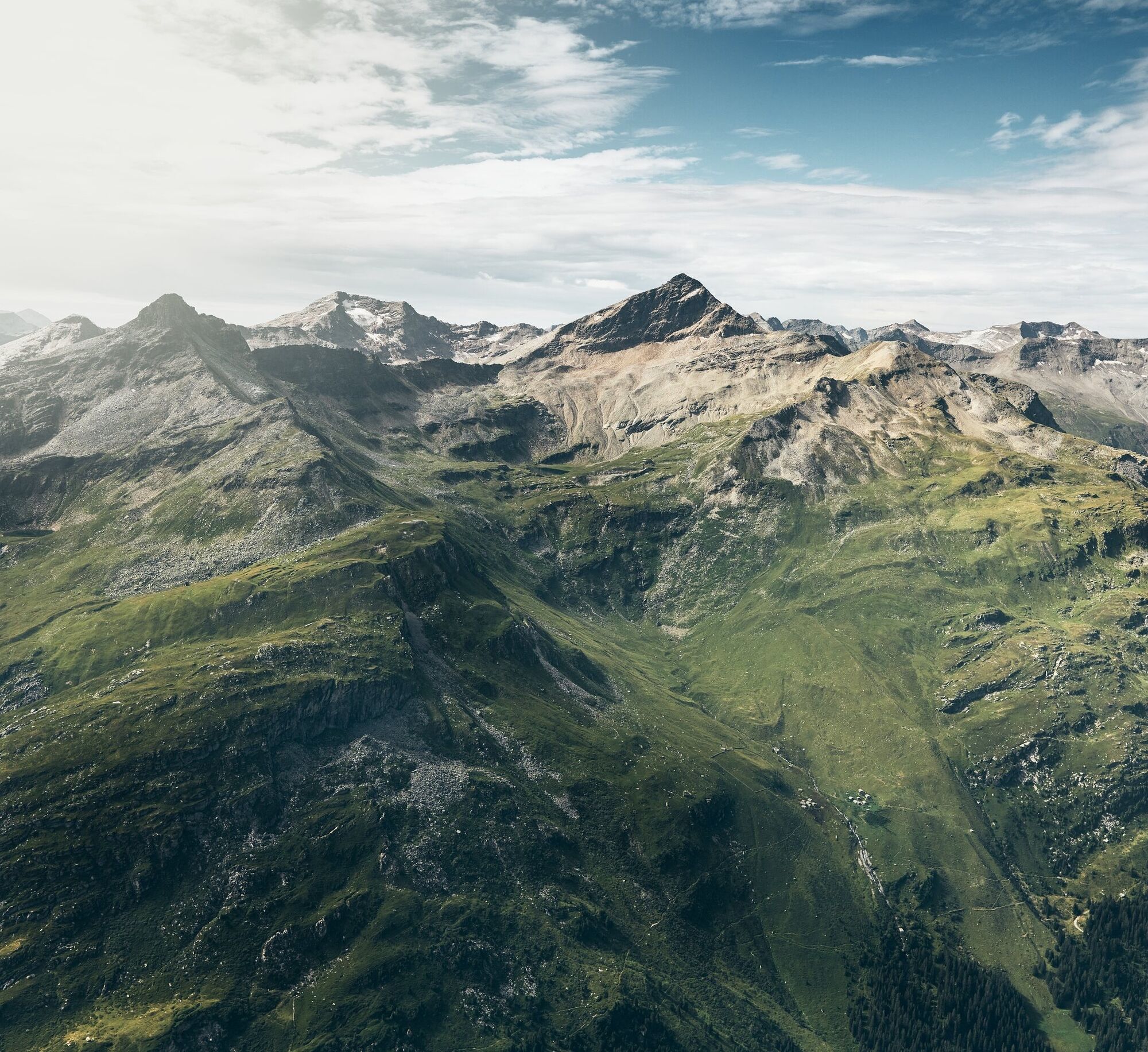
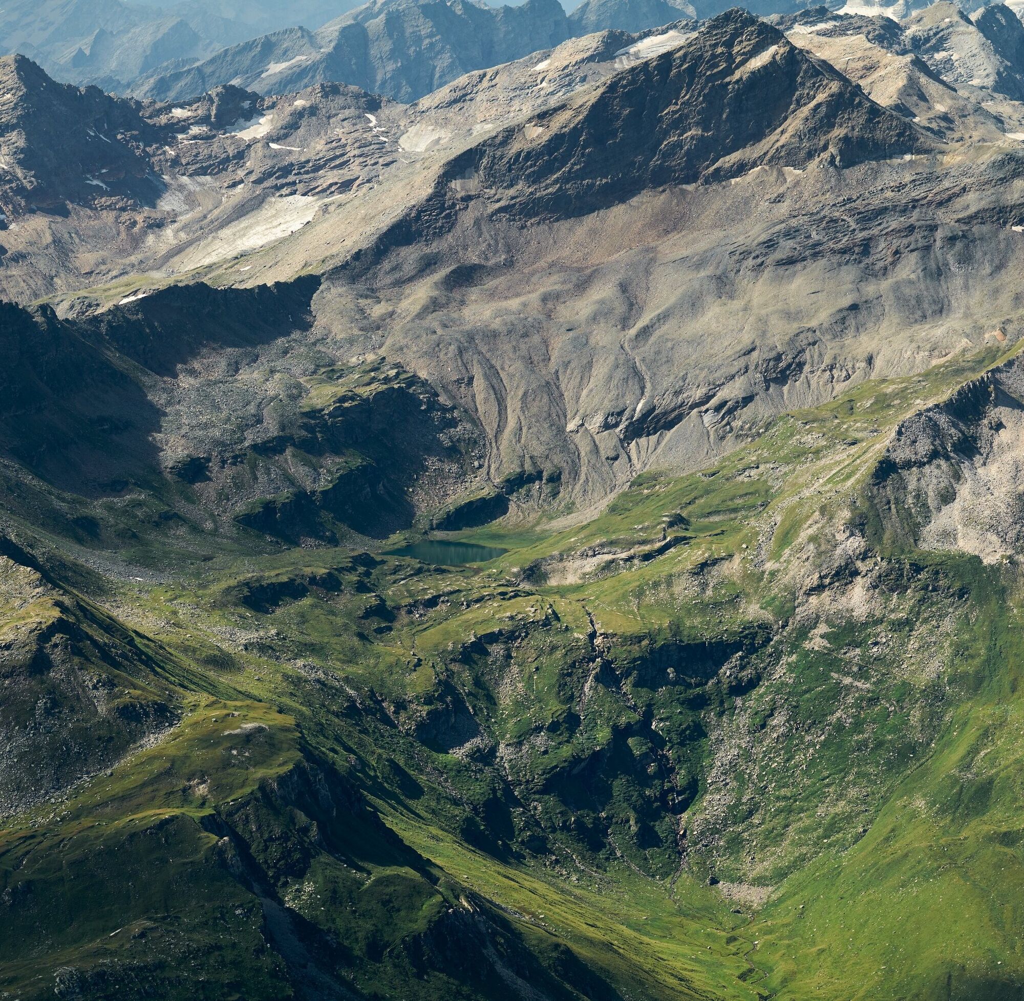
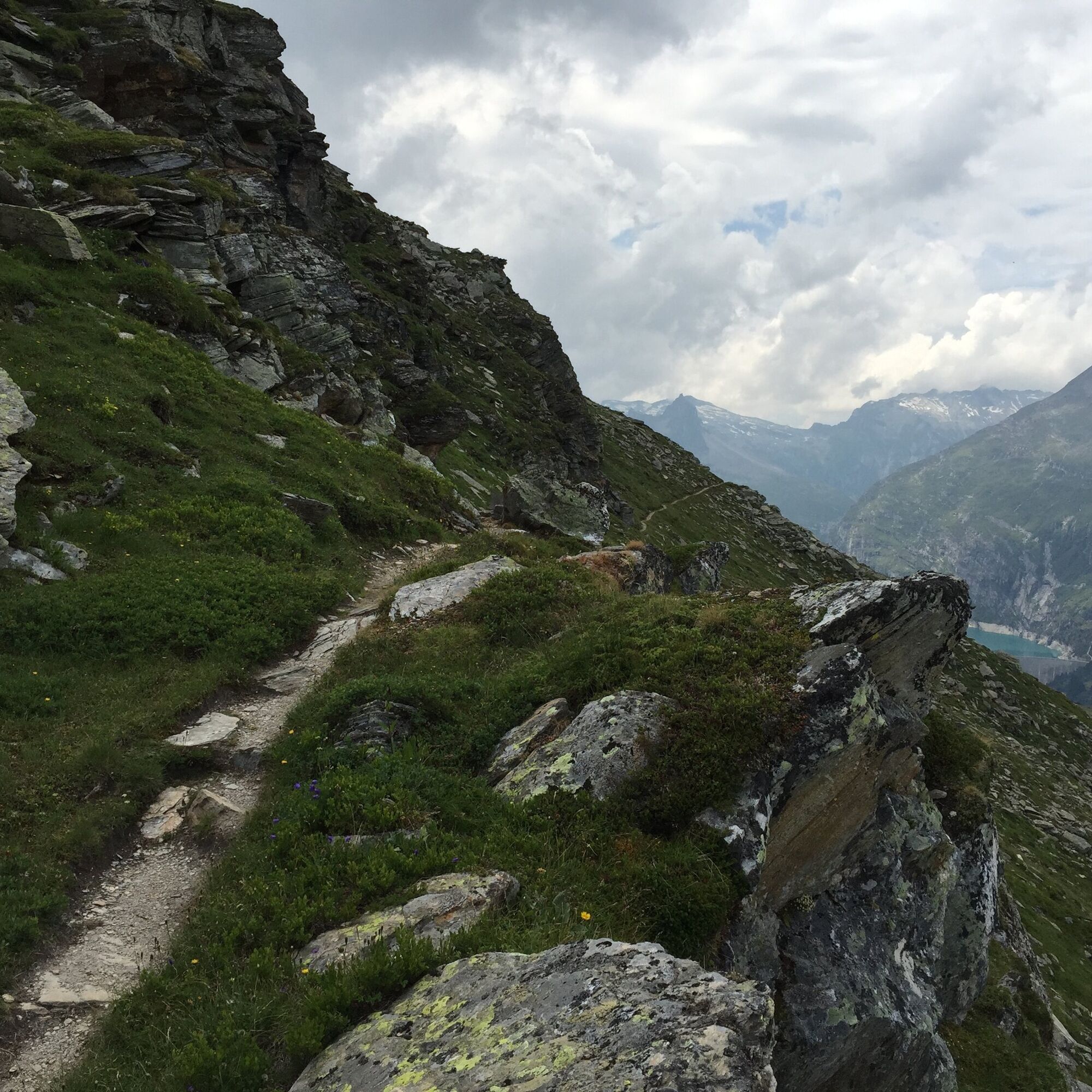
During the first half hour of the restaurant Zervreila on a paved lane. From the Chapel the mountain path starts. Good marked trail uphill to Guraletschsee. The Guraletschsee is located under the moraine of the front Fanellaglacier. At Guraletschsee cross the stream which flows out of the lake and follow the marked path in a northerly direction along the slope of the Guraletschhorns, to Zünliflue. From there follow the trail to the north down to mountain pastures, then turn right into the valley of Ampervreila and rise up to Ampervreilasee, a dark colored small mountain lake at the foot of the Guraletschhorn. Then go on the road to the north. Slight inclines and declines accompany you to the Selvasee, the last of the three mountain lakes. The next striking point of the hike is the alpine hut of Heinisch-Stafel. Then you walk towards Peiltal. The path leads to the Selvaalp, where one of the best Alp cheese of the Grisons is prepared and offered, in addition there are also other agricultural products. Two hours walking distance from Selvasee away you get into Peiltal with the small mountain kiosk Peil. From there you hike to Vals. For the timetable of the hiking bus: phone 081 935 16 49.
Igen
Solid, rain, warm clothing. Sturdy mountain or hiking shoes. Gloves, hat, sunscreen. Walking sticks, meals and drinks from the backpack, first aid kit, topographic map, altimeter, compass, mobile, flashlight.
Mother cows defend their calves. Keep a large distance and be aware of how the mother cow is behaving.
Keep the dog on a leash and let it go in case of emergency or attack. link behavior http://www.wandern.ch/de/wandern/sicher-unterwegs/mutterkuhherden
Via Chur-Ilanz-Vals-Zerfreila
From Ilanz by Postbus to Vals and on to Zerfreila (summer only ).
Parking at Restaurant Zervreila .
Refreshments: At the Peil kiosk
The cheese offered at the Alp Selva has been awarded several times for its excellent quality.
Népszerű túrák a környéken
-
5,0
Hike over the Val da Tersnaus suspension bridge
közepesKirándulás 3,24 km -
5,0
2-Tages-Wanderung Greina Hochebene
közepesKirándulás 14,9 km -
Piz Terri, 3.149 m
közepesMagashegyi túra 6,92 km -
5,0
Kronenwanderung: Vrin - Terrihütte (Etappe 8)
közepesKirándulás 10,8 km -
5,0
222 Nino Schurter Bike
közepesMountainbike 35,2 km -
3-Tagestour Greina-Lucomagno: Vrin - Capanna Scaletta (Etappe 1)
nehézhosszú távú sétaútvonal 17,2 km -
Panoramic tour
könnyűKirándulás 5,39 km -
Furggelti 2712m
nehézKirándulás 18,7 km -
Giro della Greina
Kirándulás 50,6 km -
The Greina plateau and its arch
közepesKirándulás 18,0 km
Túrázás & nyomkövetés


Ne maradjon le az ajánlatokról és az inspirációról a következő nyaralásához!
Az Ön e-mail címe hozzá lett adva a levelezőlistához.