


Kanavuori Nature Trail, Jyväskylä


Kanavuori nature trail is located right next to Vaajakoski, about 10 km from Jyväskylä city centre.
The trail is 3.4-km long and takes you up a steep rocky hill, where you can listen to the rustling of...
Kanavuori nature trail is located right next to Vaajakoski, about 10 km from Jyväskylä city centre.
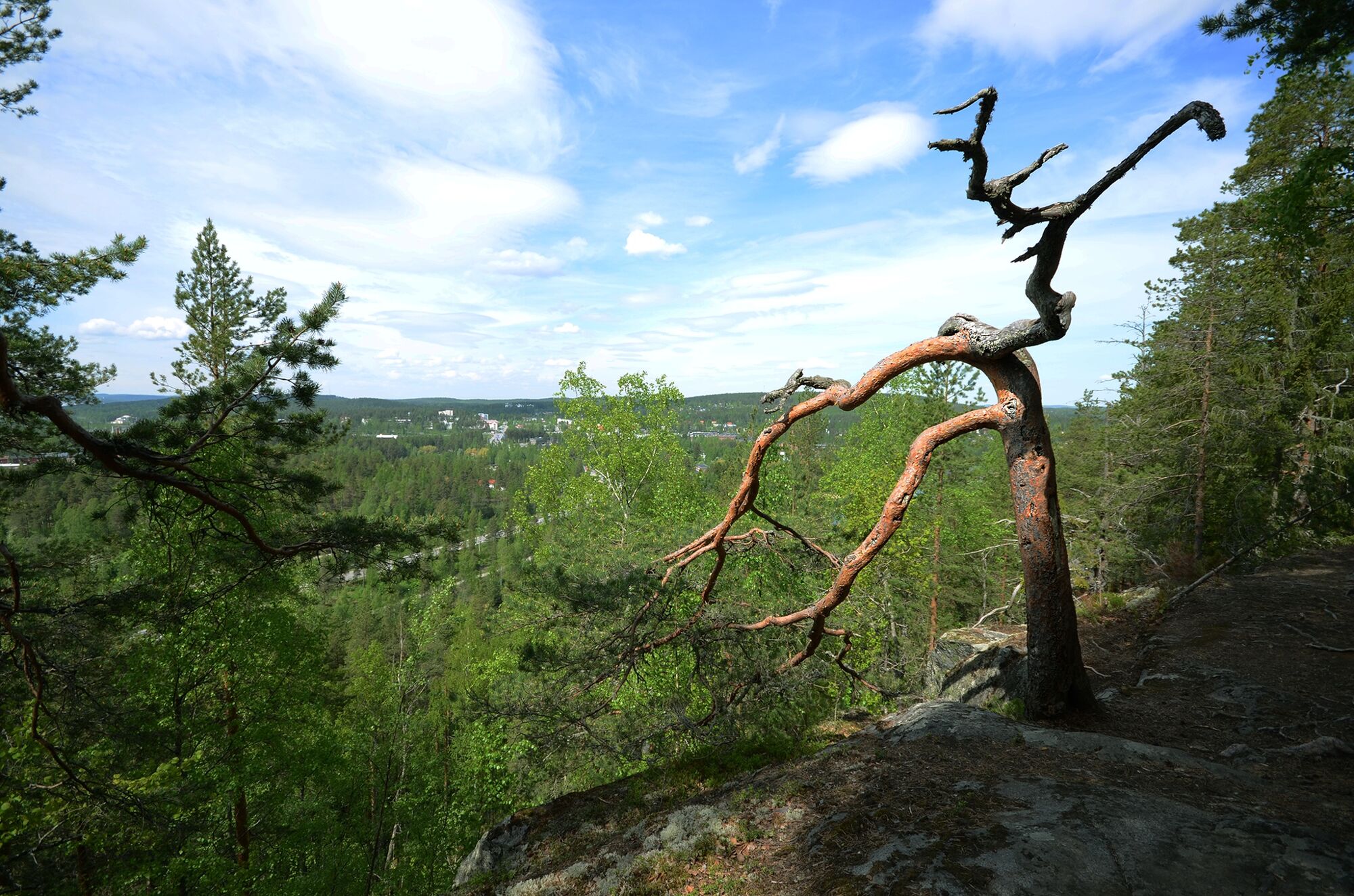
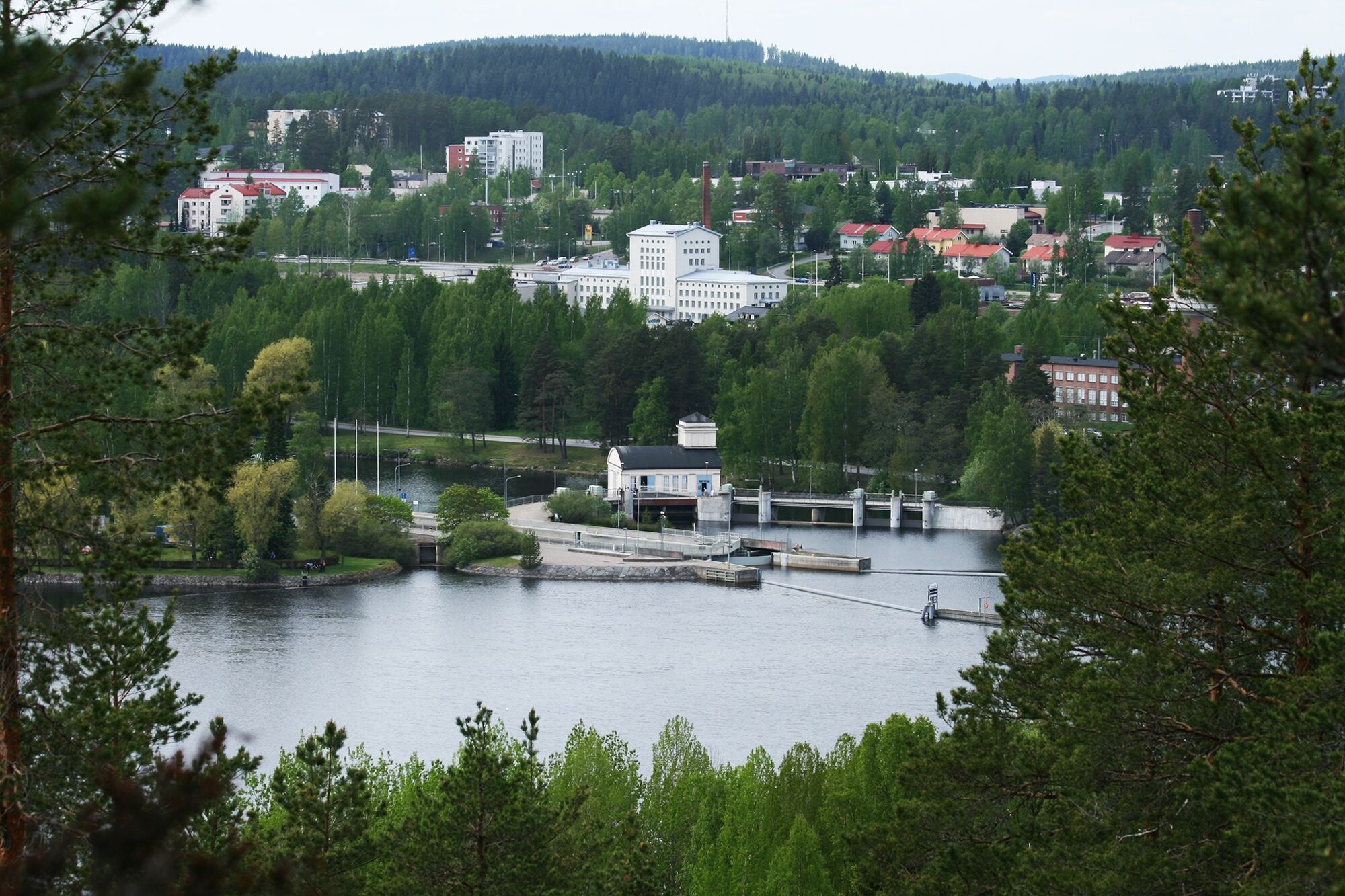
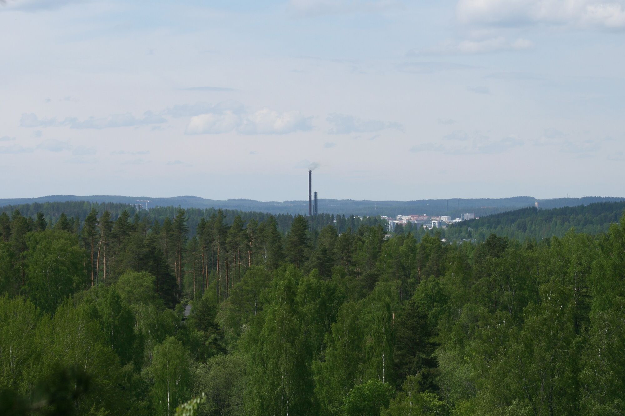
The trail is 3.4-km long and takes you up a steep rocky hill, where you can listen to the rustling of leaves in the meadows and admire the scenic views from the clifftops, all the way to Lake Päijänne and Lake Leppävesi. The trail climbs up to almost 200 meters above sea level. Though they are well-known for their environment, Kanavuori and Naissaari are also rich in cultural history; hence they are part of the Natura 2000 network. See if you can spot the old hydroelectric power plant of Naissaari from the nature trail!
Things to see
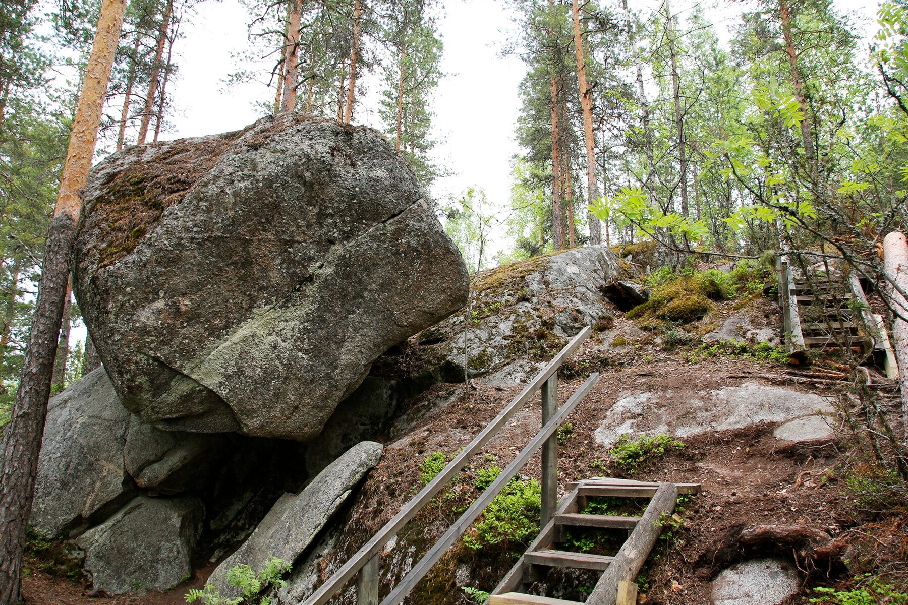
Grove plants Scenic viewpoints Boulders Rocky hillside, geocaches
The route description was created in #Keski-Suomen retkeilyreitit maailmankartalle project, funded by Central Finland's Centre for Economic Development, Transport and the Environment from the European Agricultural Fund for Rural Development: Europe investing in rural areas.


Note: If you arrive by car and park it at Naissaari parking area, you will need to walk about 700 meters from there to the start of the trail.
There is a map with more information about the trail at the parking area. Please follow the signs to the combined pedestrian bicycle path to Etu-Kanavuorentie and you will arrive at the official starting point of the trail close to Saltunlahti bay.
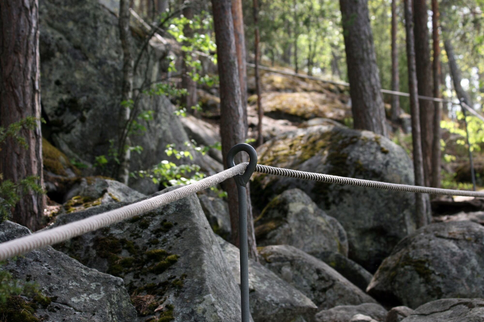
There is a steep ascent to the top of the cliffs at the beginning of the trail. There are also wooden steps and rope railings. The terrain gets more level once you have reached the top of the hill but the tracks remain narrow, rocky and covered with tree roots. The nature trail meanders through deciduous as well as mixed forests and rocky areas.
There is a large boulder at the turning point of the trail, after which you will return to the start of the trail via one more viewing point along the way.
Footwear with good ankle support and traction is recommended because of the steep ascents and descents.
Difficulty level
Kanavuori nature trail is fairly challenging. The trail begins with a steep ascent along a rocky path that is partly covered with tree roots. There are rope railings and steps that help you over the trickiest parts. After you have reached the top the route will be easier, but it remains narrow and partly covered with tree roots. There are also occasional mild ascents and descents.
The trail is circular for the most part but towards the end of the trail you will reach the familiar part of the route which will now be a challenging descent. Take care especially in wet weather, as the rocks are slippery then.
The trail is safest to walk when there is no snow on the ground, because ice and snow may make the trail even more slipper, to dangerous levels.
Route markings
There is an information point with maps and signage from Naissaari Café parking area (Naissaaren kahvi- ja juhlahuone) to the nature trail.
The trail is marked with red paint triangles and there are some rope railings and steps along the route.
No campfires
Campfires are not allowed at Kanavuori.
The starting point is by Etu-Kanavuorentie, 40800 Vaajakoski, next to Saltunlahti bay.
Coordinates: Geographic 62.240240 N 25.892900 E UTM 35V 442472 6901435
ETRS-TM35FIN N 6901435, E 442472.
Kanavuori is very easy to reach by public transportation or by bicycle. There are regular buses from Jyväskylä to Vaajakoski (distance: 10 km) and the closest bus lines to Kanavuori nature trail are buses 38 or 38K. Note that you should step off the bus at bus stop Hupeli P, located right at the crossroads of Etu-Kanavuorentie (you will need to cross the road to the start of the nature trail).
Buses back to Jyväskylä leave from bus stop Hupeli P, on the same side of the road as Kanavuori.
Please park your car at Naissaari parking area, address: Naissaarentie 2, 40800 Vaajakoski.
Note that you will need to walk about 700 meters from there to the start of the trail.
There is a map with more information about the trail at the parking area. Please follow the signs and take the combined pedestrian bicycle path to Etu-Kanavuorentie and you will arrive at the official starting point of the trail close to Saltunlahti bay. There are signs that direct you to the nature trail by the edge of the forest.
Remember to stop by also at neighbouring Naissaari where there is a café, a beach and a disc golf course.
Népszerű túrák a környéken
-
Kulonpalonmäki MTB tour 15,6 km
közepesMountainbike 14,7 km -
Legends' Loop 11,6 km
közepesMountainbike 11,3 km -
Architectural Cycle tour to Alvar Aalto
Biciklizés 8,93 km -
Lakeland by Cycle: Goblin’s Gorge Gravel Loop
közepesTávolsági kerékpározás 347,9 km -
Laajavuori mountain biking trail
Mountainbike 9,06 km -
Lutakko - Jyväskylä - River Jyväskylä - Jyväskylän helluntaiseurakunta
Motorkerékpár 43,2 km -
Janakka - Kaunisharju
könnyűKirándulás 6,03 km -
Etelä-Keljo - Eteläportti
könnyűKirándulás 7,73 km -
Kaakkolampi - Huhtasuo - Jyväskylä - Kangasvuori
könnyűKirándulás 6,49 km -
Laajis Ravintola ja Burger - Laajavuori - Jyväskylä
könnyűKirándulás 5,43 km

Túrázás & nyomkövetés


Ne maradjon le az ajánlatokról és az inspirációról a következő nyaralásához!
Az Ön e-mail címe hozzá lett adva a levelezőlistához.