


Loop no. 27: route of the Pays de Saint Gilles
Nehézségi szint: 3


Through its variety of scenery, the route of loop 27 offers you varied pleasures by regularly alternating types of terrain: roads, paths.
Gravel cyclists and mountain bikers will have plenty to enjoy:...
Through its variety of scenery, the route of loop 27 offers you varied pleasures by regularly alternating types of terrain: roads, paths.
Gravel cyclists and mountain bikers will have plenty to enjoy: some technical sections and nice climbs to spice up the outing just right.
More than a route, it is an ode to a change of scenery: dunes, coastline, vineyards, rivers and lake, fields, marshes and forests…
STARTING POINT: SAINT GILLES CROIX DE VIE
The start of loop No. 27 is at the foot of the Josephine Tower in Saint Gilles Croix de Vie. Discover its fishing port and town centre, then follow the Jaunay river where you will enjoy immersion in the wide dune area of the Dune du Jaunay and La Sauzaie. The dunes will then give way to the generous panoramas of Bretignolles sur Mer that will enchant you.
THE INLAND AREA, THE OTHER TREASURE OF PAYS DE ST GILLES CROIX DE VIE
While the coast enjoys a fine showcase via the Vélodyssée route, there is no doubt that loop 27 also gives pride of place to the inland area, where quiet roads, paths and greenery abound. Get off the beaten track and discover the unexpected, all while pedaling with a light spirit. The route mainly uses small roads with low traffic and paths.
Main stages of the inland area
Brem sur Mer
In Brem sur Mer, the port of la Gachère marks the transition between the coast and the inland area. Then a completely different world, green and peaceful, will reveal itself. At first, you will have the opportunity to explore part of the Brem vineyard, between vines and plains. Then gradually you will find yourself in settings of unsuspected beauty, where the vegetation is as dense as the silence. The Jaunay Lake
Many will be happy when crossing the Jaunay Lake area. This section will offer great sensations for cyclists and mountain bikers. Let's not forget to mention the beauty of the site, in its wild and preserved setting. Apremont
This charming Small Town of Character offers you the contemplation of a beautiful heritage, including the castle, the Saint-Martin church in Apremont, and its numerous period houses. Bonus: two nice consecutive climbs to get your legs going halfway! Commequiers
After a generous stretch on a path, the rest of the route brings you back to asphalt to cross the commune of Commequiers. A stop is highly recommended; it would be a pity to miss the surprising remains of the Commequiers castle, recently listed as a Historic Monument. Soullans
In Soullans, panoramas alternate between marshes and pockets of greenery. You will also pass by the Charles Milcendeau Museum. Saint Hilaire de Riez
The largest commune of Pays de Saint Gilles Croix de Vie, Saint Hilaire de Riez shines through the diversity of its natural environments. This is evidenced by the crossing of part of its sweet and salt marshes, where time seems to have stopped.
After a green escape on the edge of the Saint Hilaire de Riez forest, get ready for the grand finale. From Sion beach, let yourself be carried by the call of the ocean winds. For 4km, a parade of rare beauty will unfold before your eyes: the Vendée Cliff, the Fire of Grosse Terre, the Boisvinet district with its collection of exceptional villas, the Adon bay.

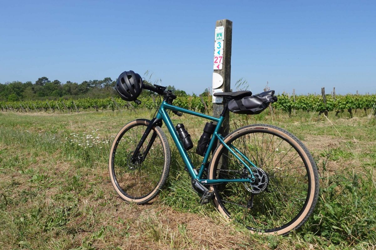
Marking: red color, no. 27
Igen
Igen
Before setting off:
Make sure the bike is in perfect mechanical condition, including tires and brakes Ensure the bike is properly adjusted to your body shape Wearing a helmet is strongly recommended Bring a repair kit Choose a route adapted to your physical abilities Inform your entourage of your itinerary Check the weather conditions A first aid kit is not essential but can be very useful Inform yourself and keep emergency phone numbers If you must return at dusk, make sure you can see and be seen
Remember that the Highway Code applies to cyclists in all circumstances
Never ride more than two abreast and move into a single file when traffic conditions require it
Respect other users as you would like to be respected
Emergency number reminder: 112
Consider carpooling
Favor public transport for your trips
Parking near the starting point
3
New: on TER with your bike!
Book a spot for your Gravel bike on the Nantes/Saint Gilles Croix de Vie TER train. It's free! Service available: weekends and public holidays in May, June, and September and every day in July/August. Learn more
To learn more about our destination, visit our website
Respect the direction of the route to properly orient yourself on site from north to south, from the seaside to the inland coast.
Népszerű túrák a környéken
-
VIGNES ET CAMPAGNE CIRCUIT N°3
közepesKirándulás 13,5 km -
BOUCLE N°22 - SAINT HILAIRE DE RIEZ
könnyűBiciklizés 25,8 km -
BOUCLE N°9 - COËX
könnyűBiciklizés 13,3 km -
5,0
LOOP N°16 - GIVRAND
könnyűBiciklizés 19,0 km -
Gastronomy and heritage along the Vie (4 days/4 nights)
közepesBiciklizés 136,1 km -
BOUCLE N°4 - BREM SUR MER
könnyűBiciklizés 12,8 km -
BOUCLE N°13 - LE FENOUILLER
könnyűBiciklizés 4,70 km -
BOUCLE N°15 - GIVRAND
könnyűBiciklizés 8,23 km -
BOUCLE N°19 - NOTRE DAME DE RIEZ
könnyűBiciklizés 11,6 km -
BOUCLE N°20 - SAINT GILLES CROIX DE VIE
könnyűBiciklizés 9,59 km

Túrázás & nyomkövetés


Ne maradjon le az ajánlatokról és az inspirációról a következő nyaralásához!
Az Ön e-mail címe hozzá lett adva a levelezőlistához.