


IM_03 San Bernardo di Mendática – Sanremo Shelter – Mount Saccarello


From Colle San Bernardo di Mendática (1263 m) follow the “Alta Via dei Monti Liguri” going up along the woody watershed between Arroscia and Tanarello valleys (south-west direction). At a crossroad ignore...
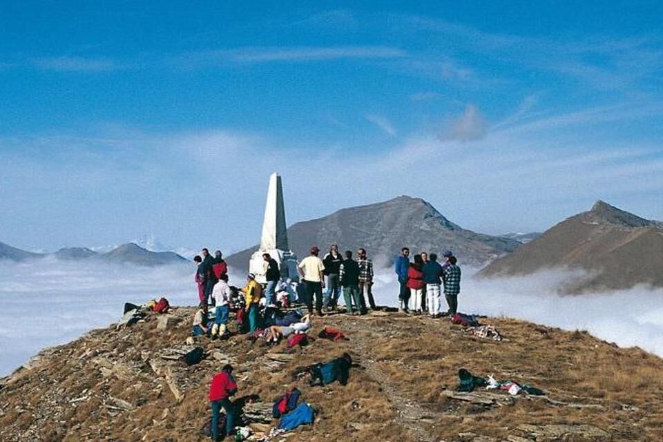
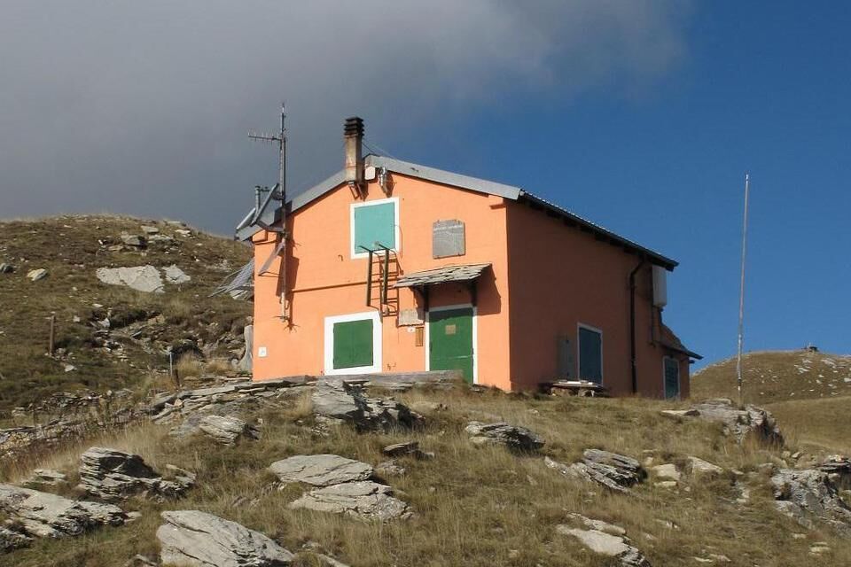
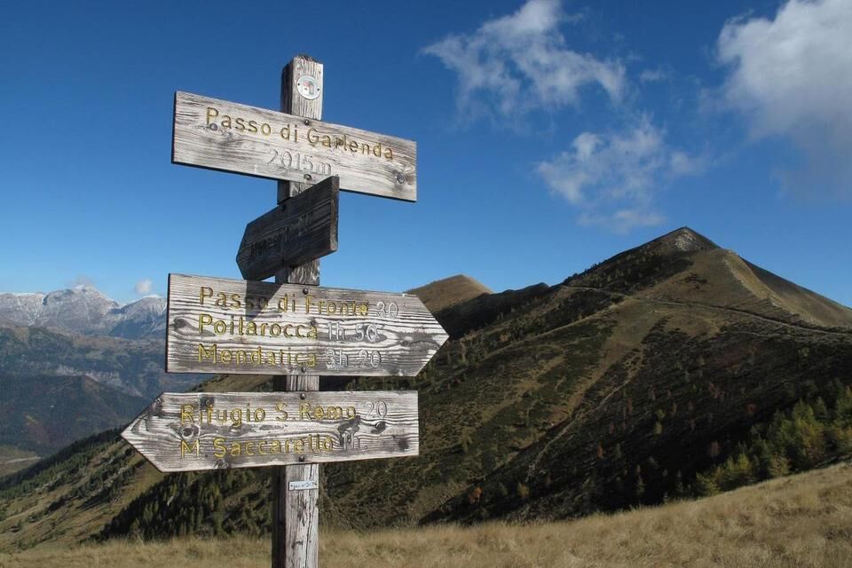
From Colle San Bernardo di Mendática (1263 m) follow the “Alta Via dei Monti Liguri” going up along the woody watershed between Arroscia and Tanarello valleys (south-west direction). At a crossroad ignore on the right the track to Reggioso and follow up in woodland. After a long going up path, the track follow level along the Val Tanarello side till a crossroad. On the left reach Margheria Garlenda (meadowland, 1593 m). Leave the building and follow up till Goletta di Garlenda (1855 m, along the ridge) and till Cima Garlenda (2141 m). Follow going down (south-west direction) along the ridge till Passo Frontè (2090 m). The “AVML track” turns the summit, but going along the ridge it's possible to reach the top of Monte Frontè (2153 m), then go down in the opposite side. After you reach Passo Garlenda (2021 m) along the watershed Tanarello - Argentina. From here follow a dirt road till Rifugio Sanremo (2054 m). From the refuge reach the old arrival point of the chair lift of Monesi (Sella della Valletta, c. 2050 m), and the “Statua del Redentore” (2164 m) overlooking the Argentina valley. Follow an other dirt road, ignore the “AVML” and go up to the left till the top of Monte Saccarello (2200 m). The return to Colle San Bernardo di Mendática is along the same itinerary.

from Albenga or Imperia Est motorway exit (A10 Genova-Ventimiglia) reach Pieve di Teco, then follow to Colle di Nava till Acquetico, then take to the left the road for Mendatica as far as Colle San Bernardo di Mendática. Or from Ceva motorway exit (A6 Savona-Torino) follow the road for Imperia as far as Nava. From Nava take to the right the road to Colle San Bernardo di Mendática.
Nature and Landscape * * * * * * Family * * * * Gourmet * * * Culture * * * *
Népszerű túrák a környéken
-
Tour du vallon de Stroup, La Brigue, Provence-Alpes-Côte d'Azur/France
közepesKirándulás 11,2 km -
Historical Mountain Routes | Alta Via del Sale, the white road of the Alps of the Sea
nehézMountainbike 104,8 km -
Trail no. 06: Sella della Valletta - Colla S. Barnardo
Kirándulás 8,04 km -
IM_13 Ring path of Triora
Kirándulás 8,70 km -
XC Molini di Triora
nehézMountainbike 31,5 km -
IM_06 Il Sentiero degli Alpini
Kirándulás 10,7 km -
IM_22 Le fortificazioni del Colle di Nava
Kirándulás 6,01 km -
Sea Mountains
nehézMountainbike 48,0 km -
5,0
Tour of Marguareis | Stage 4 Mongioie Refuge - Don Barbera Refuge
közepesKirándulás 11,6 km -
IM_16 Mendàtica - Cascate dell'Arroscia
Kirándulás 5,12 km
Túrázás & nyomkövetés


Ne maradjon le az ajánlatokról és az inspirációról a következő nyaralásához!
Az Ön e-mail címe hozzá lett adva a levelezőlistához.