


Höhenstein route


The actual "Höhenstein route" has been well marked with red signs for several years.
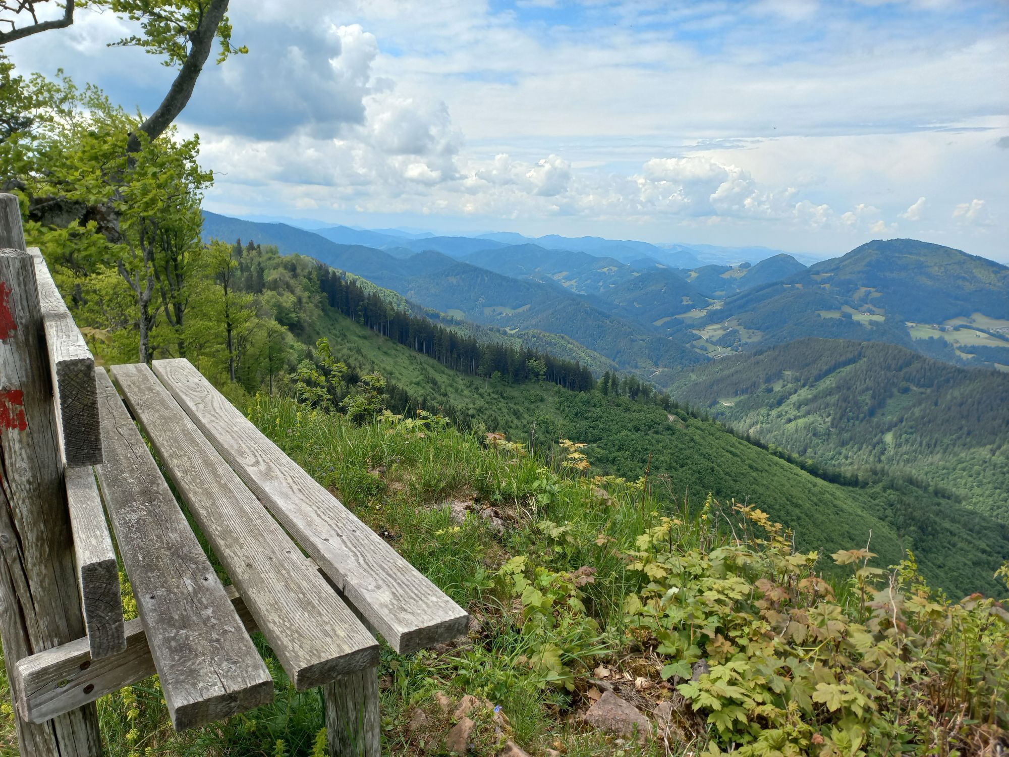
It is a relatively short and easy but very varied and therefore rewarding route. Although no single spot offers a panoramic...
The actual "Höhenstein route" has been well marked with red signs for several years.
It is a relatively short and easy but very varied and therefore rewarding route. Although no single spot offers a panoramic view all around, the path passes many beautiful viewpoints that naturally invite stops and photos.
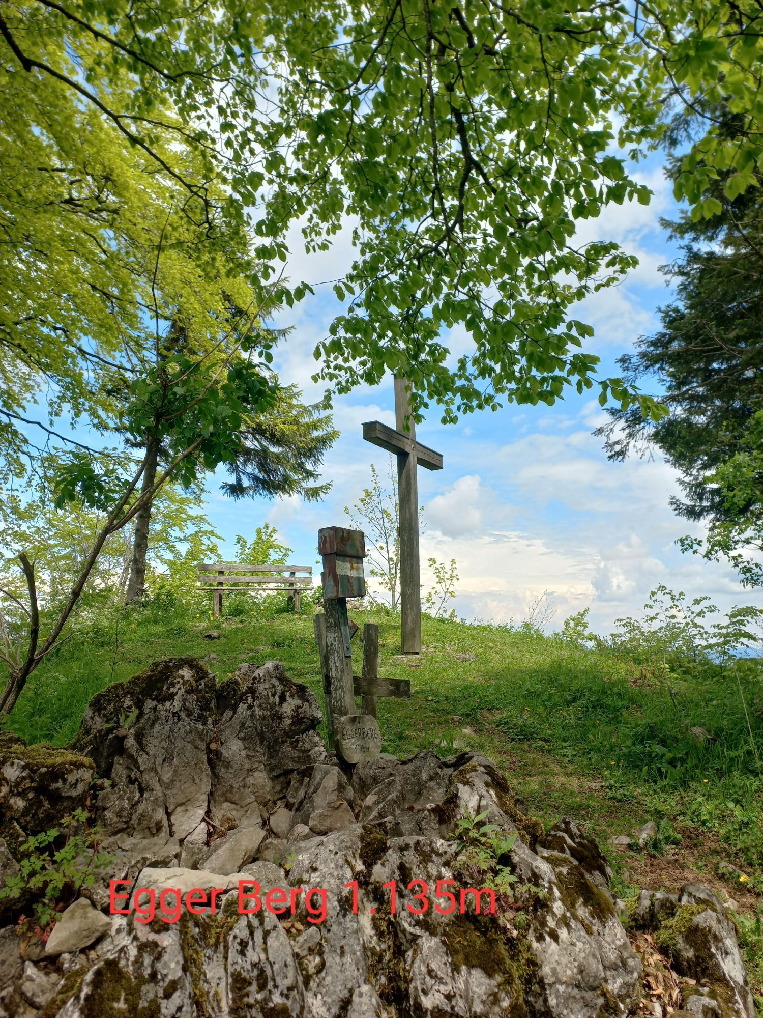
From the parking lot, follow the marked forest path uphill for about 35 minutes until you reach the ridge (bench; panoramic view of Ötscher, Scheiblingstein & Co). Then follow the ridge until you reach the highest point of the hike (wooden cross at Egger Berg 1,134 m). From here, it goes gently downhill to Höhensteineck. From there, go down through the forest to the Höhensteinstube house, where you follow the asphalt road back to the starting point.


Igen
Sturdy footwear
By car: from Linz, Salzburg, Munich or Vienna via the A1 to exit Ybbs an der Donau – then via B25 to Lunz am See
By train to Scheibbs or Waidhofen an der Ybbs and from there by bus to Lunz am See
Parking is available at the dilapidated farmstead Windhag and at the Höhensteinstube house.
Lunz am See Tourist Office
Amonstraße 16, 3293 Lunz am See
T +43 7486 8081 15
E info@lunz.gv.at
www.lunz.at
www.ybbstaler-alpen.at
This route is especially recommended in autumn!
Népszerű túrák a környéken
-
4,8
Lechner Graben - Ybbstaler Hütte
közepesKirándulás 14,2 km -
4,9
Kurzeck- Siebenhütten- Turnhöhe- Kitzhütte Göstling an der Ybbs, Österreich
könnyűKirándulás 12,8 km -
4,3
Prochenberg von Ybbsitz
könnyűKirándulás 6,29 km -
4,6
LUNZ Seehof Scheiblingstein Dürrenstein Herrenalm Ober- Mittersee 03.08.2018
nehézKirándulás 25,2 km -
4,2
Rund um den smaragdgrünen Lunzer See
könnyűKirándulás 4,80 km -
4,8
Herrenalm
közepesKirándulás 8,29 km -
3,8
Scheibe und Scheiblingstein ab/bis Lunz
közepesKirándulás 16,4 km -
4,1
LANGAU Taglesbachbrücke, Scheibe, Scheiblingstein, Bärenleitenkogel, Leonardikreuz, Herrenalm, Alpinweg retour 25.07.2018
közepesKirándulás 14,4 km -
3,8
wanderung auf den alpl
közepesKirándulás 8,18 km -
4,6
Opponitz Gorge Hiking Trail
közepesKirándulás 4,42 km
Túrázás & nyomkövetés


Ne maradjon le az ajánlatokról és az inspirációról a következő nyaralásához!
Az Ön e-mail címe hozzá lett adva a levelezőlistához.