MTB - Rodltal tour
Mountainbike 2,7
Navigálás
Navigálás
Szerezd meg ezt a túrát a mobiltelefonodon
Térkép
MTB - Rodltal tour
Mountainbike
31,48 km
Szkennelje be a QR-kódot, és indítsa el a navigációt a bergfex alkalmazásban.
QR Code
Túrázás & nyomkövetés

MTB - Rodltal tour

Távolság
31,48 km
Időtartam
03:25 h
Felszállás
728 hm
Tengerszint
258 - 529 m
Track letöltés
Térkép
MTB - Rodltal tour
Mountainbike
31,48 km

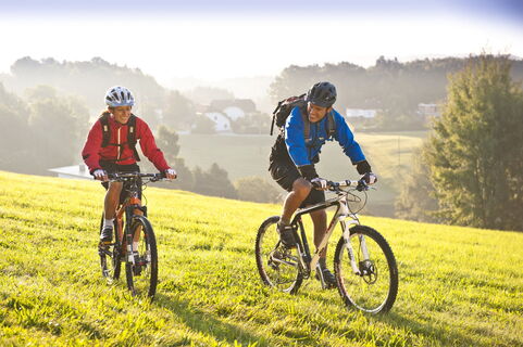
From the Walding Sports Park, the Rodltal tour leads past the Walding Zoo to the Mursberg, until a short single trail leads down to the Saurüsselbach and over the Oberstraßer Höhenrücken to the idyllic...


A leírás a

From the Walding Sports Park, the Rodltal tour leads past the Walding Zoo to the Mursberg, until a short single trail leads down to the Saurüsselbach and over the Oberstraßer Höhenrücken to the idyllic Eschelbach, where you meet the connection to the Granitlandrunde or Hansbergland-Südrunde. Further along the tour, the beautiful onion tower of the St. Gotthard church soon comes into view. From the valley of the Kleine Rodl, the route leads up to Limberg, where a breathtaking view of the Danube valley and the Alps can be enjoyed, before it goes down in serpentines to the Große Rodl and you can let the bike run easily to Rottenegg. But still in the village it goes up to the next viewpoint to Jörgensbühl and finally along the Brandstätterbach back to the sports park Walding.

The variant E1 leads from the parking lot in the Rottenegg sports field street over the old stone-paved trade route, the Krumauer Reichsstraße, to the Oberstraßer Höhenrücken and there joins the Rodltal tour E. If you finish this in Rottenegg, you are back at the starting point of the variant E1.
A leírás a

The tour leads up to panoramic heights and through five river valleys. You can start with parking in Walding at the Sportpark or in St. Gotthard at the Musikheim. Also at the sports field Rottenegg can be entered into the variant E1.

Technológia
n.a.
Feltétel
n.a.
Tájkép
5 / 6
Tapasztalat
5 / 6
Az év legjobb időszaka
Jan
Feb
Már
Ápr
Máj
Jún
Júl
Aug
Sze
Okt
Nov
Dec
Szerző
A túrát MTB - Rodltal tour a outdooractive.com biztosítja.
Logo
Megosztás túra
Térkép
MTB - Rodltal tour
Mountainbike
31,48 km
Hiba
Hiba történt. Kérjük, próbálja meg újra.
Értékelések
2,7
5
(0)
4
(1)
3
(1)
2
(0)
1
(1)
1 Comment
Avatar a Georg M.
Georg M.
09. ápr.. 2024
Verified gone
Gute Tour auch mit dem Gravelbike machbar.
Hasznos (0) |
Jelentés
Hiba
Hiba történt. Kérjük, próbálja meg újra.
Írjon egy véleményt

A vélemények segítenek más felhasználóknak kiválasztani a következő kalandot. Kérjük, csak a túrát értékelje, ne az időjárást vagy az uzsonnát.

Válassza ki az egyik csillagot a túra értékeléséhez
Rossz túra
Gyenge túra
Középszerű túra
Jó túra
Kiváló túra
bergfex logo Szerezd meg a betekintést Mindig élőben a helyszínen, több mint 9500 webkamerával. bergfex Pro felhasználóként mostantól számos túra megfelelő webkameráját láthatja a túrák alkalmazásban. Így közvetlenül megtekintheti az aktuális körülményeket.
Túrázás & nyomkövetés

Túrázás & nyomkövetés

Túrázás & nyomkövetés
Több mint 550.000 túrajavaslat, részletes térképek és egy intuitív útvonaltervező teszi az alkalmazást kötelezővé minden természetkedvelő számára.
Túrázás & nyomkövetés