


Schaffhausen - Beringer Randenturm


The hike takes you on marked hiking trails from the old town of Schaffhausen via Breite to Hemmental, further via Hägliloh to the Beringer Randenturm viewing tower. This tower was built in 1998 in steel...
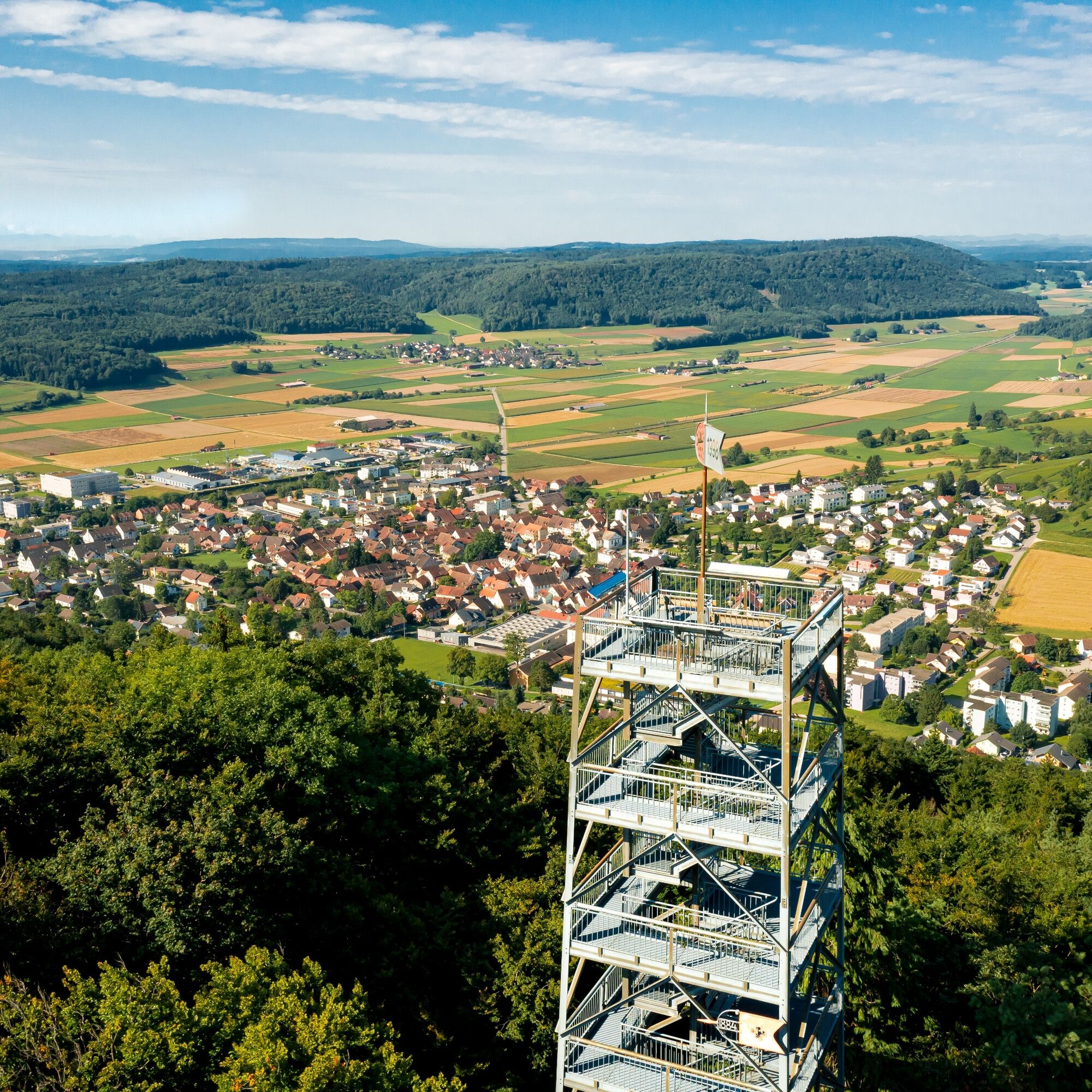
The hike takes you on marked hiking trails from the old town of Schaffhausen via Breite to Hemmental, further via Hägliloh to the Beringer Randenturm viewing tower. This tower was built in 1998 in steel lattice construction above Beringen and is one of the four Randentürme (edge towers) in the Schaffhausen region. The tower is 26 meters high and offers a magnificent view of the vast Klettgau and the Alps.
At the foot of the tower is the Beringer Randenturm restaurant. Whether you are a gourmet or an excursionist – all wishes are fulfilled here. From the Beringer Randenturm, a zigzag path leads down to the village, where you can comfortably take the bus or train back to the starting point in Schaffhausen.
If you need a cooling off, a swim in the natural pool Gwaage Badi in Beringen is recommended. A visit to the local museum in Beringen is also worthwhile.

From Schaffhausen station, the hiking trail leads you over the Vordersteig to Beckengässchen, then further up the Hintersteig to Breite. Follow the hiking trail past the Schaffhausen Psychiatric Centre. Then along Nordstrasse and keep left until Nordstrasse changes into Holenbaumstrasse. At the curve, turn right into Holenbaumstrasse, which passes the Pfadi hut Güetli.
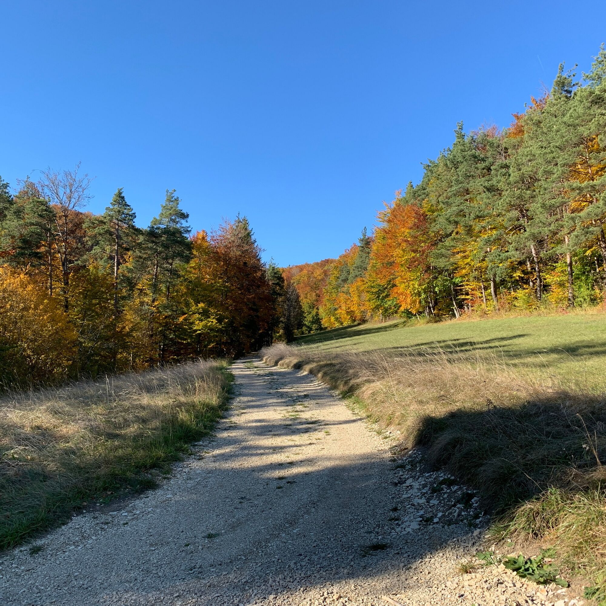
Follow the hiking trail to the Sommerwies fork and take the right path there. At the next fork, follow the official hiking trail left to Hemmental. Past the village square, a path leads left from Randenerstrasse up to the Rütihalden. Here the hiking trail runs along the field into the forest. Follow the path through the Heerebüel until it sharply turns left in the direction of Hägliloh.
At the fork where the path divides into three other hiking trails, choose the middle path – this leads you directly to the Beringer Randenturm. From the tower, take the steep zigzag path down into the village, where various options (bus or train) await you for the return trip to Schaffhausen.
Trekking or hiking shoes, drinks for the way.
By car to Schaffhausen station.
by bus or train to Schaffhausen station
by bus or train from Beringen back to Schaffhausen
Parking available at Parkhaus Diana, Parkhaus Bahnhof, and other parking spaces.
Enjoy the view from the Beringer Randenturm
Have a bite at the Beringer Randenturm restaurant
Take a swim in the Gwaage Badi
Visit the local museum
Népszerű túrák a környéken
-
4,6
Small Rheinfall Circular Route
könnyűKirándulás 3,48 km -
3,5
"Hegauer Kegelspiel" Wannenberg hike
közepesKirándulás 9,35 km -
4,8
Rundwanderweg Rheinau
könnyűKirándulás 6,85 km -
Castle trail 1 - From Tengen via Blumenfeld and back via Büßlingen
közepesKirándulás 10,1 km -
SwitzerlandMobility 902: Reiatweg
közepesKirándulás 19,0 km -
Hike to the highest point of Schaffhausen
közepesKirándulás 10,1 km -
Kleie Rheinfallrunde
könnyűKirándulás 3,82 km -
4,5
SchweizMobil 593: Nordspitze Panoramaweg
közepesKirándulás 13,7 km -
Chläggi-Route
nehézBiciklizés 58,1 km -
Stone Age Trail Route Kesslerloch-Schweizersbild
közepesTanösvény 11,2 km
Túrázás & nyomkövetés


Ne maradjon le az ajánlatokról és az inspirációról a következő nyaralásához!
Az Ön e-mail címe hozzá lett adva a levelezőlistához.