


Winter hike Sellamatt - Iltios
Nehézségi szint: 2


With the combination cable car from Alt St. Johann to Sellamatt. Then wonderful hiking from Sellamatt through the winter landscape over to Iltios. From there with the funicular to Unterwasser. You have...
With the combination cable car from Alt St. Johann to Sellamatt. Then wonderful hiking from Sellamatt through the winter landscape over to Iltios. From there with the funicular to Unterwasser. You have the option to return to Alt St. Johann on foot along the Thurweg or by post bus.


At the Sellamatt mountain station, follow the signposted winter hiking trail westwards to the Iltios mountain station.
Igen
Igen
Day hiking backpack (approx. 20 liters) with rain cover, comfortable and waterproof winter shoes or sturdy hiking boots, crampons and gaiters if necessary, warm and weatherproof clothing in layers, hat / headband, scarf, gloves, sun and rain protection, provisions and drinking water, thermos flask with hot drink, first aid kit, mobile phone, telescopic poles if needed
The route is continuously signposted and regularly prepared. Walking times may vary depending on snow conditions.
From the greater Zurich area and central Switzerland:
On the A3 at Reichenburg towards Rapperswil and then over the Ricken Pass to Wattwil. Then up the Toggenburg to Alt St. Johann.
- From Eastern Switzerland:
From St. Gallen to Herisau and further over the Wasserfluh to Lichtensteig. Or drive from St. Gallen to Wil, take the Toggenburg exit. Follow the main road to Alt St. Johann.
- From the southern German region:
Via Bregenz and St. Margrethen on the A13 to Haag and take the exit towards Toggenburg/Wildhaus. Or via Konstanz to Wil, then take the Toggenburg exit and follow the main road to Alt St. Johann.
By train to Nesslau Neu St. Johann station and then by bus to Alt St. Johann village.
From the Rhine Valley by train to Buchs SG station and then by bus to Alt St. Johann village.
Parking lots at the valley stations of the mountain railways in Alt St. Johann and Unterwasser.
2
You can find the operating times of the Toggenburg mountain railways here.
Toggenburg Tourism
Hauptstrasse 104
9658 Wildhaus
+41 71 999 99 11
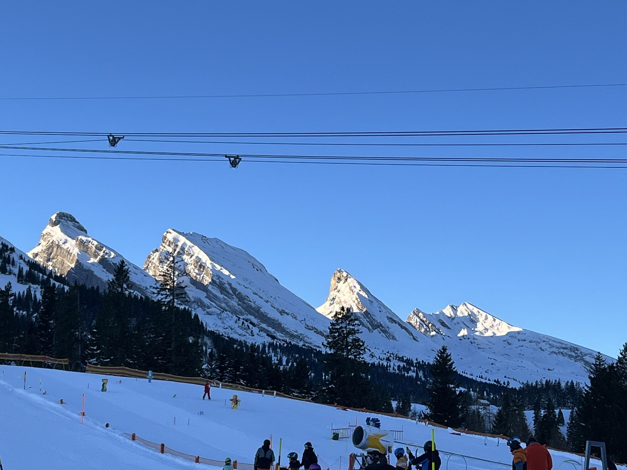
A break with a view of the Churfirsten at the mountain inn Illtios or Sellamatt.
Népszerű túrák a környéken
-
4,5
Tour Brülisau - Saxerlücke - Hoherkasten⛰
nehézKirándulás 16,6 km -
4,7
Riviera Walensee Walenstadt - Quinten
közepesKirándulás 10,4 km -
4,9
Säntis-Gipfeltour, Wasserauen / Appenzell Innerrhoden
nehézKirándulás 21,1 km -
4,6
Riviera Lake Walen Weesen – Quinten
közepesKirándulás 10,2 km -
4,7
Wasserauen - Seealpsee - Wasserauen
közepesKirándulás 7,71 km -
5,0
Staubern-Runde (15.8.2021)
közepesKirándulás 8,65 km -
4,5
Weesen - Quinten - Walenstadt
nehézKirándulás 20,6 km -
4,8
Seealpsee
közepesKirándulás 12,3 km -
5,0
Seealpsee Runde
közepesKirándulás 8,22 km -
3,0
Ebenalb, Aescher, Seealpsee, Meglisalp, Wasserauen
nehézKirándulás 13,6 km
Túrázás & nyomkövetés


Ne maradjon le az ajánlatokról és az inspirációról a következő nyaralásához!
Az Ön e-mail címe hozzá lett adva a levelezőlistához.