


The Glorious Return of the Waldensians | Stage 5 Balziglia - Ghigo di Prali


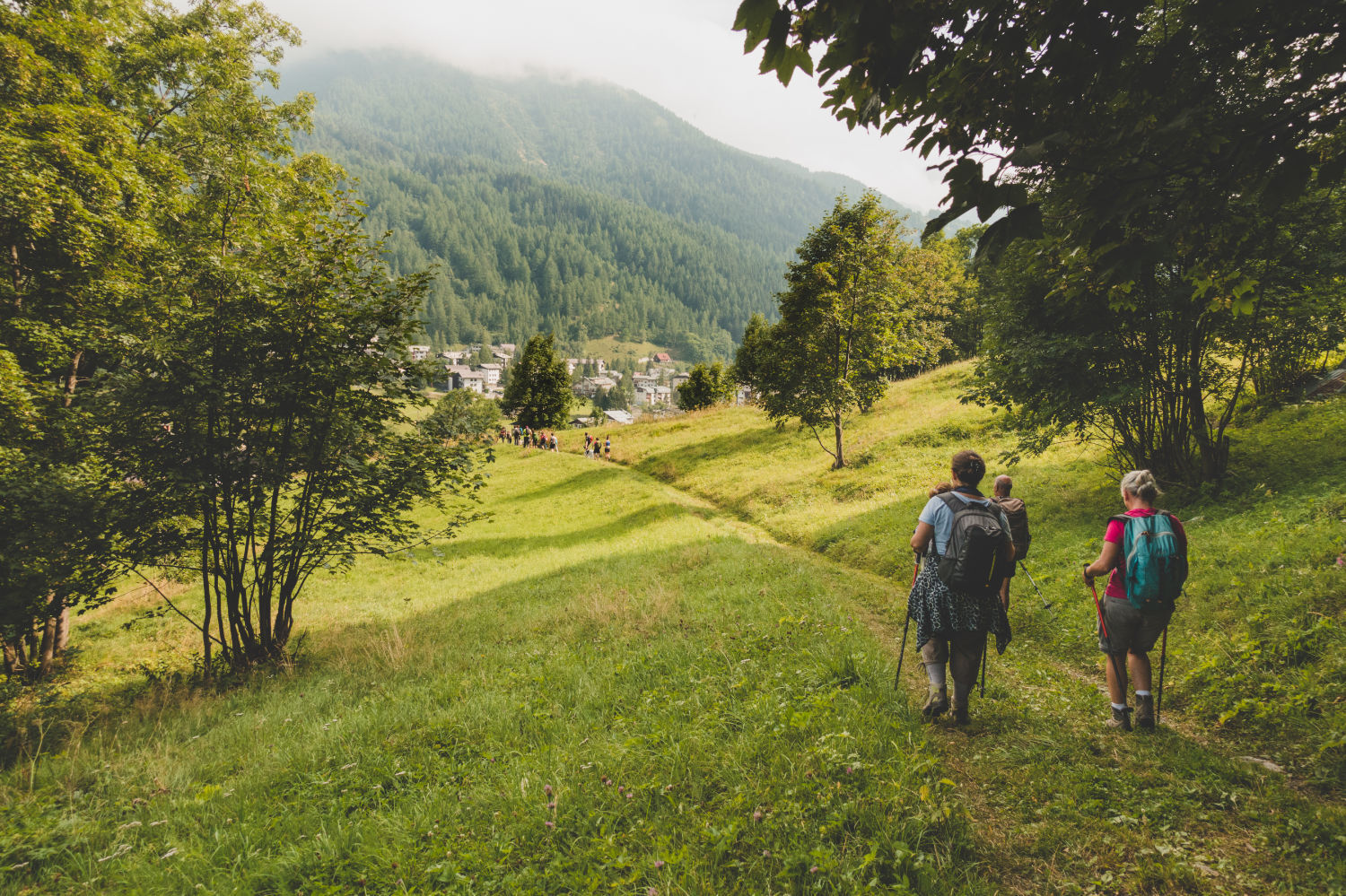
In this fifth stage you walk mainly in the woods, at mid-mountain altitudes, overcoming the two easy hills of Serrevecchio and Galmont. The main points of interest of the stage are the many villages, where,...
In this fifth stage you walk mainly in the woods, at mid-mountain altitudes, overcoming the two easy hills of Serrevecchio and Galmont. The main points of interest of the stage are the many villages, where, despite the depopulation, there are always interesting encounters. Do not miss a visit to the beautiful Rodoretto museum, "La Meizoun de nostri donn", in an old house where the village school was also located, which has come down to us with all its furnishings. Another museum to learn more about the history of the community can be visited in Ghigo, in the oldest Waldensian temple in the valleys. You walk mainly in the woods, at mid-mountain altitudes, passing the two easy hills of Serrevecchio and Galmont. The main points of interest of the stage are the many villages, where, despite the depopulation, there are always interesting encounters. Do not miss a visit to the beautiful Rodoretto museum, "La Meizoun de nostri donn", in an old house where the village school was also located, which has come down to us with all its furnishings. Another museum to learn more about the history of the community can be visited in Ghigo, in the oldest Waldensian temple in the valleys. Text taken from www.lestradedeivaldesi.com

It starts from the clearing near Balziglia, where you can leave your car. Go down an asphalted road to the hamlet of Piccolo Passet. where you turn left onto the path, in the direction of the Gorges and the Piccolo Passet mill. After passing the mill, continue on a cart track, pass the Germanasca torrent and reach the paved provincial road near the hamlet of Reynaud. Continue on the provincial road up to the crossroads for Salza. ignore the deviation for Campo la Salza (paved road) and for the Galleria Gianna (path) and you reach the hamlet of Didiero, seat of the Municipality of Salza. Past the municipal seat, continue for a few hundred meters up to the junction, on the dirt road, for Colletto delle Fontane. From here, follow the dirt road for a few hundred meters and then take a right onto the path. From this crossroads, the path cuts the dirt road several times, until it joins it just below the hill. Upon reaching the hill, there is a fountain, located in the center of a crossroads of dirt roads. Continue from the hill passing on the meadow where an equipped area has been created, and climb up until you reach the Serrevecchio hill. From the pass you descend along paths and old mule tracks, crossing the villages of Serrevecchio and Bounous, until you reach Rodoretto. Then take the paved road that passes to the left of the town until you reach a crossroads: ignore the paved road which also leads into the Rodoretto valley and take the dirt road that descends towards the stream. Once you reach the stone bridge, ignoring some variations on the path, continue on the dirt road until you reach the junction with the main path, which you follow up to Colle Galmont, cutting a forest track numerous times. From Colle Galmonte you overcome a small asperity and then you reach a second hill where you meet again the forest track. From here, turn left and continue on the path and after about one km a dirt track joins which you follow up to the hamlet of Cugno, just beyond which the road becomes asphalted. Continue to the crossroads with the provincial road at the bottom of the valley and after a few minutes you reach Ghigo di Prali.
Igen
Népszerű túrák a környéken
-
SAUZE DI CESANA Argentera Valley
közepesMountainbike 30,7 km -
PERRERO The lakes of Conca Cialancia
nehézMountainbike 21,6 km -
PRALI Ring of Rocca Bianca
nehézMountainbike 17,9 km -
The Roads of the Forts
nehézZarándokút 226,8 km -
Argentera Valley : Brusà del Plan- Ponte Montenero (no. 39)
könnyűKirándulás 6,02 km -
Praly4All Trail
könnyűKirándulás 2,30 km -
SAN GERMANO CHISONE Lazzarà Hill Ring
nehézMountainbike 29,6 km -
PEROSA ARGENTINA Dahu Trail
nehézMountainbike 44,2 km -
PRALI Thirteen Lakes - Giulian Hill - Villanova
közepesMountainbike 19,0 km -
Le Strade dei Forti - stage 12 from Prali to the Conca del Prà
nehézKirándulás 23,0 km
Túrázás & nyomkövetés


Ne maradjon le az ajánlatokról és az inspirációról a következő nyaralásához!
Az Ön e-mail címe hozzá lett adva a levelezőlistához.