


Via Geoalpina | Stage 2 Pian Vadà refuge - Alpe Curgei


Fotók felhasználóinkról
-

 © Francesca SemeraroLétrehozta a 26.08.2025
 -
 © Francesca SemeraroLétrehozta a 26.08.2025
 -

 © AnerLétrehozta a 15.06.2025
 -
 © AnerLétrehozta a 15.06.2025
 -

 © Teresa 8Létrehozta a 11.05.2025
 -
 © Koen De WitLétrehozta a 10.08.2024
 -
 © Koen De WitLétrehozta a 10.08.2024
 -
 © Koen De WitLétrehozta a 05.08.2024
 -
 © Ralf UmmingerLétrehozta a 27.09.2023
 -
 © Ralf UmmingerLétrehozta a 27.09.2023
 -
 © Ralf UmmingerLétrehozta a 27.09.2023
 -
 © Ralf UmmingerLétrehozta a 27.09.2023


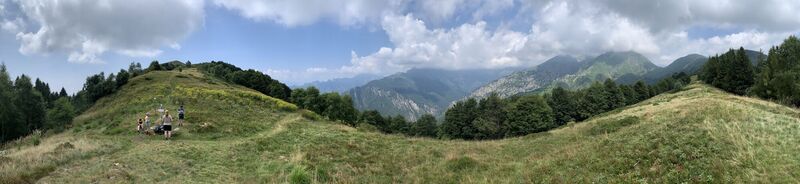
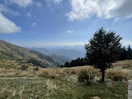
From the Pian Vadà bivouac (1,711 m), go up in the direction of Monte Zeda along the VBAR20 path, which runs along the Cadorna military road up to an altitude of 1,701 m and then, with a clear trail, follows...
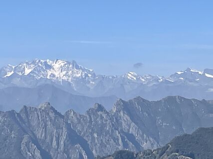
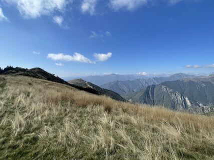
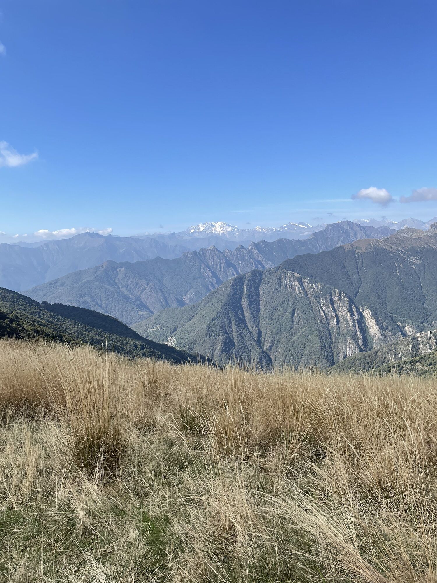
From the Pian Vadà bivouac (1,711 m), go up in the direction of Monte Zeda along the VBAR20 path, which runs along the Cadorna military road up to an altitude of 1,701 m and then, with a clear trail, follows the ridge. At an altitude of 1,701 m, after about forty minutes of walking, you take the VBAR03A path, which branches off to the left and cuts across the south-eastern side of Mt. Zeda. Follow it, gaining altitude, until it joins, along the watershed ridge between Valle Intrasca and Val Pogallo, with the VBAR03 path, just before Pizzo Marona (altitude 2,000 m). Follow the VBAR03 path along the ridge, reaching Pizzo Marona (2,050 m), the highest point of the stage and the itinerary and, beyond, already downhill, the chapel of the same name.
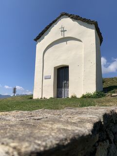
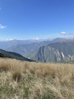
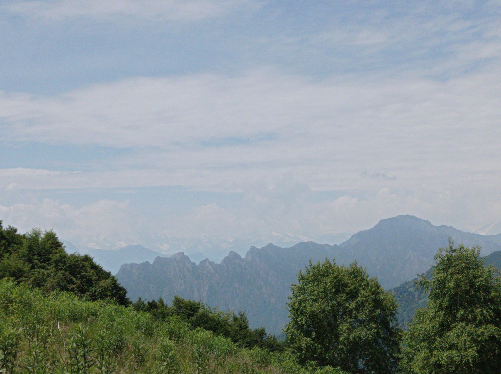
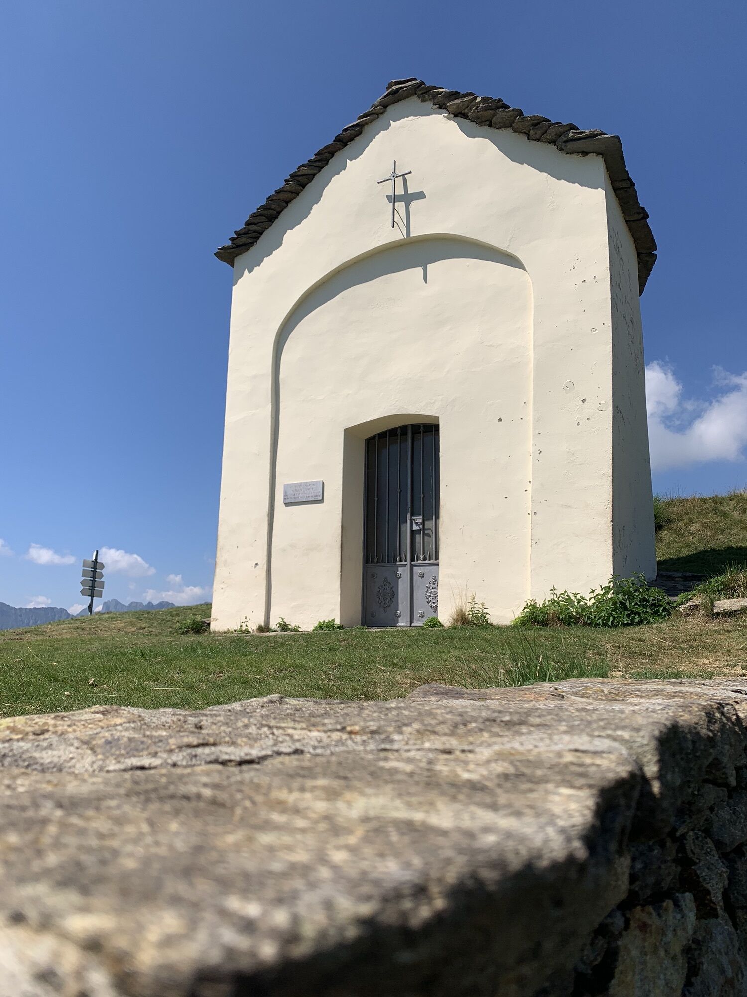
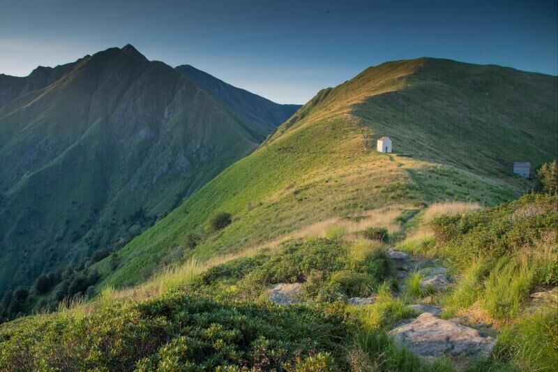
Continuing along the VBAR03 path, you descend, always along the ridge, in a southerly direction up to an altitude of 2,006 m; go around Cima Cugnacorta, crossing the eastern side overlooking the Intrasca Valley; you regain the ridge at Colle della Forcola (1,519 m); continue across the western slope of Mount Todano and, having completed the most mountaineering section of the stage, you reach the saddle of Pian Cavallone and the chapel of the same name (1,546 m). The chapel represents an important crossroads of the paths that go up the left orographic side of the Intrasca Valley and a key access to the Val Grande Park, through the Val Pogallo.
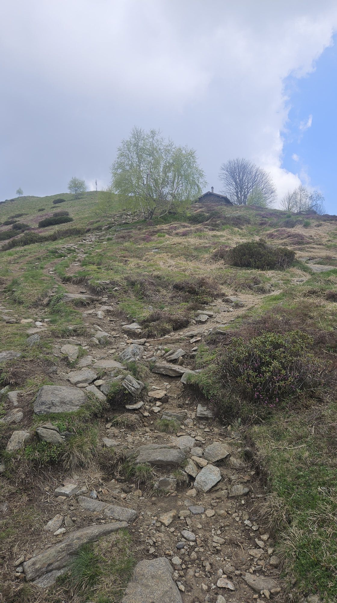
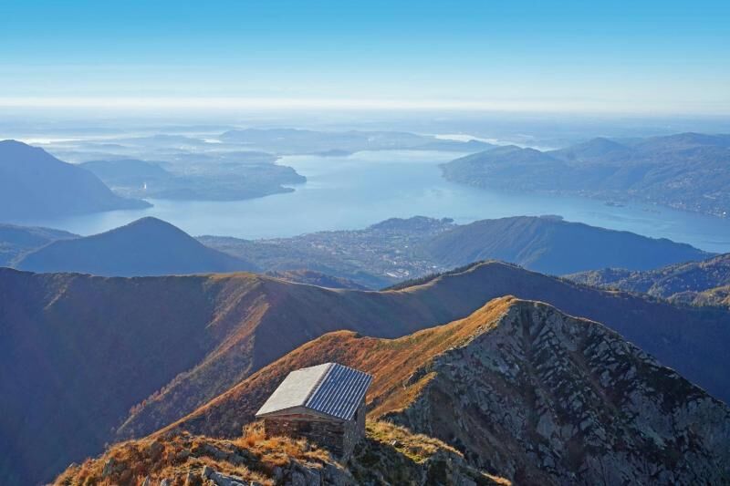
Continue downhill along the ridge, still along the VBAR03 path, until the crossroads for the VBAP06 path, at the foot of the climb that leads to Pizzo Pernice. From the ridge, take the VBAP06 path on the right which descends in the direction of Cicogna (fraction of the municipality of Cossogno and certification point of the S.P. n. 90 Rovegro-Cicogna) and in 10 minutes of descent, on a clear track in a beech forest, you reach Alpe Curgei and the bivouac of the same name.


Igen
The Alpe Curgei bivouac, managed by the Pro Loco Association of Miazzina, is unattended and always open: it offers around 8 beds, is heated with a wood stove and has a fountain in the relevant area. For information call n. 0323/494101. Alternatively, in the Cappella del Pian Cavallone area, it is possible to descend along the VBAR07 path to the Pian Cavallone CAI refuge. The structure offers approximately 25 beds in rooms with 4-6-8 seats, refreshment service, electric light supplied by a generator. It is open every weekend, on holidays from June to October and every day from the last week of July to the end of August. For information, you can call the refuge (0323 407482) or the manager, identifying the references on the CAI website www.caiverbano.it
Népszerű túrák a környéken
-
3,5
Cannobio zu Sant’Aagata
könnyűKirándulás 5,85 km -
4,0
Cicogna, Strada Sutermeister, Alpe Pogallo, Alpe Pra, Cicogna
közepesKirándulás 9,83 km -
5,0
Himmel
közepesKirándulás 12,7 km -
Monte Faiè
közepesKirándulás 6,37 km -
Centres of energy in the Ghiridone
közepesTanösvény 7,35 km -
5,0
Oggonio
könnyűKirándulás 7,55 km -
4,3
Pian Cavallone
könnyűKirándulás 7,55 km -
Val Pale - Pizzo Pernice, Piemonte/Italia
közepesKirándulás 6,14 km -
Montofano - Mergozzo, Piemonte/Italia
közepesKirándulás 8,61 km -
Camedo-Bordei-Terra Vecchia-Rasa
közepesKirándulás 10,9 km

Túrázás & nyomkövetés


Ne maradjon le az ajánlatokról és az inspirációról a következő nyaralásához!
Az Ön e-mail címe hozzá lett adva a levelezőlistához.