


Erratic boulders trail of Vialfré


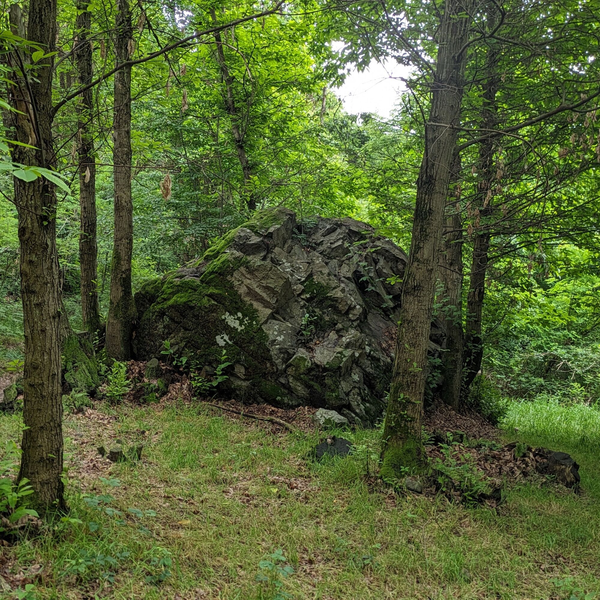
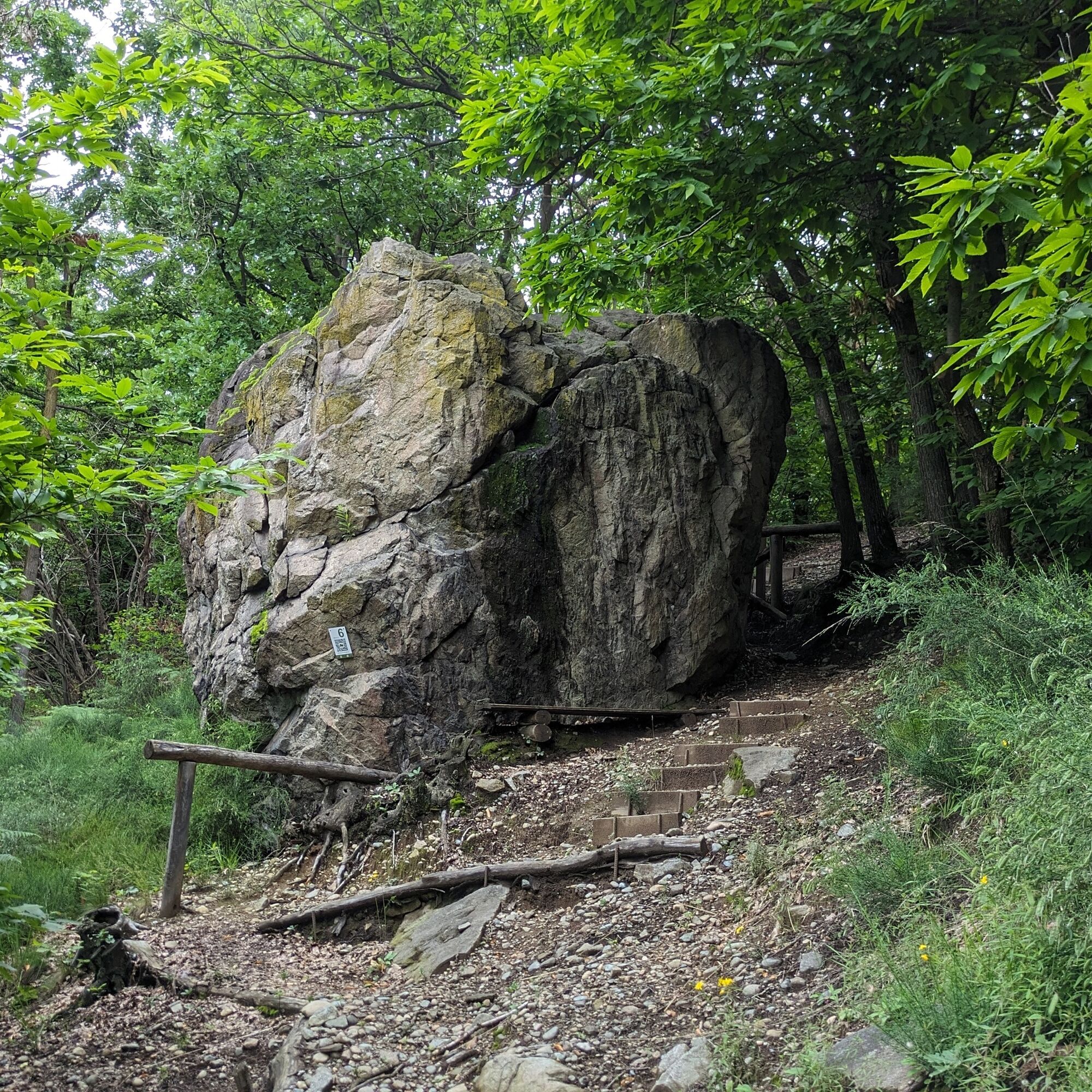
Thematic route focused on the presence of erratic boulders, whose transport was carried out by the Balteo glacier during the Pleistocene period. When the glacier retreated, the stone blocks remained on...
Thematic route focused on the presence of erratic boulders, whose transport was carried out by the Balteo glacier during the Pleistocene period. When the glacier retreated, the stone blocks remained on the ground, sometimes in scenic spots, constantly stimulating the curiosity of those who observe them.
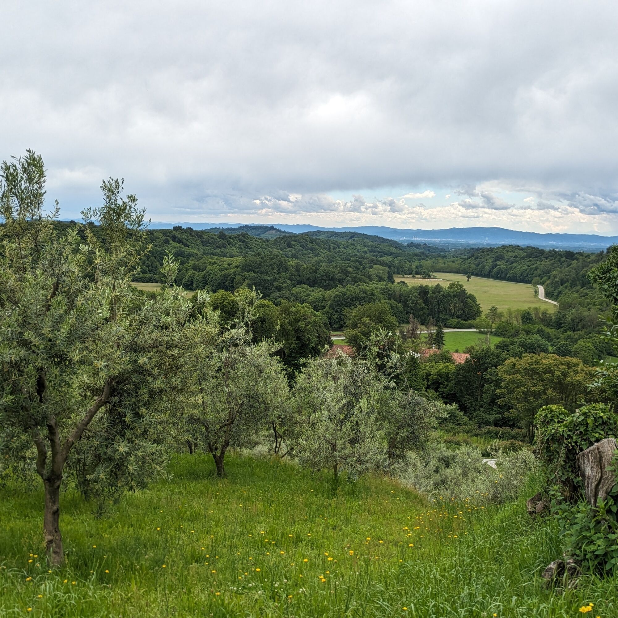
The path is part of the broader project called Morena Ovest: routes that connect the main historic centers of this part of the morainic amphitheater, with insights on the geological genesis of this territory, enjoying panoramic views and reconnecting with the natural environment.
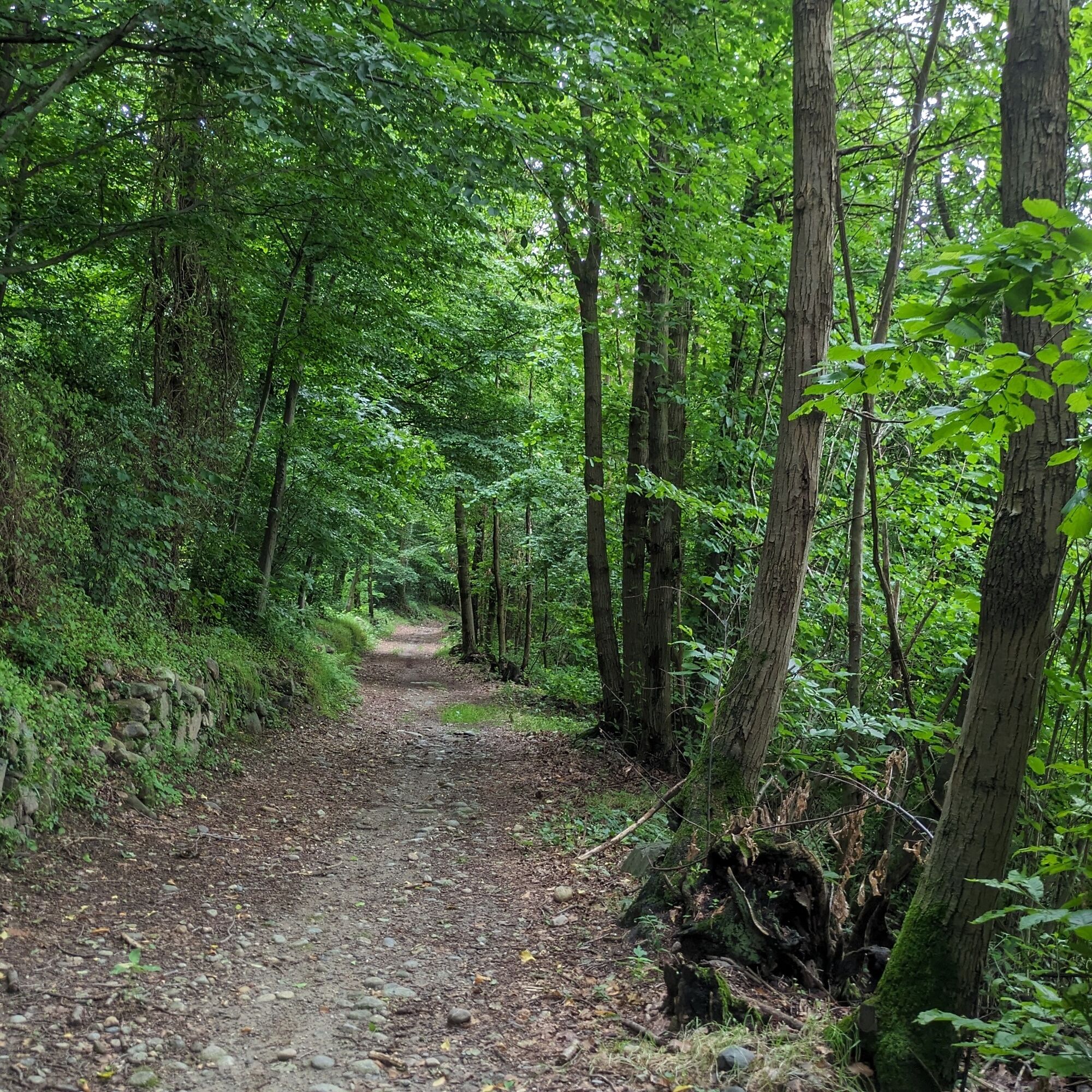
The departure is from the center of the village of Vialfré. The route does not present major difficulties: it develops on secondary roads first, then forest roads, and can be traveled by bike except for the final small loop that crosses the ridge of the hill via a hiking trail. The erratic boulders are accompanied by explanatory panels with QR codes for further information.

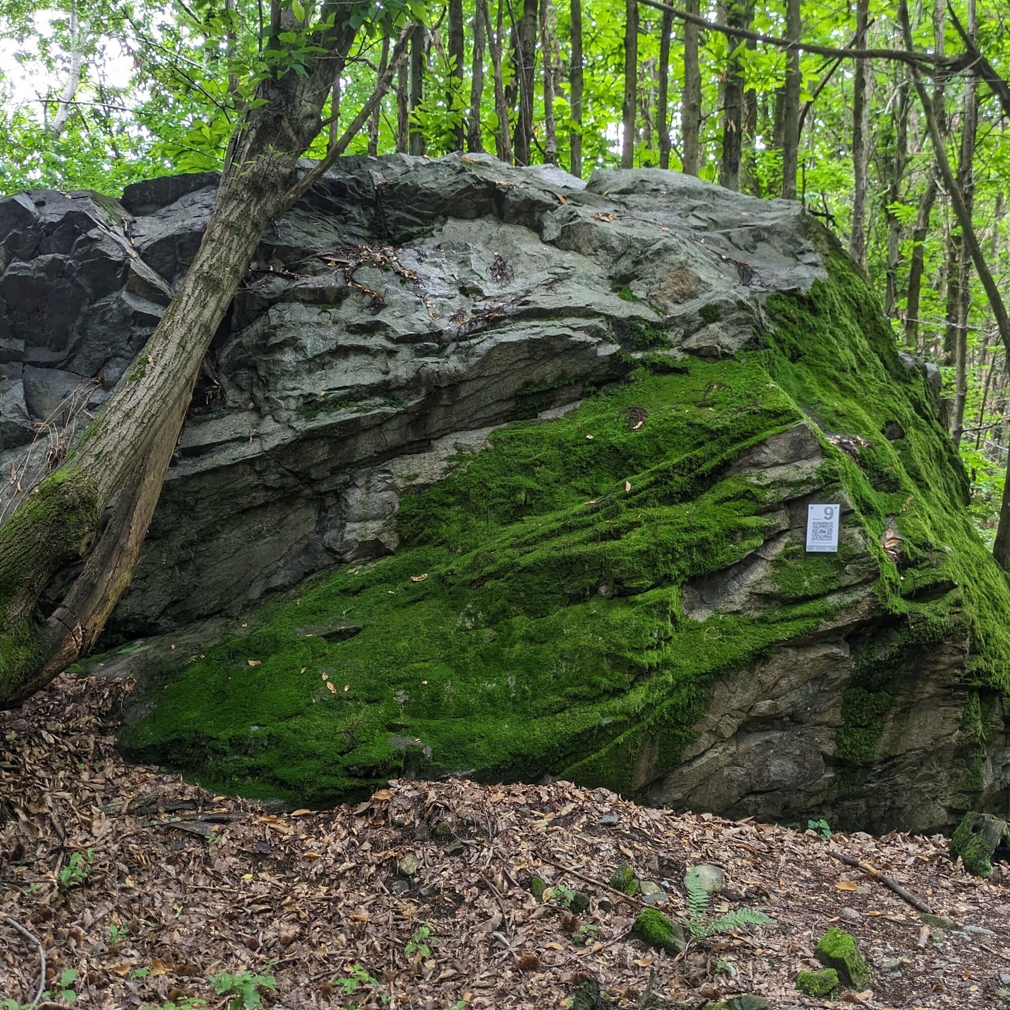
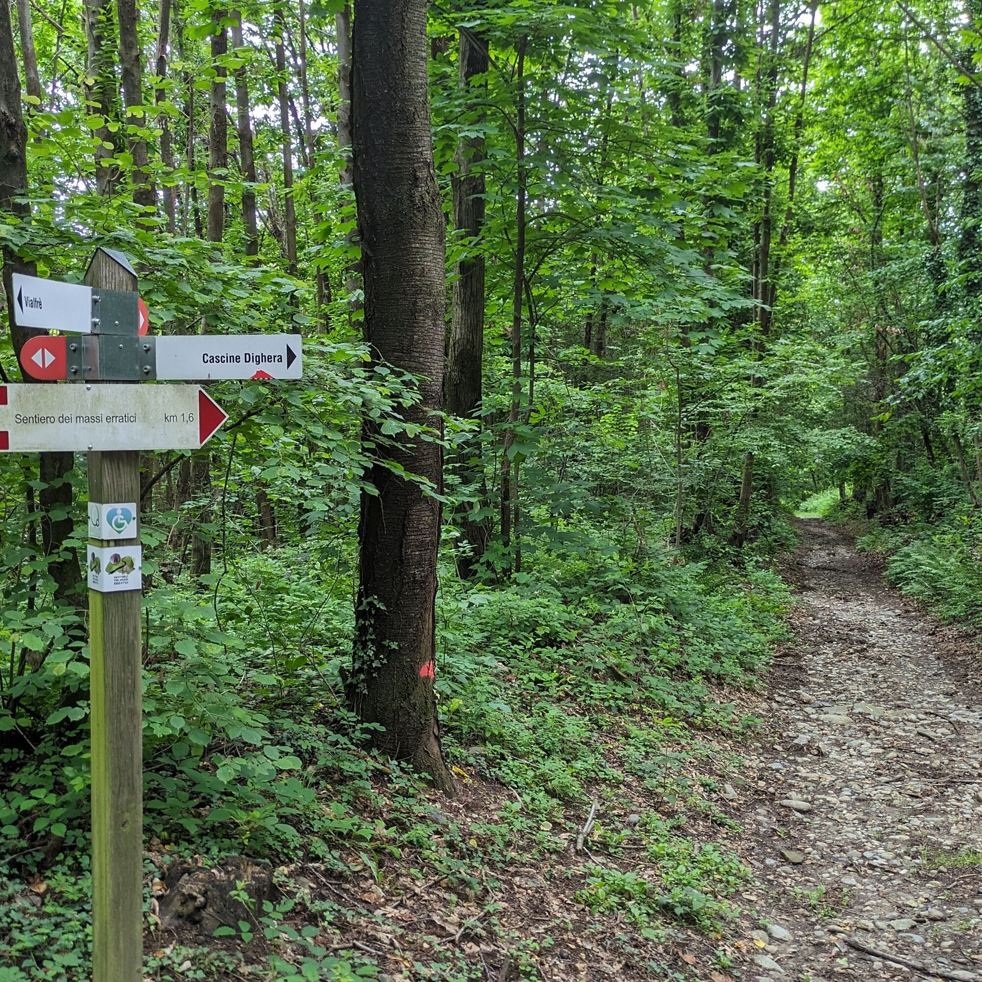
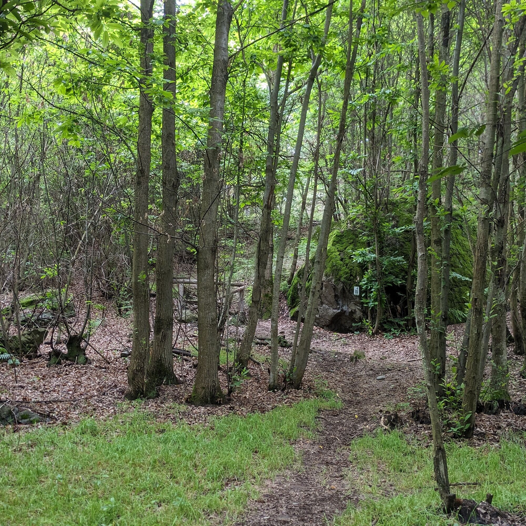
Leaving the church behind, follow via Roma; then keep right onto via Borghetto which leaves the town and becomes a trail. The path ends on via Circonvallazione: turn right. At the first bend take the dirt road to the left and shortly after turn right (signpost "Erratic Boulders Trail"). Continue along the trail on the flat for about 1 km, then leave the dirt road for the straight path: soon you will meet the first erratic boulder.
After the third boulder the trail turns left and climbs to the top of the ridge of the hill to descend on the opposite side: then turn left following the signs. Near stop number 7 turn left and once again cross to the other side of the hill. From here, turning right, you return along the outward route.
Igen
Igen
Non-slip sole footwear and wind/rain protection are recommended
For those arriving from Turin the nearest highway exit is San Giorgio Canavese (A5), follow directions for Montalenghe and Vialfré.
Arriving from the North the most convenient highway exit is Scarmagno.
Vialfré is served by the GTT bus line 4152 Silva - Vialfré - Ivrea.
See the GTT website for schedules and stops.
Just before the historic center of Vialfré there are two parking lots (one on each side of the provincial road):
Parking Area Via per Silva (larger) and near the BalOK bar
For any further information about the route: morenaovest.it
For all tourist information consult the web portal Turismo in Canavese
Before undertaking any hike it is advisable to check weather reports or ask for information at local Tourist Offices.
It is good practice not to hike alone and always inform someone of your destination.
Do not litter but carry your waste with you and possibly collect any left by others.
The indicated travel times are approximate and may vary depending on weather conditions and personal ability.
Népszerű túrák a környéken
-
Ring of the ancient Balteo Glacier
közepesTávolsági kerékpározás 195,4 km -
VIALFRÉ Morena West Loop
közepesMountainbike 22,2 km -
MAZZE' Lake Candia and Masino Castle Loop
közepesBiciklizés 44,8 km -
CALUSO Lake Candia Loop Morena West
közepesBiciklizés 31,0 km -
IVREA Anello Ivrea - Alice Superiore
közepesTávolsági kerékpározás 35,0 km -
IVREA Anello Ivrea - Viverone
közepesTávolsági kerékpározás 52,4 km -
Ring of the Ancient Balteo Glacier (stage 2)
közepesTávolsági kerékpározás 56,8 km -
CORIO Runde Oberes Canavese Westmoräne
közepesBiciklizés 76,4 km -
CASTELLAMONTE Sacred Valley Loop - Lower Valchiusella
közepesBiciklizés 27,8 km -
TORRE CANAVESE Nature Route
könnyűKirándulás 6,71 km
Túrázás & nyomkövetés


Ne maradjon le az ajánlatokról és az inspirációról a következő nyaralásához!
Az Ön e-mail címe hozzá lett adva a levelezőlistához.