


LEMIE Ovarda Lakes loop


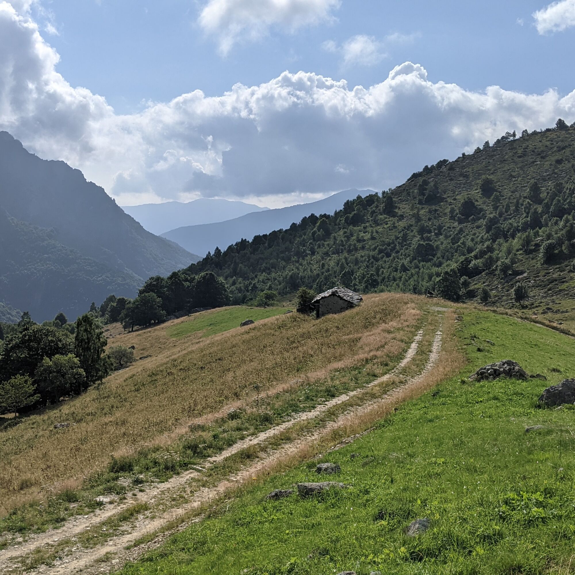
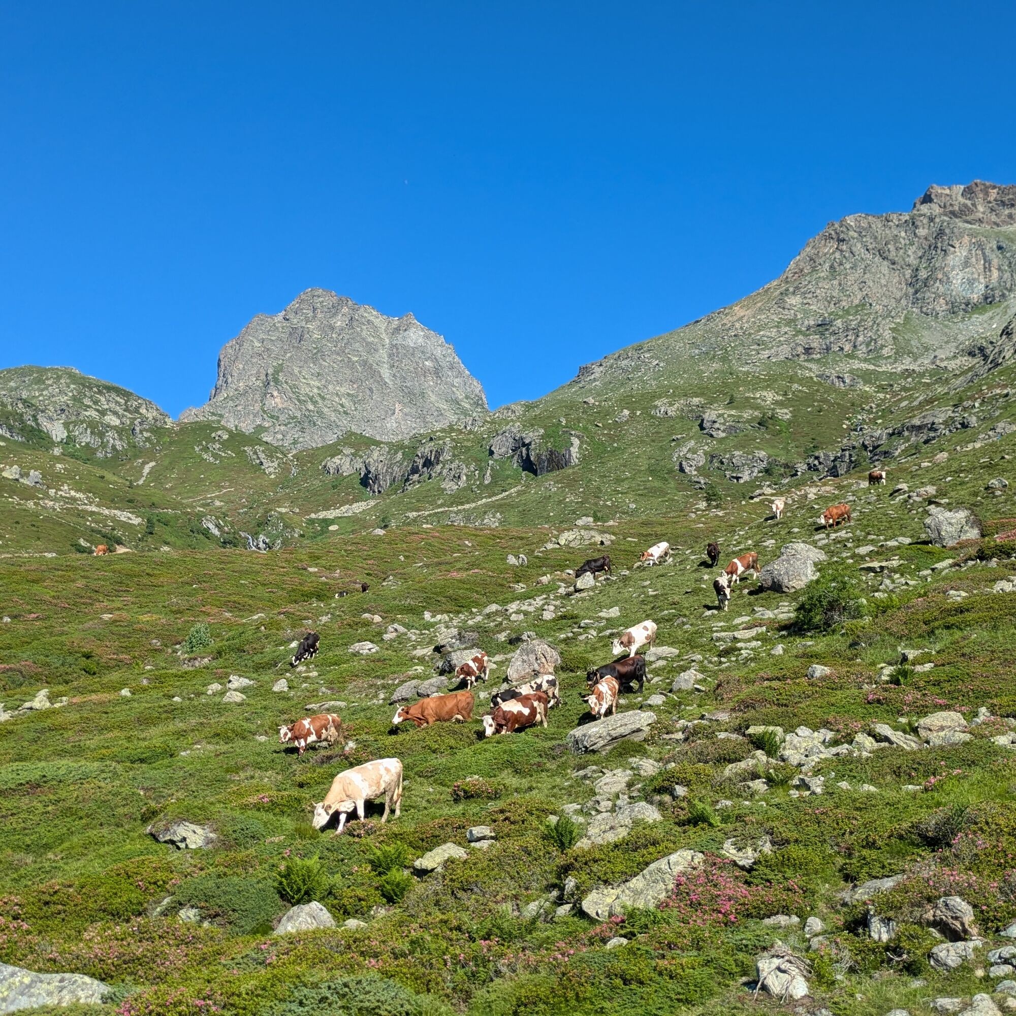
The route runs along a sunny side valley, lateral to the main valley, which hosts numerous mountain pastures colored by fantastic blooms in early summer and reached by a dirt road. As you climb you can...
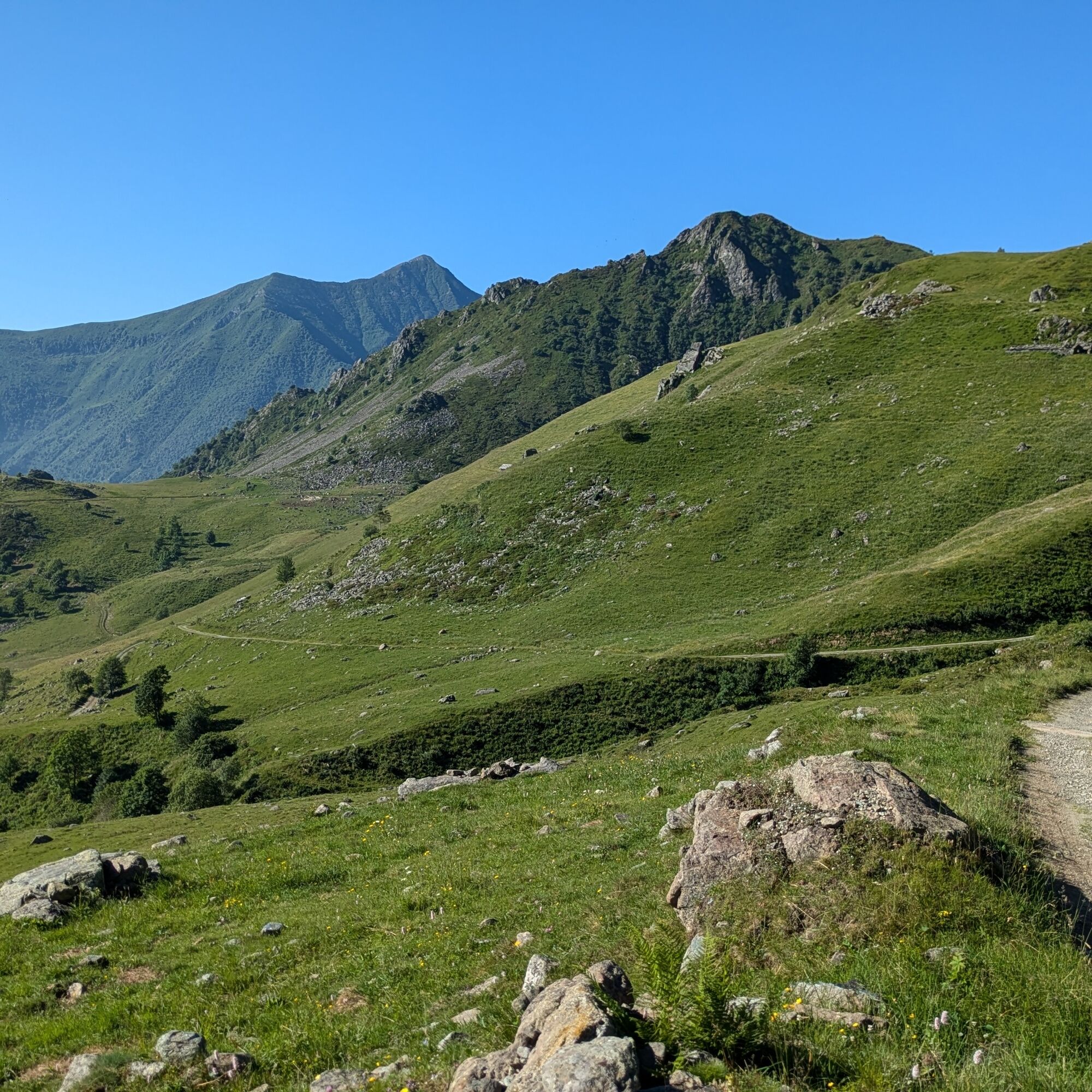
The route runs along a sunny side valley, lateral to the main valley, which hosts numerous mountain pastures colored by fantastic blooms in early summer and reached by a dirt road. As you climb you can admire the shapes of the rocky peaks of Torre d'Ovarda and Punta Golai, but once at the top the view opens to the remaining mountains of the middle Val di Viù and from the highest points also other Piedmontese peaks.
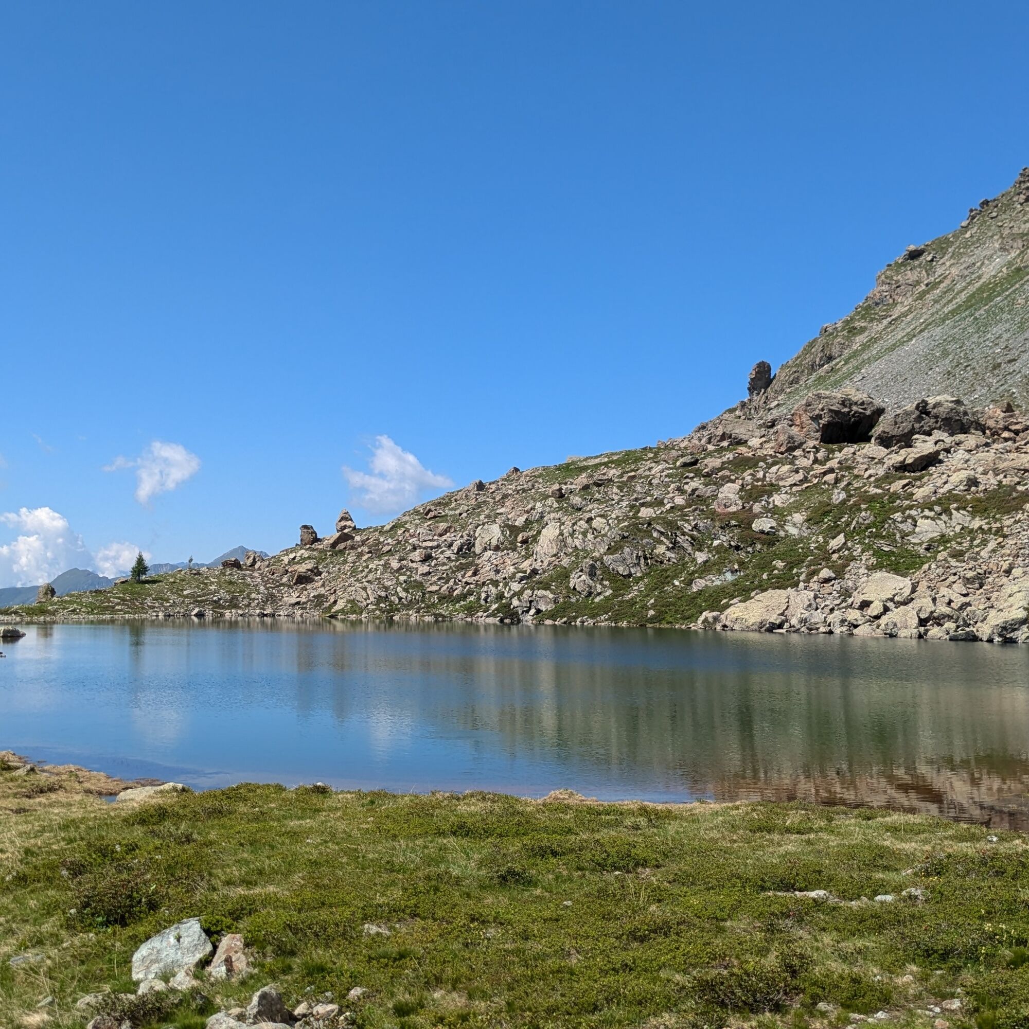
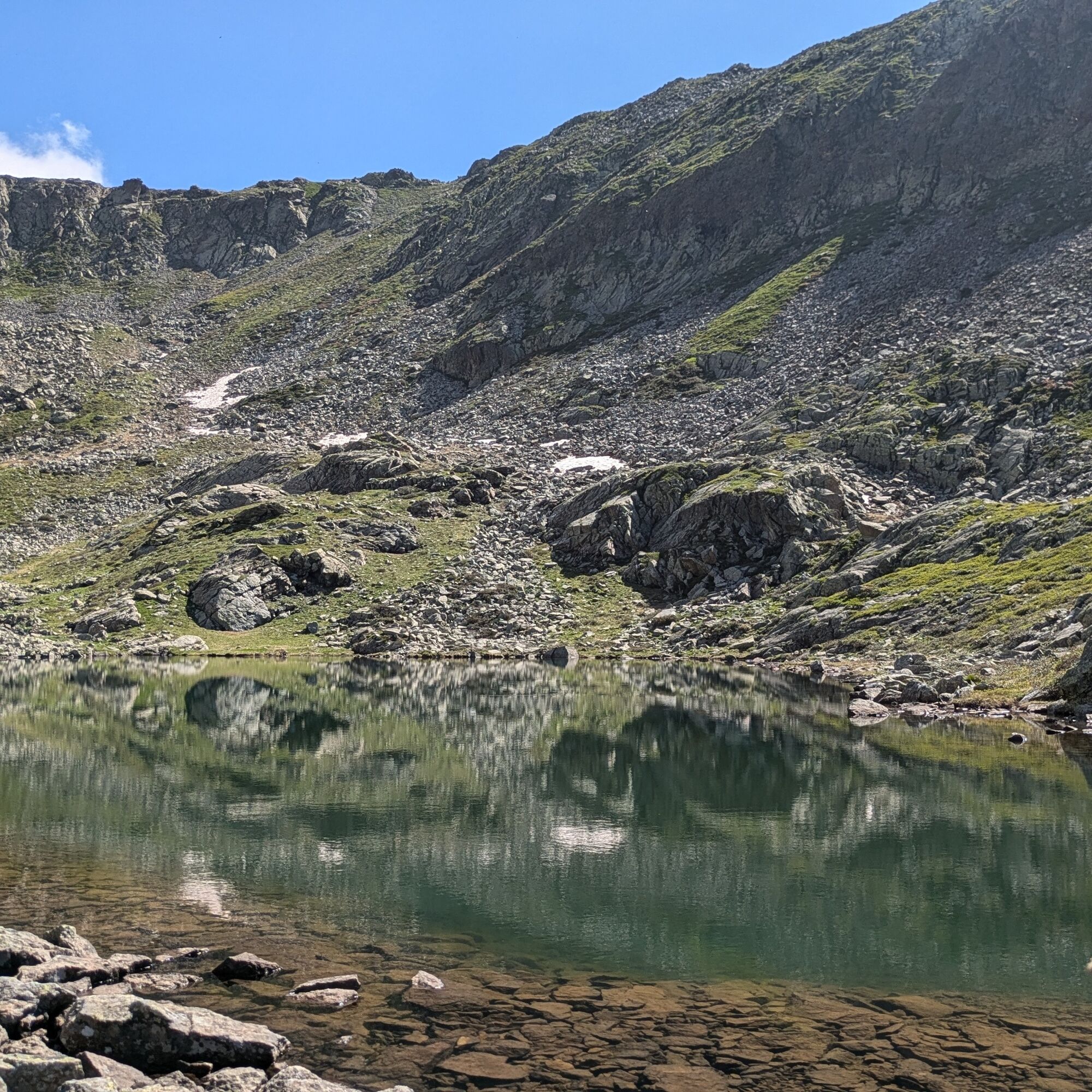
In the upper part there are seven glacial origin small lakes along a loop route that can be further divided into two parts so that you can shorten the duration if you want. Shapes and colors vary a lot from one lake to another.
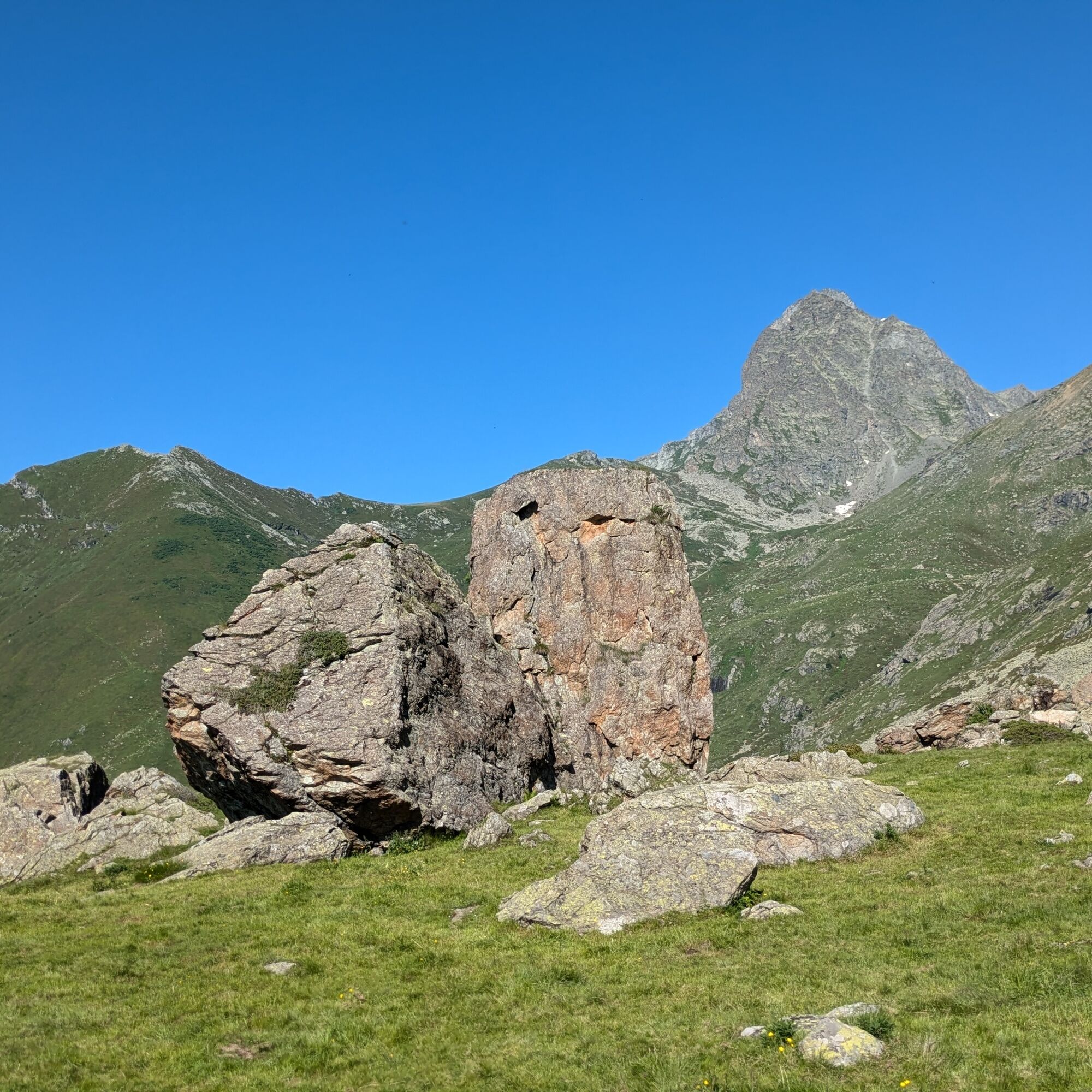
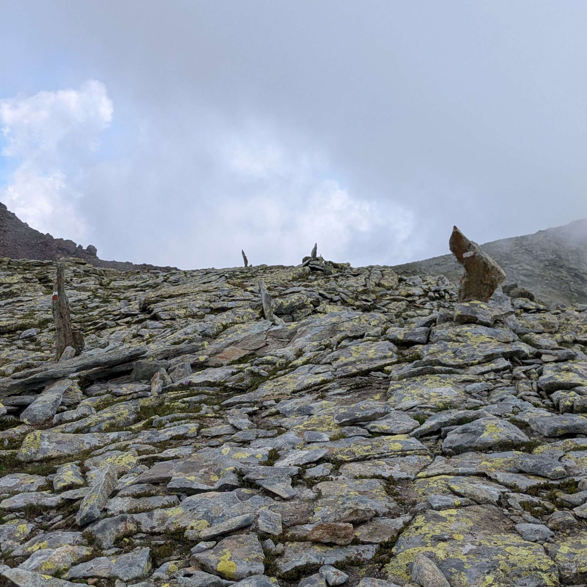
The trails are well marked in the lower part, a bit less in the upper part where they still remain noticeable by following white/red markers and typical stone cairns. There is a single exposed passage to be overcome with the help of two chains fixed to the rock.

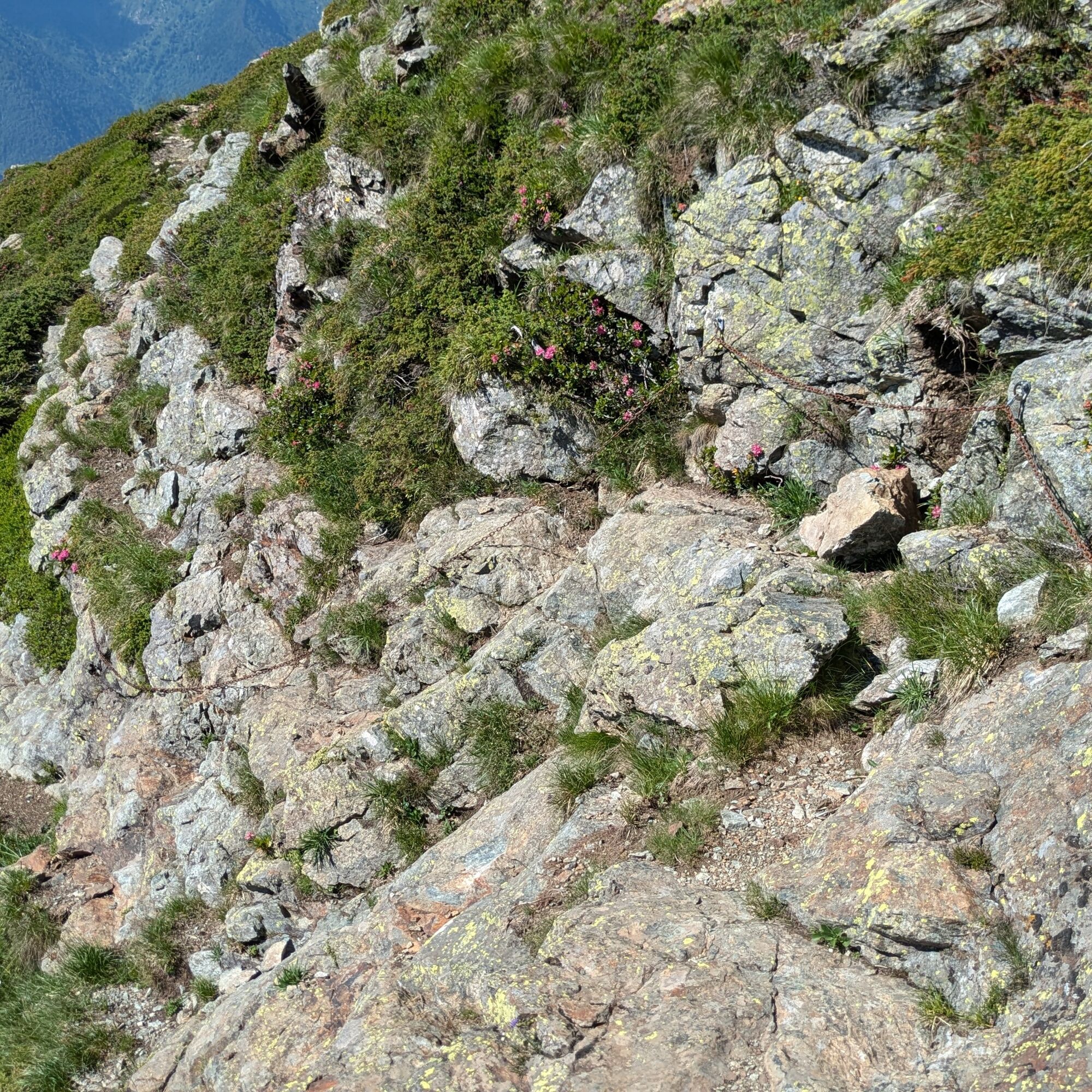
Near the parking lot after the chapel, the 128A trail begins in the forest. Shortly after the Frontera huts, take the dirt road uphill to a hairpin turn, just before Alpe Grosso, where you take the trail on the right (small CAI notice board present). After a short distance, turn right (small plaque on a stone, trail 127) to cross the stream on the stones (be careful!) and then turn right. Then climb through meadows and rhododendrons to the Pian del Gioco plateau (1995 m). The route continues, always in the same direction, crossing some small valleys. Upon reaching a fork (you will meet it closing the loop) continue straight with signs for Lago Piccolo. Here there is an exposed passage that can be crossed with the help of two chains (pay attention!!). Then you arrive near Lago Piccolo.
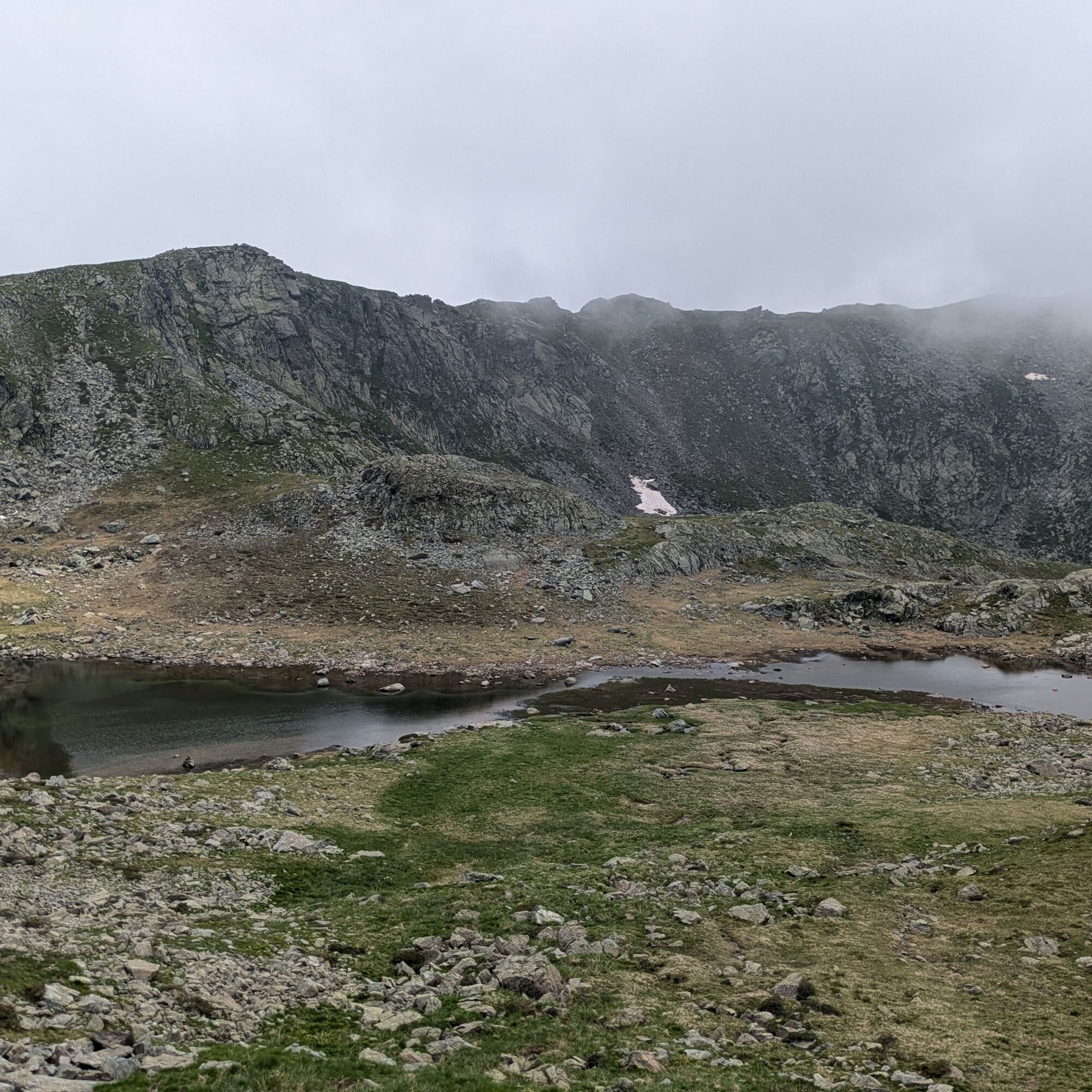
Continuing along the grassy ridge you reach a wide meadow area on the right of which is Lago Bleu. From the lake, turn sharply left and cross the large meadow heading towards the visible sign near the big lake. At this point you can choose whether to close the loop without the upper part or continue.
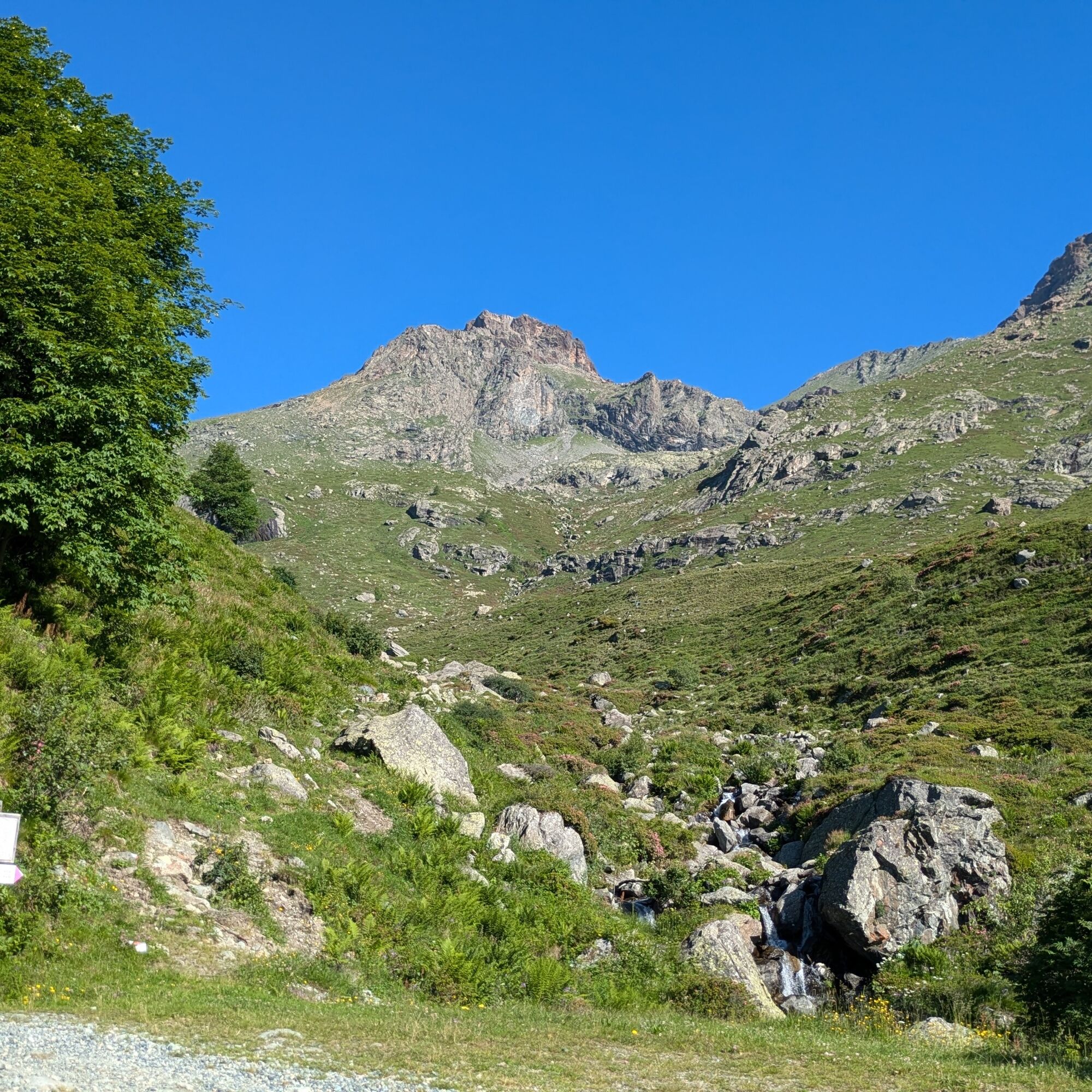
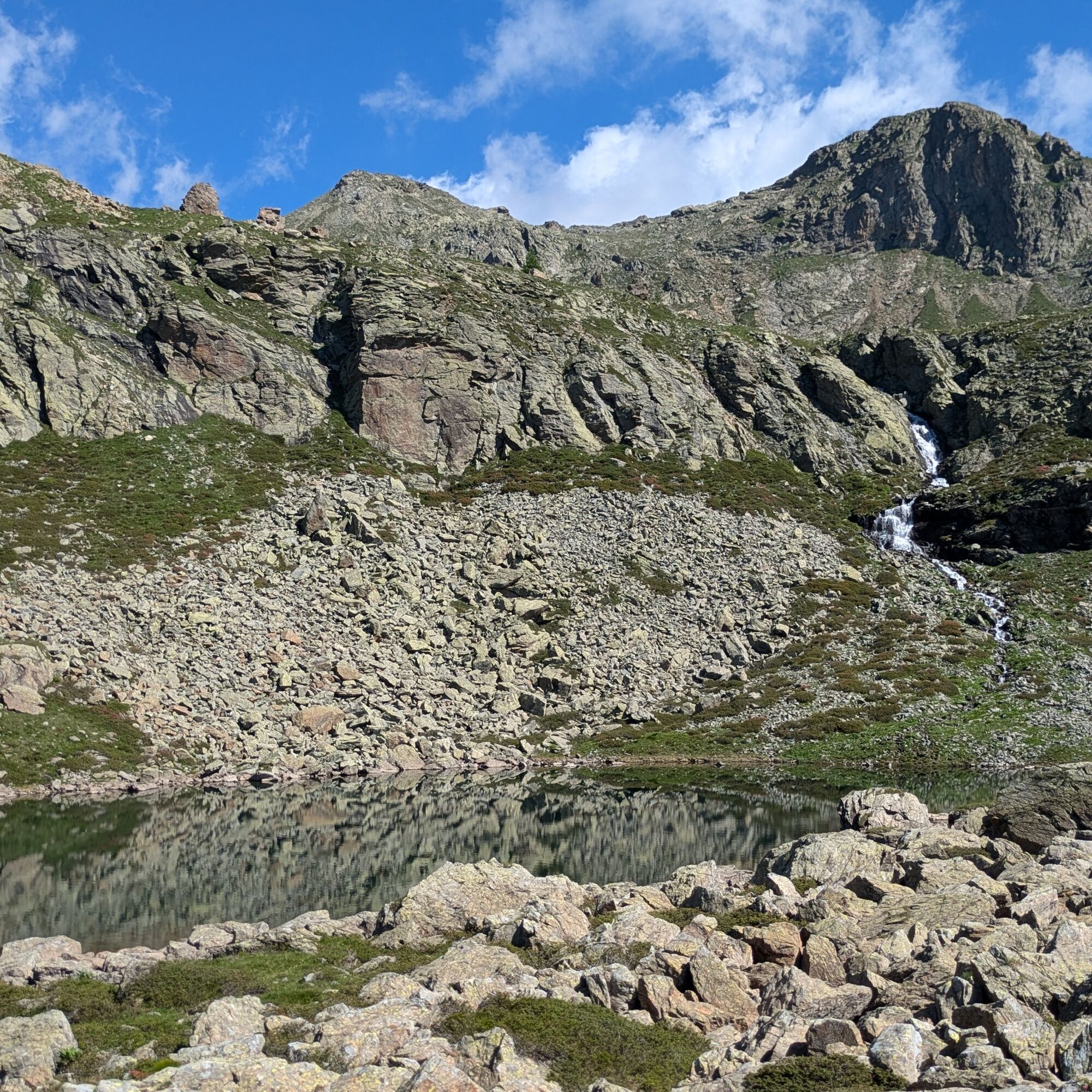
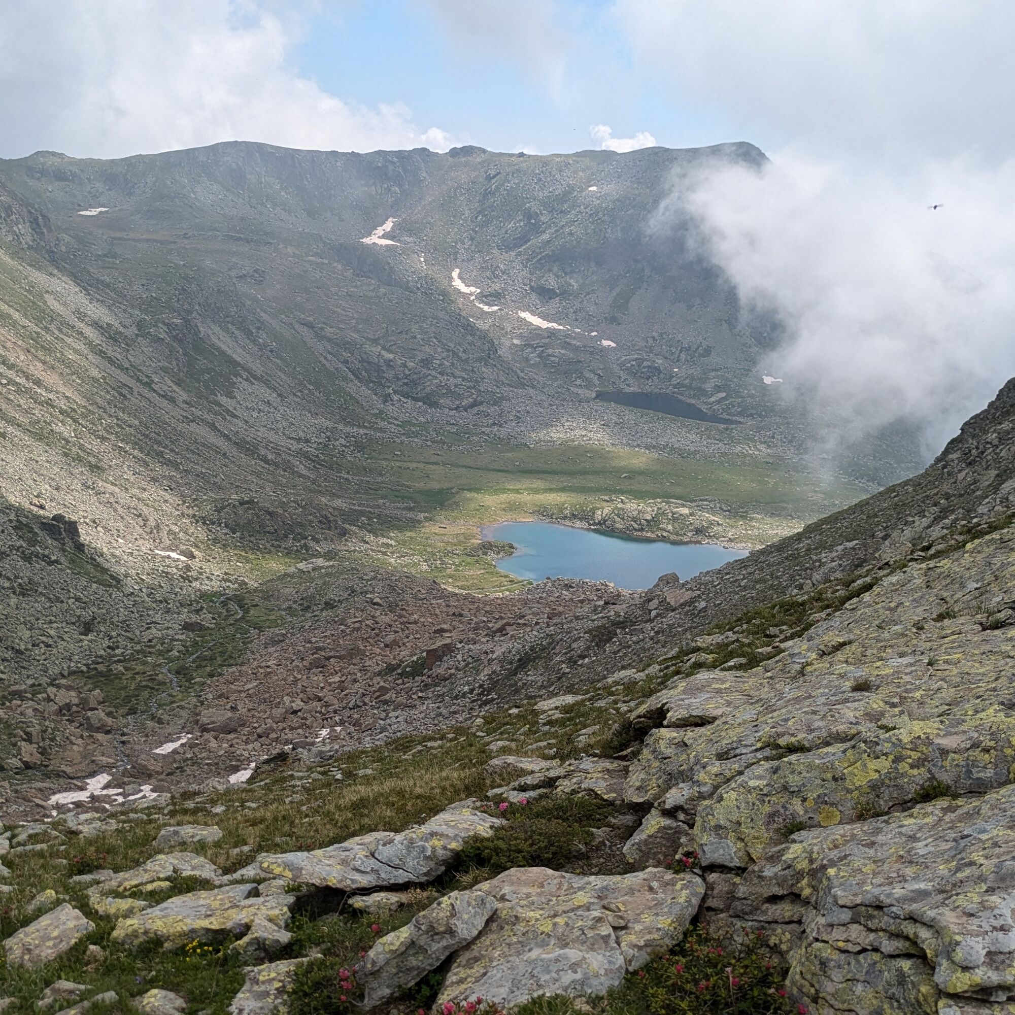
Continue westwards entering the rocky basin which must be climbed up to its natural saddle. Just past the ridge, keep right uphill on a not obvious path, but soon the white/red markers reappear. Follow a short traverse over scree before reaching the two small lakes marked on the maps as "i Tre Laghetti".
Climb further among rocks to reach Lago dalle Rocce Rosse (sometimes dry in midsummer). For those who want, next to the small lake a trail climbs to the obvious Passo Mazzucchini (2457 m). Returning to the small lake continue east on a rocky plateau then descend to Lago Lungo (2302 m).
Continue downhill, descending diagonally right on the steepest part to reach Lago Grande.
Follow the shore of Lago Grande on the rocks until crossing the stream flowing out of the lake. Climb the ridge (trail not very obvious) and follow trail 127 over the scree which then descends steeply to the fork met on the ascent. From here retrace the outward route.
High shoes with non-slip soles, wind/rain protection, a warm layer, a supply of water and food, first aid, hat and sunglasses are recommended.
There are no support points or water: start with adequate supplies.
In case of fog, the route in the upper part is hard to distinguish; carefully evaluate whether to continue or not.
In many parts of the itinerary there is no mobile phone network coverage.
From the plain, after passing Germagnano, turn left for Val di Viù. Proceed to Lemie. Shortly after the main town, turn right onto a small road with signs for Fontana - Inversigni. Continue on the road which becomes paved until the parking lot just past the chapel of San Bartolomeo (no further progress possible).
Parking after the chapel of San Bartolomeo
For tourist information about the valleys: Consorzio Operatori Turistici Valli di Lanzo - www.turismovallidilanzo.it
The road leading to the starting point becomes dirt in the last kilometers with short sections of steepness: it is possible to drive with a small car, provided it is not too low.
Before undertaking any excursion it is advisable to consult weather forecasts or ask for information at the local Tourist Offices.
It is good practice not to undertake an excursion alone, always inform someone about your destination.
Do not litter the environment but carry your rubbish with you, possibly collecting that left by others.
The estimated walking times are indicative and may vary according to weather conditions and personal abilities.
Start early in the morning to avoid the fog that often forms in the afternoon in summer.
Népszerű túrák a környéken
-
GERMAGNANO loop Colle della Dieta
Országúti kerékpározás 41,7 km -
CHIALAMBERTO Frassa Loop
közepesKirándulás 10,1 km -
CERES Sentiero Natura Val Grande
közepesBiciklizés 40,7 km -
BALME Molino Bivouac Loop
közepesKirándulás 7,55 km -
PESSINETTO Lake Monastero
közepesBiciklizés 30,9 km -
PIALPETTA Val Grande Balcony Trail loop
közepesKirándulás 13,1 km -
COLLE DEL LYS Alpine Loop
közepesKirándulás 15,3 km -
Ceres sentiero natura sino a Forno Alpi Graie
közepesMountainbike 36,1 km -
Lanzo - Mount Turu from Lanzo
közepesMountainbike 29,7 km -
CERES Santa Cristina Loop
közepesKirándulás 7,84 km

Túrázás & nyomkövetés


Ne maradjon le az ajánlatokról és az inspirációról a következő nyaralásához!
Az Ön e-mail címe hozzá lett adva a levelezőlistához.