


Family hike Prinzensee


Fotók felhasználóinkról
-

 © Monika JeskovaLétrehozta a 19.10.2025
 -
 © Monika JeskovaLétrehozta a 19.10.2025
 -
 © Monika JeskovaLétrehozta a 19.10.2025
 -
 © Monika JeskovaLétrehozta a 19.10.2025
 -
 © Monika JeskovaLétrehozta a 19.10.2025
 -

 © GeraldLétrehozta a 12.08.2025
 -

 © Fantom RoKLétrehozta a 04.07.2025
 -
 © Fantom RoKLétrehozta a 04.07.2025
 -
 © Fantom RoKLétrehozta a 04.07.2025
 -

 © Christian HebenstreitLétrehozta a 05.04.2025
 -
 © Christian HebenstreitLétrehozta a 05.04.2025
 -
 © Anna StossierLétrehozta a 31.08.2024
 -
 © Christian LeidenfrostLétrehozta a 20.08.2024
 -
 © Christian LeidenfrostLétrehozta a 20.08.2024
 -
 © Matej Mikus 1Létrehozta a 29.05.2024
 -
 © Matej Mikus 1Létrehozta a 29.05.2024
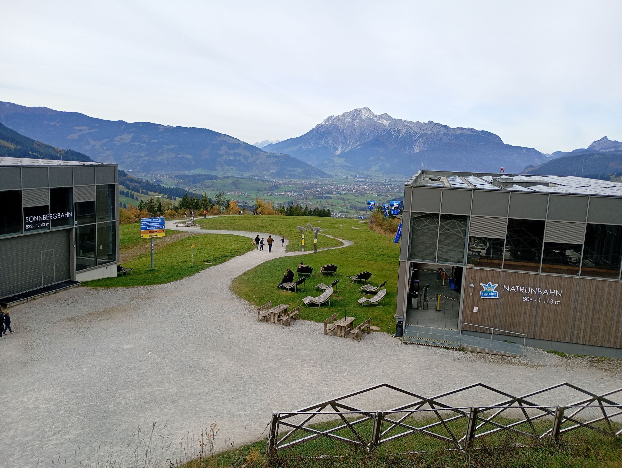


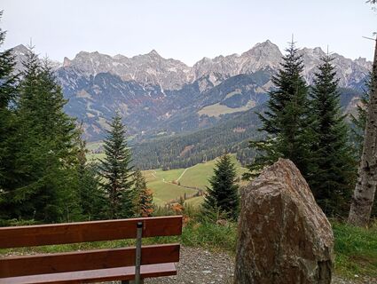
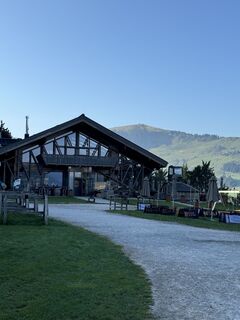
The start is directly in the town center of Maria Alm, from where you can comfortably gondola up with the TOM Almhütte offering a castle playground and herb garden as a first stop. Of course, you can also...
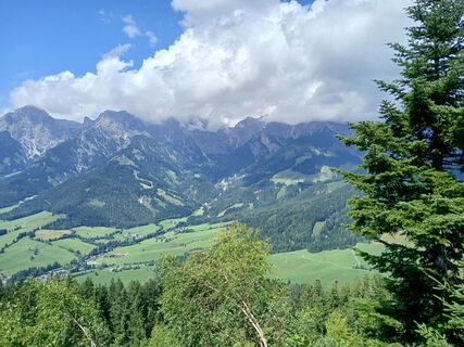
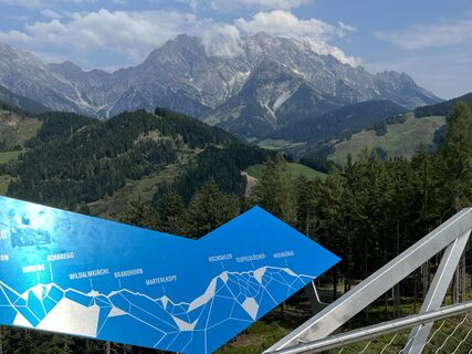
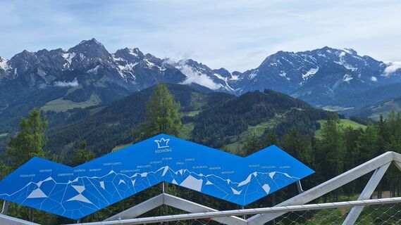
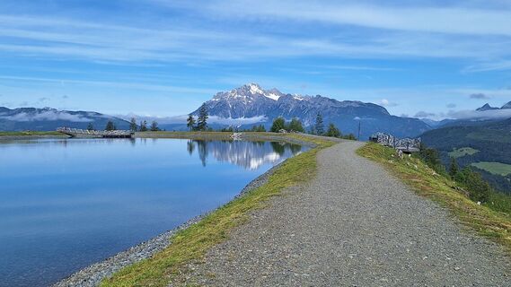
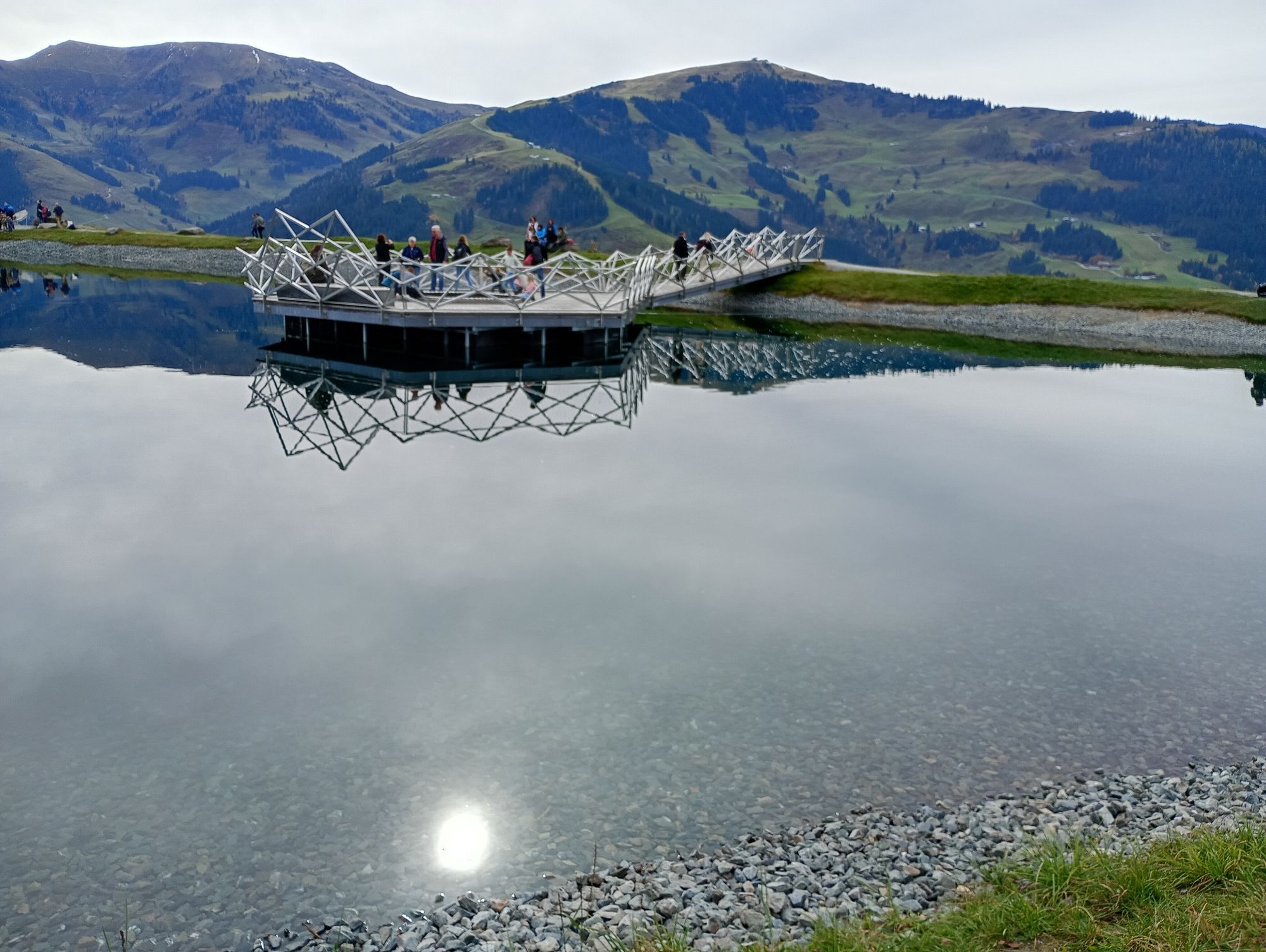
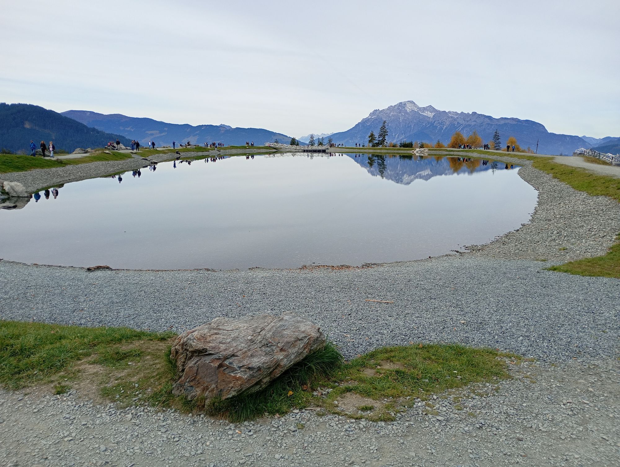
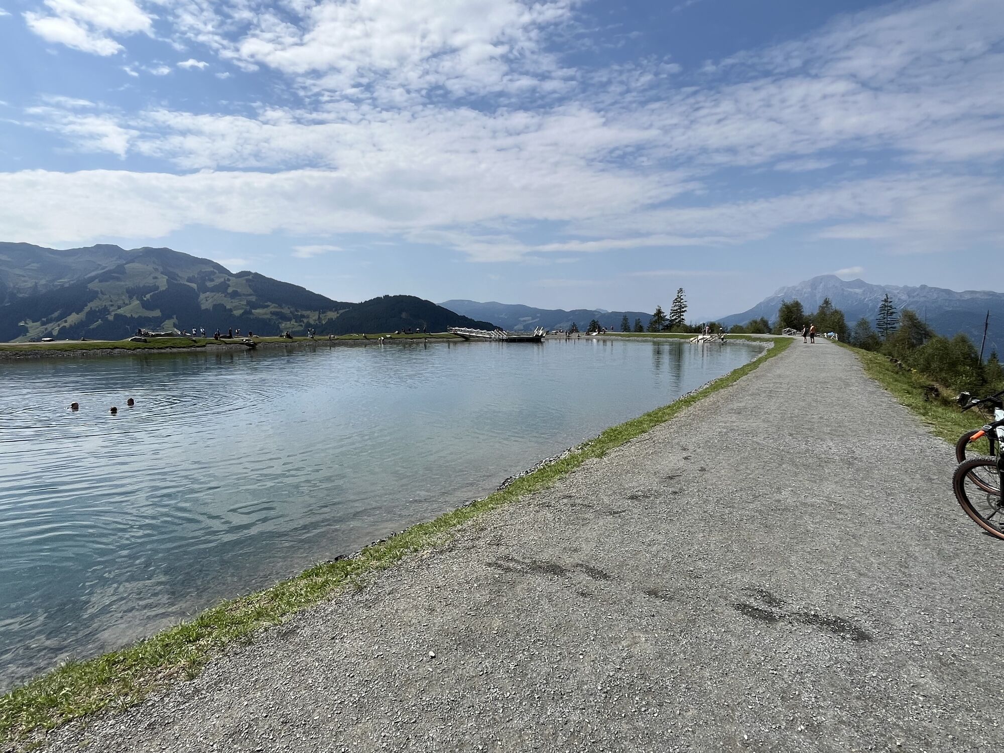
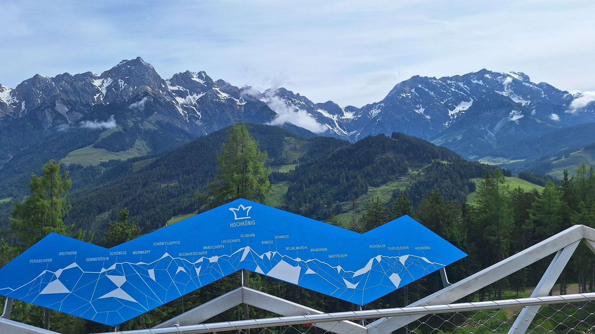
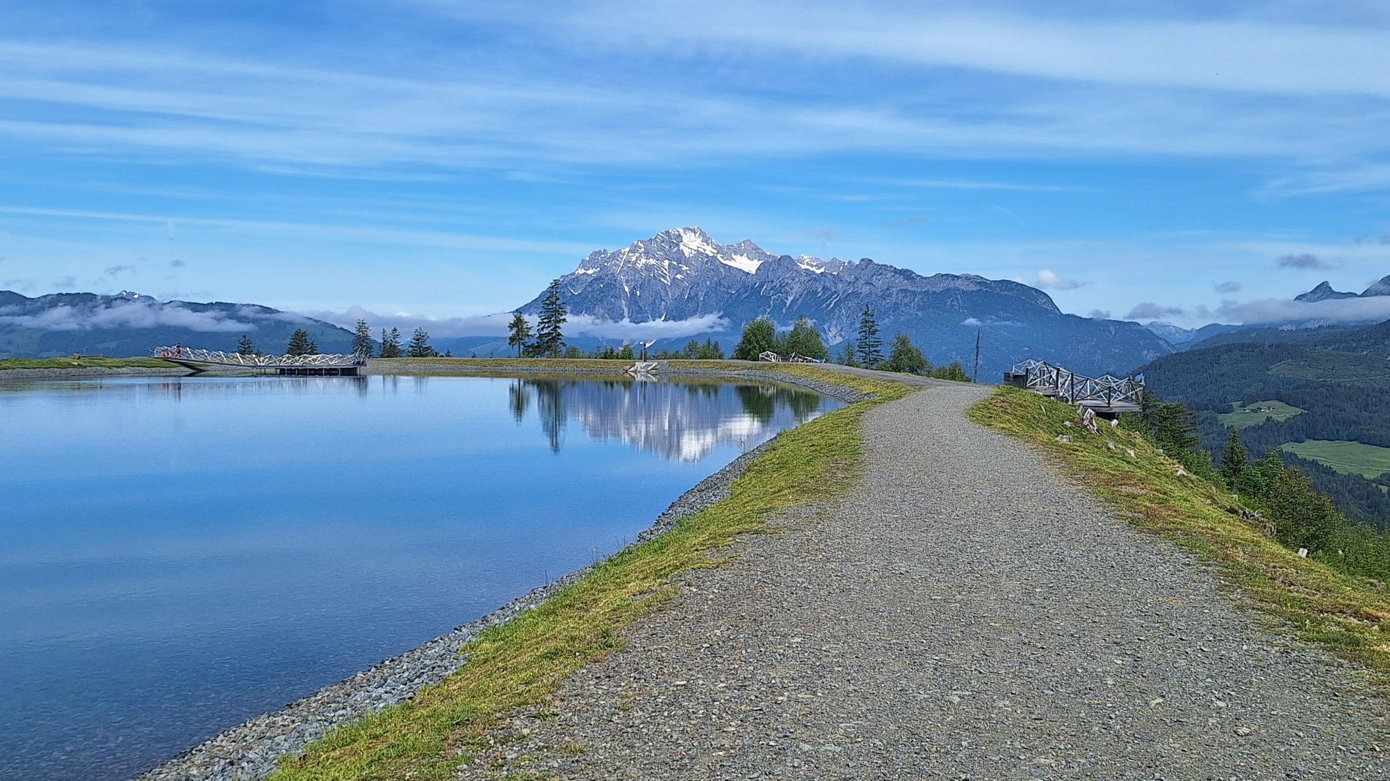
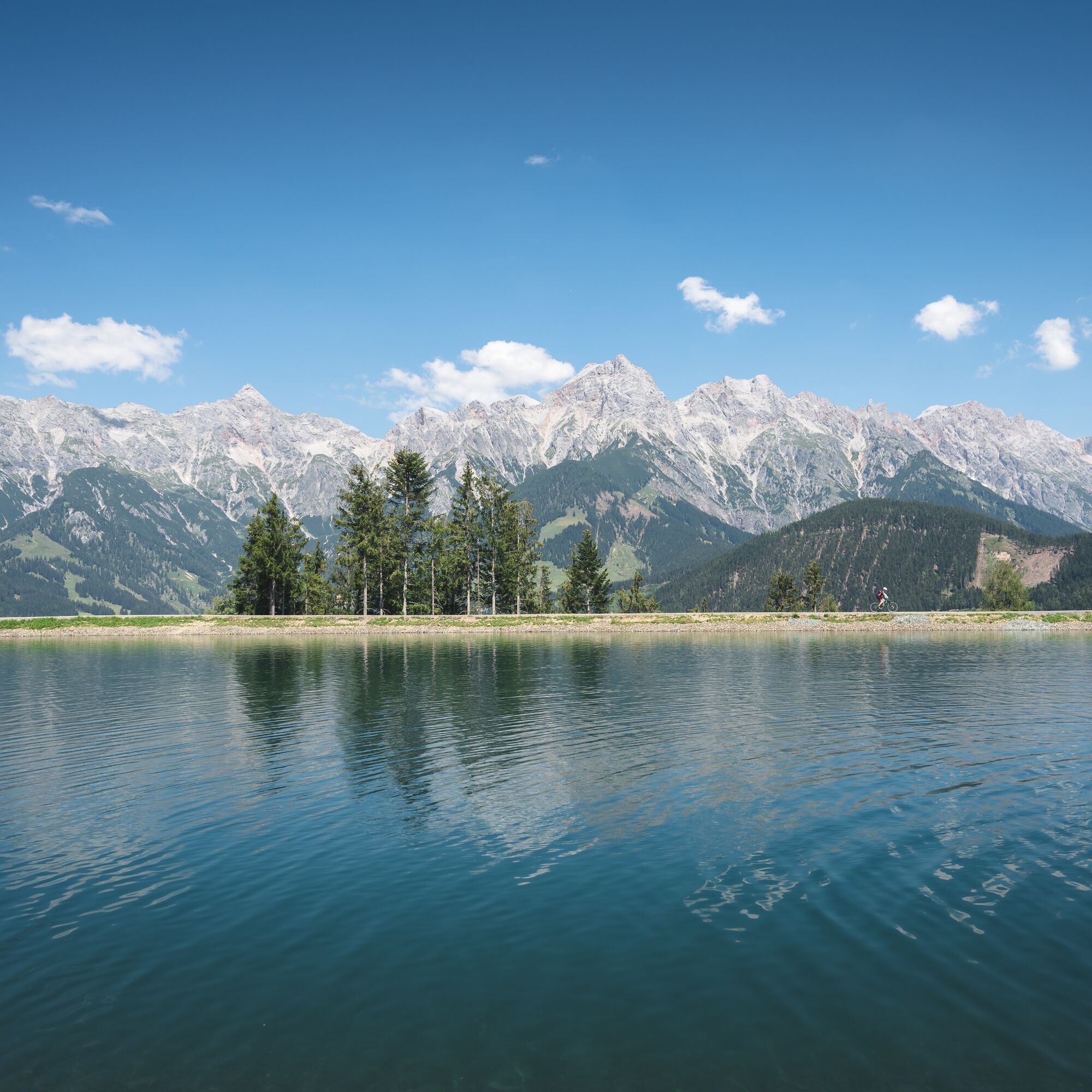
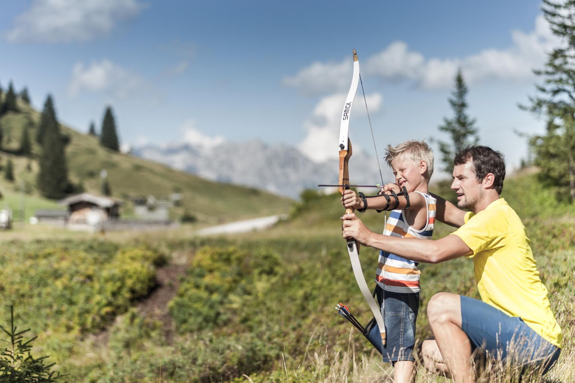
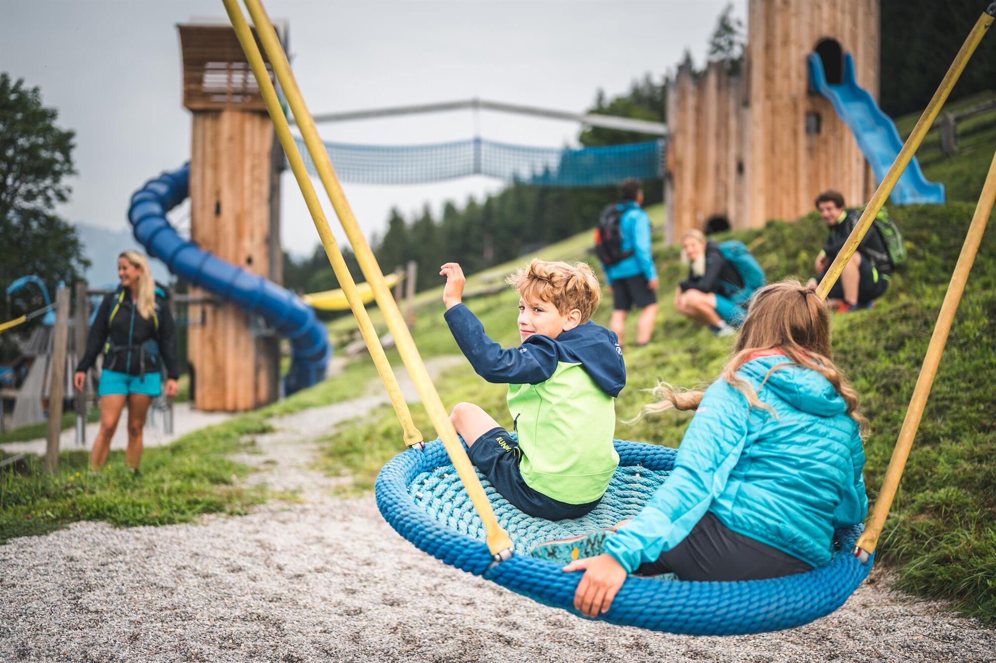
The start is directly in the town center of Maria Alm, from where you can comfortably gondola up with the TOM Almhütte offering a castle playground and herb garden as a first stop. Of course, you can also go straight for the summit of the Natrun. It is reachable after a gentle ascent. Here, the first highlight awaits. The beautiful Prinzensee with its magnificent 360° panoramic view will enchant not only the little princesses and princes. Who knows if mom and dad might get inspired to a thrilling fairy tale, making the long-distance hiking even easier. The next station is then the Jufenalm, where a bow course and a wildlife enclosure are already waiting for you. Afterward, the route continues to the Grammlergut. Those still having energy to romp will love the huge adventure playground right next to the hut. Laid out as a circular path, this hike is ideal for children as it offers plenty of variety!
The start is directly in the town center of Maria Alm, from where you can comfortably gondola up with the Natrunbahn. The summit of Natrun can be reached after a gentle ascent via trail no. 401A in about 20 minutes. However, it only takes about 30 minutes to reach the next station – the Jufenalm. To return to the starting point of the hike, follow trail no. 26a to the Jausenstation Grammlergut. From there, it is only a few more minutes’ walk to the mountain station of the Natrunbahn.
Igen
Igen
Sturdy, ankle-high footwear
Hiking poles
Headgear
Sunscreen
Sunglasses
Rain protection
Drinks and a small snack
Necessary medications
First aid kit
Hiking map
Self-assessment: Before every mountain tour, check your physical fitness and accurately assess your strength as well as that of your companions – especially your children! Surefootedness and a head for heights are often very important!
Planning and preparation: Plan each intended mountain tour carefully in advance. Hiking maps and guides as well as information from alpine clubs and locals such as mountain guides and hut hosts can be helpful.
Equipment: You need appropriate equipment and clothing in the mountains, especially sturdy, high footwear with a grippy sole. Weather and cold protection are essential as weather can often change suddenly.
Weather forecasts: Check the current weather conditions at: zamg.at or www.uwz.at.
Respect for others: Observe the 10 rules for the proper handling of grazing animals and do not leave any waste in nature!
Do not kick stones: Do not kick stones as this can seriously endanger other hikers. Marked areas with danger of falling rocks should be crossed as quickly as possible with attention and caution.
Turn back in time: This is no shame but a sign of wisdom. It becomes necessary if the weather changes, fog sets in, or if the trail becomes too difficult or is not in good condition.
Emergency numbers: Alpine emergency: 140, International emergency: 112, Rescue service: 144
Arrival from Salzburg: Take the A10 motorway to the Bischofshofen exit, then continue on the B311 towards Bischofshofen. Follow the Hochkönig federal road/B164 to Maria Alm.
Arrival from Innsbruck/Kufstein: Take the Lofer road/B178 towards St. Johann i.T., then over the Hochkönig federal road/B164 via Saalfelden to Maria Alm.
A valid vignette is required for using the Austrian motorway and expressway network. Carrying a first aid kit, warning triangle, and reflective vest is also mandatory. Further information can be found at Asfinag.
ÖBB-Scotty: Timetable information
Bus line 620: Timetable information
Hiking bus: Timetable information
Free parking options at the entrance and in the town center of Maria Alm
More information about hikes and activities in the Hochkönig region:
For detailed information about hiking maps, opening hours of cable cars as well as huts and alpine pastures in summer, we recommend visiting the service center on site. There you will not only receive the hiking map, but also valuable tips on the best hiking routes and current conditions.
Summer cable car opening hours: The cable cars offer different opening times during the summer months, which can vary depending on the weather and season. Please check the current operating hours in advance.
Opening hours of huts & alpine pastures in summer: The huts and alpine pastures in the region are ideal rest stops for hikers. Opening hours may also vary by season and weekday. Let the friendly hosts advise you about the offers and specialties on site.
For more information please visit our website: www.hochkoenig.at.
If you have questions or want to receive specific information, feel free to contact us:
Email: region@hochkoenig.at
Phone: +43 (0)6584 20388
We look forward to helping you and wish you lots of fun exploring the beautiful hiking region Hochkönig!
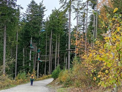
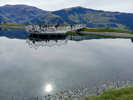
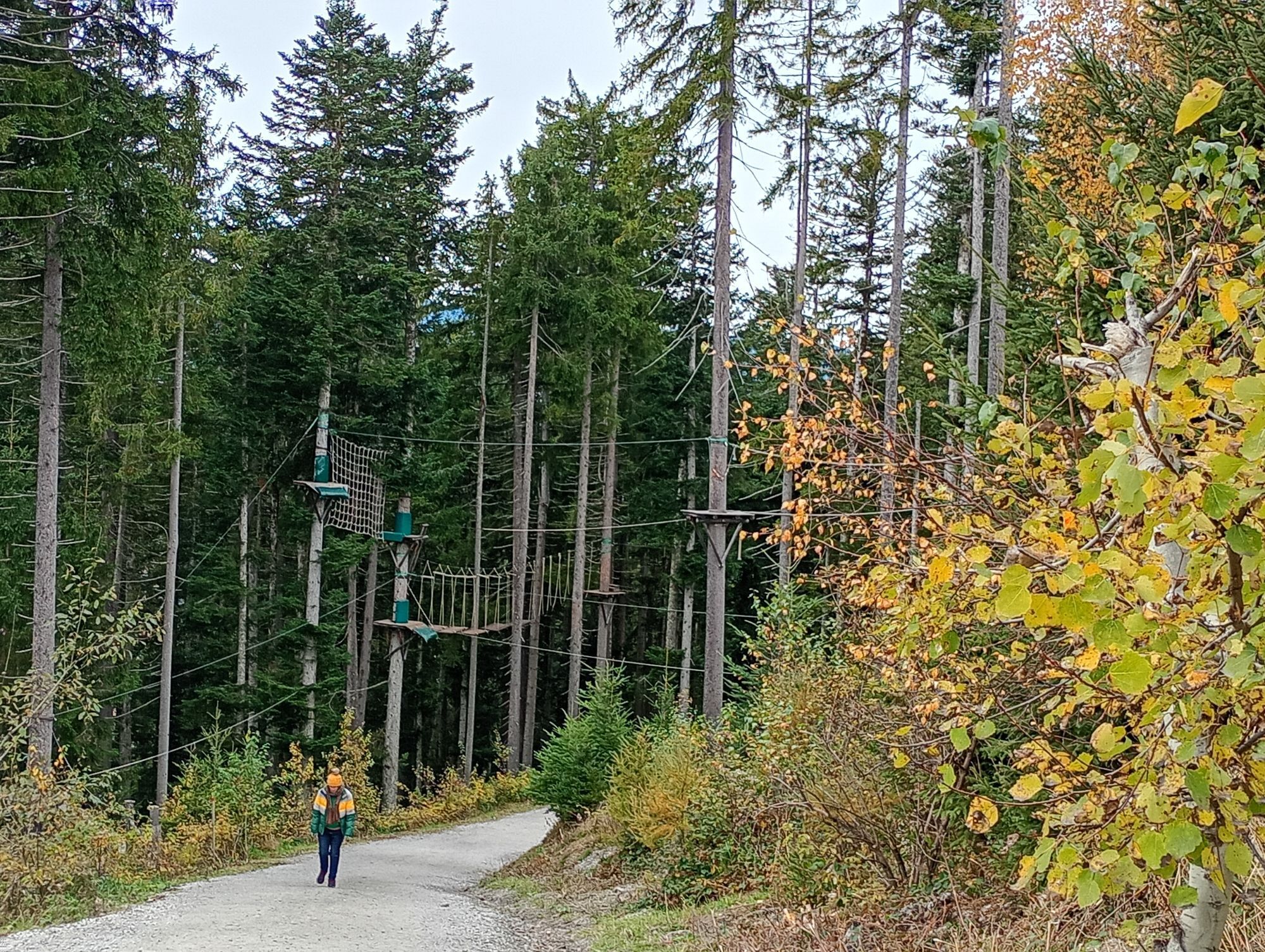
The Prinzensee invites you to linger and take photographs. From the Tom Almhütte back down to the valley via the forest slide park.
Népszerű túrák a környéken
-
4,8
Summit storming route Taghaube
nehézKirándulás 6,25 km -
4,9
Hochkönig - Gipfel der Gefühle - Matrashaus
nehézKirándulás 20,9 km -
3,8
Hochkönig summit route - main ascent
nehézKirándulás 18,1 km -
4,8
Summit stormer route Lauskopf
nehézKirándulás 8,16 km -
4,7
About the "Four Huts circular route" to Windraucheggalm
közepesKirándulás 10,1 km -
5,0
Königssee - Kärlinger-Haus
Kirándulás 10,1 km -
4,4
Riemannhaus
nehézKirándulás 3,69 km -
3,9
Mühlbacher Höhenweg
közepesKirándulás 11,2 km -
4,3
Peter-Wiechenthaler Hut
közepesKirándulás 4,32 km -
3,0
Alpine hike to Erichhütte
könnyűKirándulás 4,02 km
Túrázás & nyomkövetés


Ne maradjon le az ajánlatokról és az inspirációról a következő nyaralásához!
Az Ön e-mail címe hozzá lett adva a levelezőlistához.