


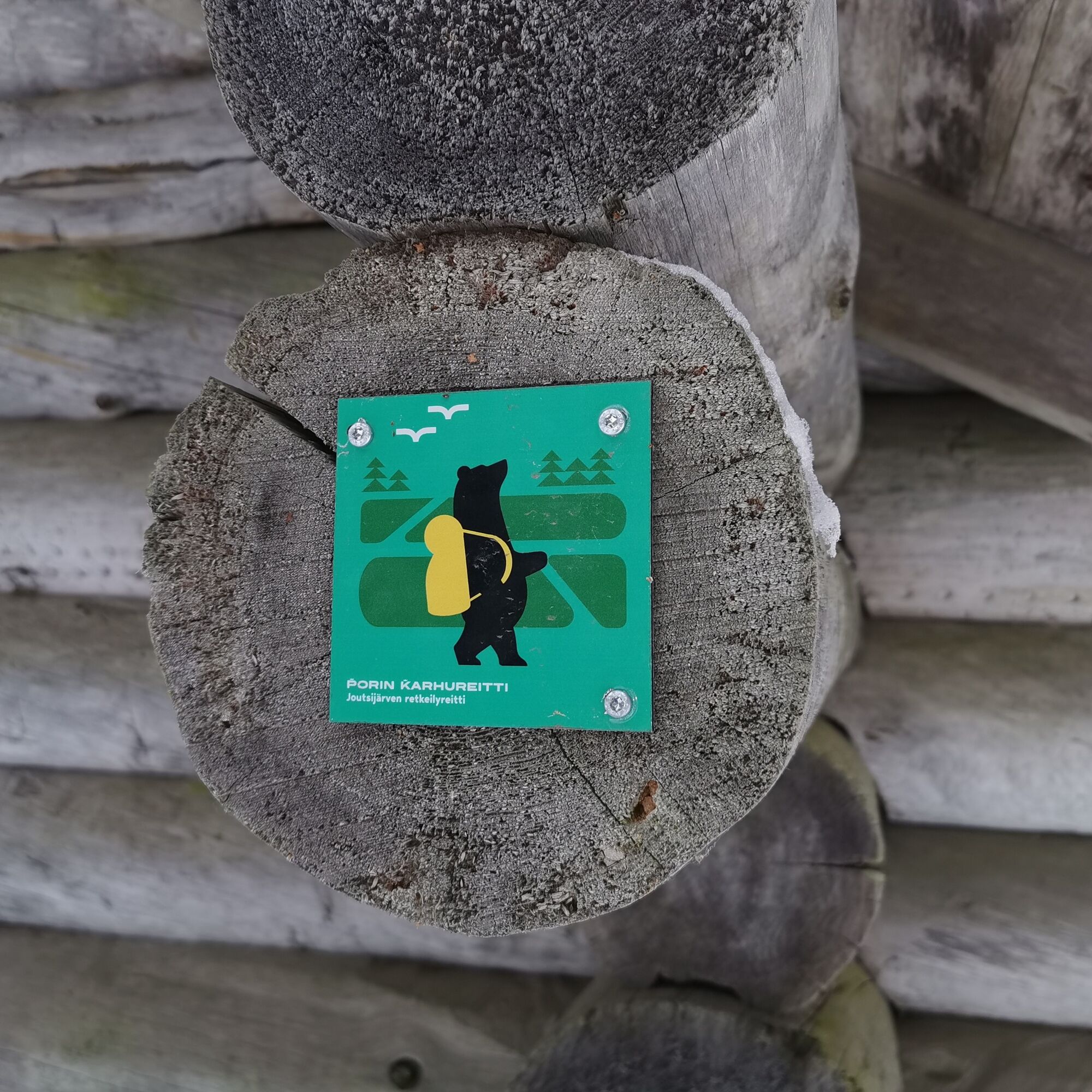
Joutsijärvi hiking trail


Joutsijärvi is one of the largest lakes in Satakunta, and it can be circled on a roughly 30-kilometer circular route. You can manage to go around the lake in a day, but along the way, there are charming...
Joutsijärvi is one of the largest lakes in Satakunta, and it can be circled on a roughly 30-kilometer circular route. You can manage to go around the lake in a day, but along the way, there are charming places to stay overnight, and for instance, the wilderness huts along the route are popular. Along the journey, you will see hikers who have come to stay overnight, exercisers who circle the route in a day, or trail runners, for example.
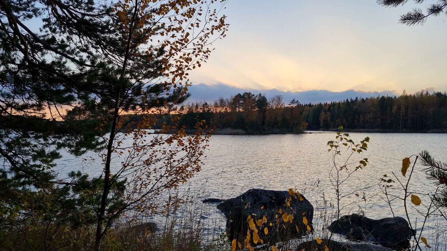
There are various rest stops along the route. Most are by the water, and log lean-tos and wilderness huts provide a feel for genuine wilderness nature. On the Joutsijärvi hiking trail, there are two wells whose water has been tested and found usable. The wells are tested approximately every 3 years. One of the wells is on Kulhantie near Rekitaipale, and the other is located on Kakkurintie about 500 m from the Sisälmystenlahti wilderness hut.
The nature and wildlife of Joutsijärvi with its rare birds and vegetation guarantee a memorable nature experience. The lake and its shore waters are home to, among others, osprey, honey buzzard, sparrowhawk, and hobby.

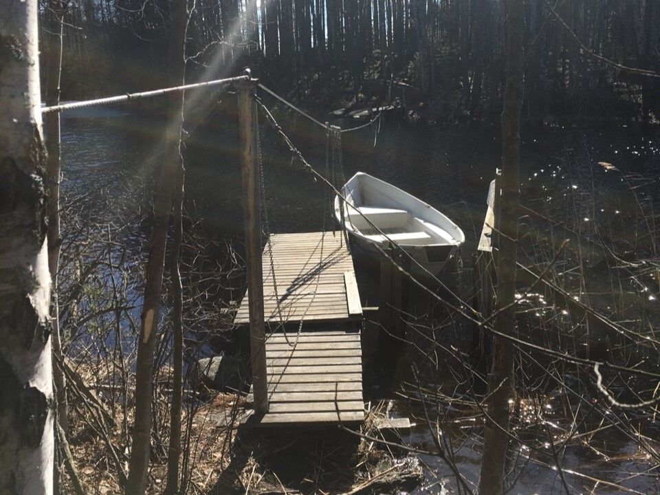
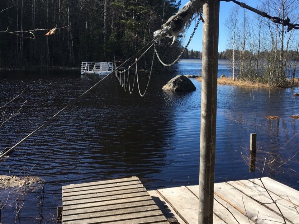
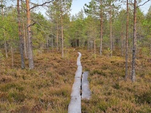
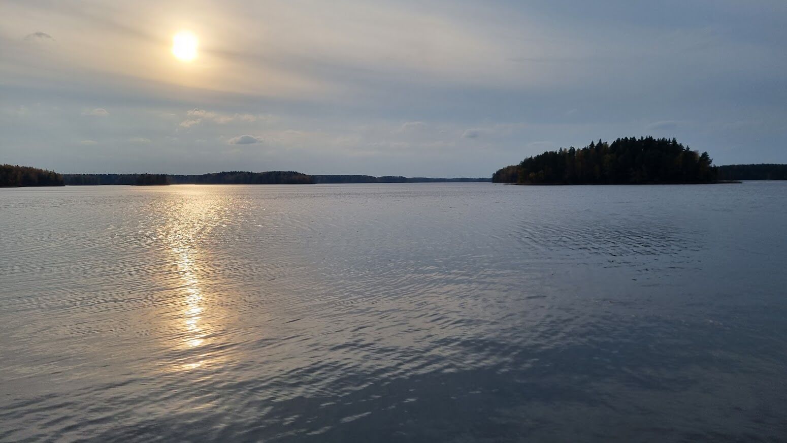
The route circles around the entire Joutsijärvi, making it suitable for hiking, for example, over one night or a weekend. On the southern side of the lake, there is also a 4.2-kilometer-long nature trail, which is especially designed for families with children and hikers who prefer easier terrain. Both routes are available year-round. The terrain of the route is mostly rocky mixed forest, partially equipped with atmospheric boardwalks. Part of the route is also illuminated. Between Joutsijärvi and Tuurujärvi there is a bridge, a ferry, and a boat ferry that separate the lakes. Along the route, there are plenty of rest spots such as wilderness huts, fire pits, a well, and a beach. If you start from the Tammen camp center and circle the whole route, it is recommended to go clockwise around the lake.
Igen
It is advisable to take appropriate clothing, good outdoor shoes, snacks, and drinks. Binoculars are also a nice addition for birdwatching in nature. If you decide to stay overnight along the route, prepare accordingly with sufficient weather-appropriate equipment.
We recommend downloading the 112 app in case something happens on the route.
Exercise general caution The terrain is sometimes a bit difficult to walk on, such as rocky forest paths
The use of motorboats is forbidden on Joutsijärvi, which allows for a peaceful atmosphere for moving in nature.
Do not light campfires if a forest fire warning is in effect. You can check the warning situation for Satakunta here.
You can arrive by your own car to the Tammen camp center at Tammentie 197, 29340 Ulvila
There is no public transport to the route, but you can check the nearest bus line at Schedules and routes - Porin Joukkoliikenne
There is plenty of parking space for cars at the Tammen camp center parking lot!
It is advisable to set aside plenty of time for the route; staying overnight along the route is possible in several places. There are many campfire spots, 5 lean-tos, and 4 wilderness huts along the route.
You can find general information about wilderness huts at luontoon.fi
Along the journey, you can also experience various water crossings in the form of ferries.
Of course, you do not have to circle the entire lake, and you can experience amazing adventures even on a smaller section.
In late summer and autumn, you can pick blueberries, lingonberries, and mushrooms. You might also find cranberries.
Firewood is available at campfire sites.
Remember also that
In nature, you are an honored guest. Thank you for adhering to hiking etiquette so that our valuable natural sites will also be preserved for the future! Read more at https://www.luontoon.fi/retkietiketti
Some rest stops deviate from the route, adding extra distance for those who want longer hikes.
Túrázás & nyomkövetés


Ne maradjon le az ajánlatokról és az inspirációról a következő nyaralásához!
Az Ön e-mail címe hozzá lett adva a levelezőlistához.