


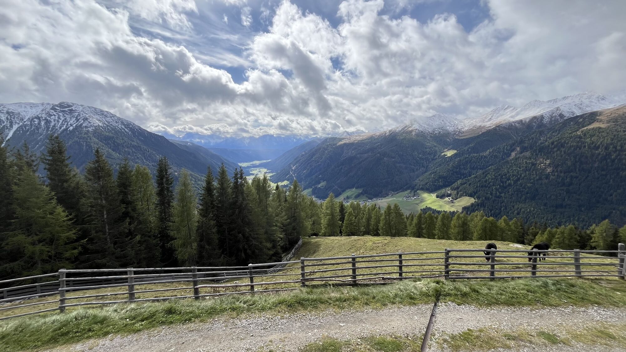
Ski Tour: Uwaldalm in S. Maddalena/Gsieser Tal Valley


From the head of the valley in St. Magdalena in the Gsieser Valley 1465 m, follow the signpost number 12 over the new bridge, then turn left and after the “Schlosser Hof” left again before you reach the...
From the head of the valley in St. Magdalena in the Gsieser Valley 1465 m, follow the signpost number 12 over the new bridge, then turn left and after the “Schlosser Hof” left again before you reach the old “Viehtrieb”, the cattle drive, on your right enclosed by fences and shrubs. Near the “Burger Hof” cross the bridge of the rustic mountain stream and trudge along the windy forest road through winter landscape covered in deep snow. On your hike you come across several little glades that offer an impressive view of our valley and the Dolomites of Prags that rise into the blue sky in the southwest. At an altitude of approximately 1870 m cross the Pfoi Stream, hike through fenced alpine meadows and get, after a few metres, to the path diverting on the left that takes you westwards across meadows and woods to the Uwald Alm at 2042 m (rest point). b) shortcut: approximately 100 metres before reaching the bridge of the Pfoi Stream, leave the forest road number 12 by turning right and hike past the big notice board into the woods. There, cross the narrow bridge at 1522 m that has a wayside cross – now you are already on the old Pfoi trail that takes you along the left side of the stream to the forest road number 12 at 1800 m and on to the Uwaldalm at 2042 m (rest point) in a long steep climb. Enjoy the wonderful views across the Gsieser Valley!


Népszerű túrák a környéken
-
4,6
Mountain hike to Mountain „Lutterkopf and Durakopf (2145/2275m)“
közepesHegyi túrázás 11,8 km -
5,0
Antholzer See - Steinzger Alm
közepesKirándulás 7,48 km -
4,9
Oberhausalm - Jagdhaushütte
könnyűKirándulás 14,0 km -
4,7
Von Kalkstein auf das Toblacher Pfannhorn (2.663 m) und Marchkinkele
közepesKirándulás 14,2 km -
5,0
Jagdhausalm und Pfauenauge
könnyűKirándulás 14 km -
4,2
Seespitze
közepesKirándulás 13,7 km -
4,0
Innervillgraten - Kalkstein - Alfenalm - Schönegg
közepesKirándulás 12,6 km -
4,5
Thurntaler Rundweg - Parggenspitze - Hochrast
közepesKirándulás 18,0 km -
5,0
Rote Wand
közepesMagashegyi túra 12,0 km -
5,0
Trojertal, Hintere Trojeralm
könnyűKirándulás 8,97 km
Túrázás & nyomkövetés


Ne maradjon le az ajánlatokról és az inspirációról a következő nyaralásához!
Az Ön e-mail címe hozzá lett adva a levelezőlistához.