


Rotes Kinkele


Who doesn’t know the Rote Kinkele. It is for the most part way up there on the wish list of ski tours in Villgraten, and does indeed have something to offer everyone - a long forest trail, a lovely Alpine...
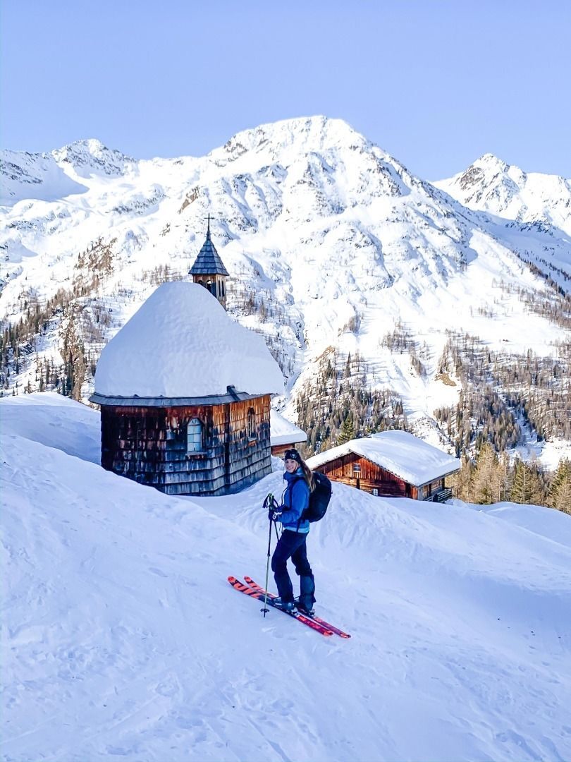
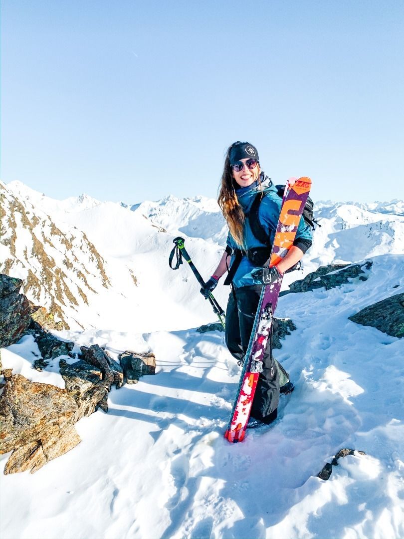
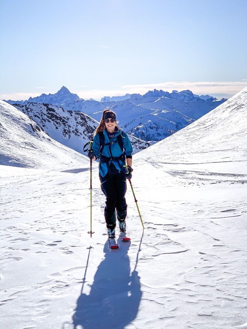
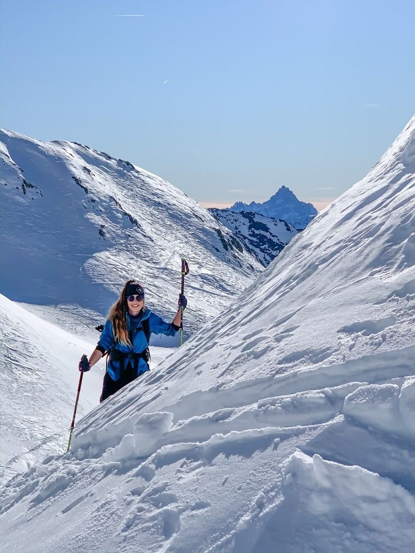
Who doesn’t know the Rote Kinkele. It is for the most part way up there on the wish list of ski tours in Villgraten, and does indeed have something to offer everyone - a long forest trail, a lovely Alpine pasture with a chapel, troughs, steep slopes and for good measure a summit ridge which provides plenty of views to the isolated mountain lakes. Depending on the snow conditions and motivation there are two different starting points for our tour. The shorter variant starts from Osttirol's highest farmstead (Schettlet) at 1700 m. There are few car parking options available. Ascent 1.5 km to the west of Innvervillgraten before a bridge, taking the mountain road there up to the Hochberg. From the car via the first finish, along a somewhat ascending forest trail in 1 hour to the Kamelisenalm (1973 m). The second variant starts in the Arntal. From the Arnbach via steep pastures to the farms of Fürat, then after a woodland section, coming to the aforementioned forest trail. Access to Arntal on the ascent to Kalkstein and continuing via the cleared road to its end (car parking available). From the Kamelisenalm we then follow the wide trail into the valley up to around 2100 m. We cross the river on the left and head for the south-facing slopes which head out of the concealed high mountain valley. We tackle a few hairpin bends and are at an Alpine inn on a slope side. The terrain now flattens out and we reach the terrain at the foot of the summit structure. Making use of a shortcut from there on the west side of the ridge which takes us directly to the highest point. However, we follow the track into the valley and reach our destination from the rear side via a flat trough system (summer trail). Afterwards the short northern ridge does not present any problem and when there is plenty of snow it can be tackled on skis. Descent recommended via the summer trail.
Additional ski tour tips can be obtained in the ski tour guides by Thomas Mariacher. These are available here: http://www.grafikzloebl.at/verlag/buecher/
Mit dem Bus bis zum Parkplatz Schettlet
Parkplatz Schettlet
Népszerű túrák a környéken
-
5,0
Antholzer See - Steinzger Alm
közepesKirándulás 7,48 km -
4,7
Von Kalkstein auf das Toblacher Pfannhorn (2.663 m) und Marchkinkele
közepesKirándulás 14,2 km -
4,2
Seespitze
közepesKirándulás 13,7 km -
4,0
Innervillgraten - Kalkstein - Alfenalm - Schönegg
közepesKirándulás 12,6 km -
4,5
Thurntaler Rundweg - Parggenspitze - Hochrast
közepesKirándulás 18,0 km -
5,0
Rote Wand
közepesMagashegyi túra 12,0 km -
5,0
Trojertal, Hintere Trojeralm
könnyűKirándulás 8,97 km -
5,0
Schwarzsee
közepesKirándulás 7,38 km -
5,0
Oberstalleralm - Weisse Spitze - Rote Spitze - Oberstalleralm
nehézKirándulás 10,2 km -
5,0
Toblacher Pfannhorn
könnyűSítúra 11,0 km
Túrázás & nyomkövetés


Ne maradjon le az ajánlatokról és az inspirációról a következő nyaralásához!
Az Ön e-mail címe hozzá lett adva a levelezőlistához.