


Through the Les Follatères nature reserve to Fully


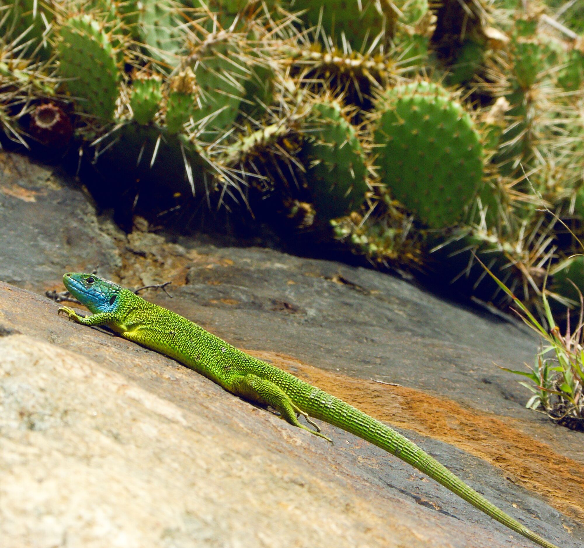
The Follatères nature reserve offers a glimpse into foreign worlds: hearing the sounds of cicadas and seeing plants typical of hot climates, one would think of the Mediterranean rather than the midst of...
The Follatères nature reserve offers a glimpse into foreign worlds: hearing the sounds of cicadas and seeing plants typical of hot climates, one would think of the Mediterranean rather than the midst of the Alps.
The nature reserve lies at the Rhône knee near Martigny; the region is therefore influenced by the climate of Lake Geneva as well as the Valais Alps. The area has an exceptionally diverse geology: calcareous rocks and flysch of the pre-Alps meet crystalline granite and gneiss of the central Alps.
These conditions allow great biological diversity in the nature reserve, which extends over 5 square kilometers from the valley floor at 450 m above sea level up to 1800 m above sea level. A large part of the landscape is pristine and has been preserved from development due to its steepness.
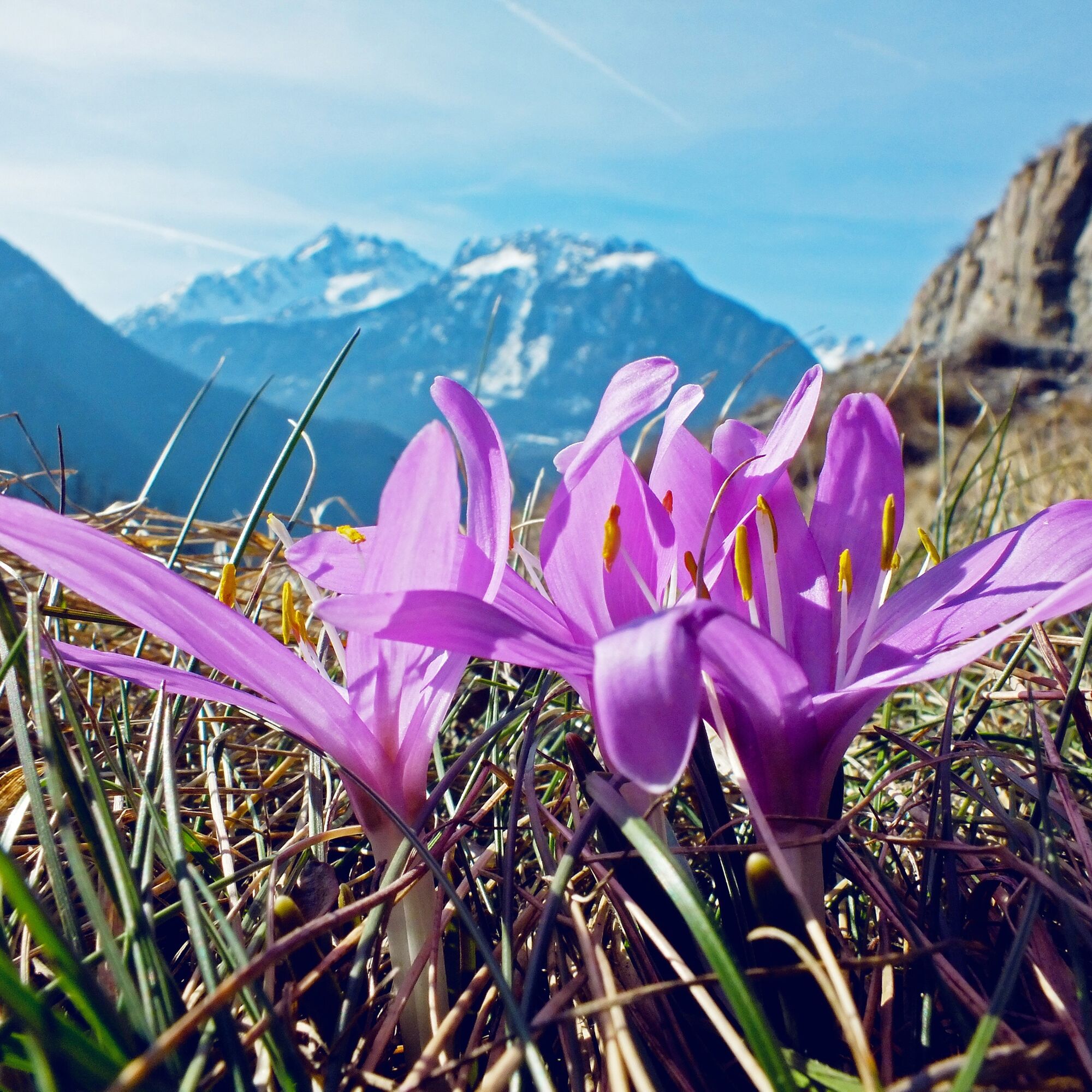
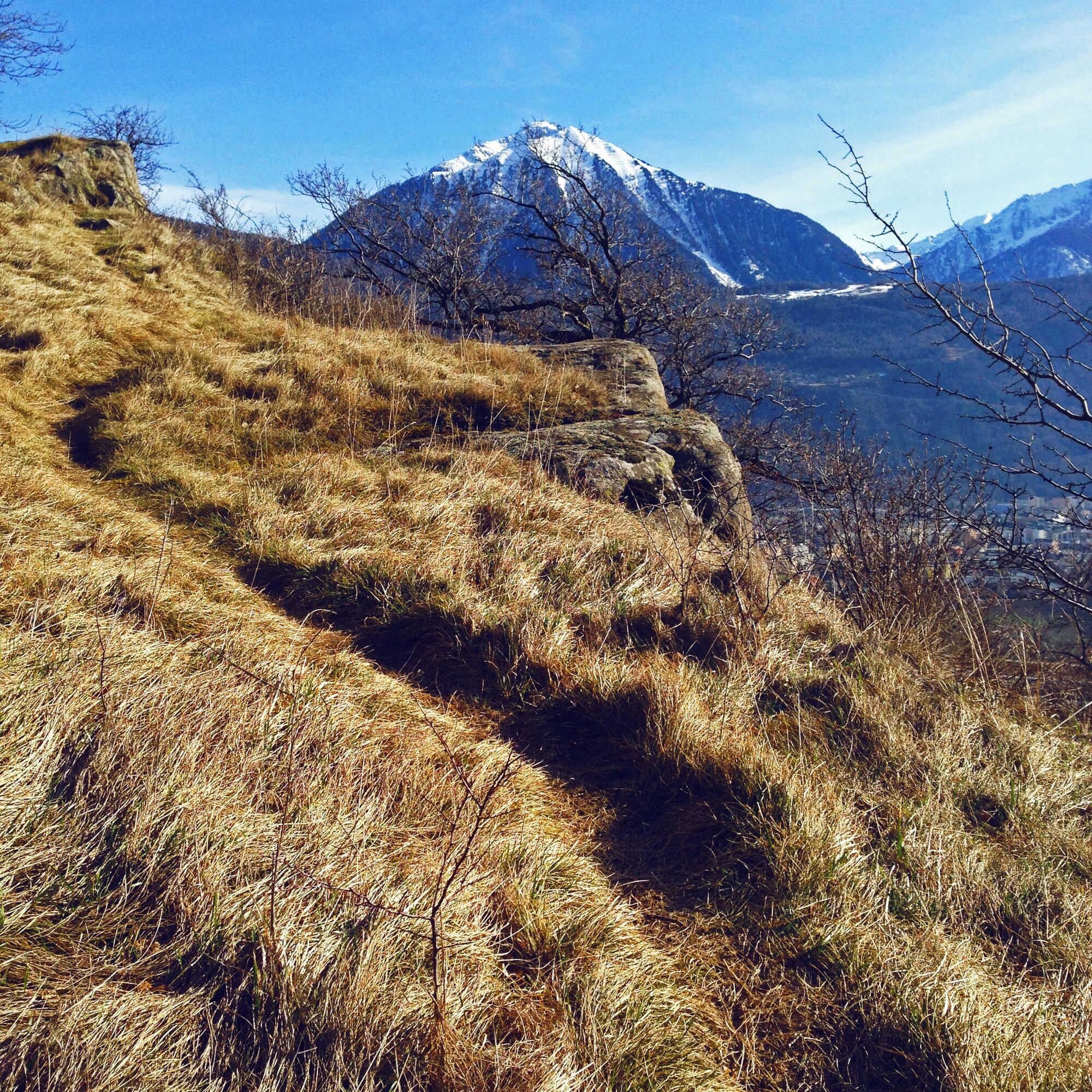
The hike varies greatly depending on the season. In spring the paths are lined with flowers and the hiker is accompanied by songbirds. In summer the landscape turns golden and is filled with the chirping of cicadas. Autumn offers a true play of colors and with some luck you can observe birds of prey before their departure south.
The path crosses various habitats. From pine and oak forest over rocky grassland and dry meadows – all these landscapes provide a home for rich fauna.
Highlights of the route
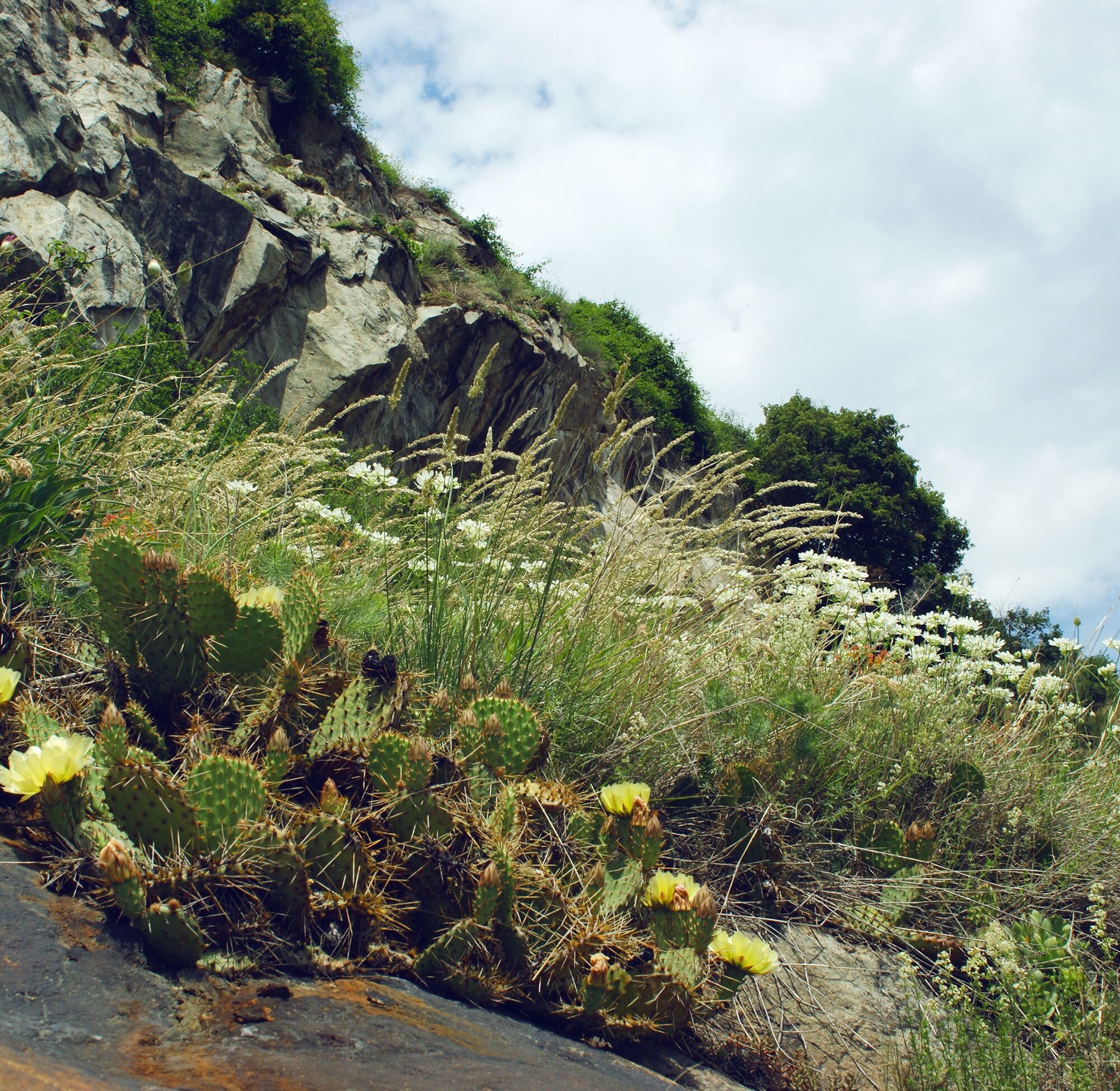
Nature reserve of national importance, regularly attracting scientists from around the world. Dry and sunny paths with over 200 plant species of southern or oriental origin.

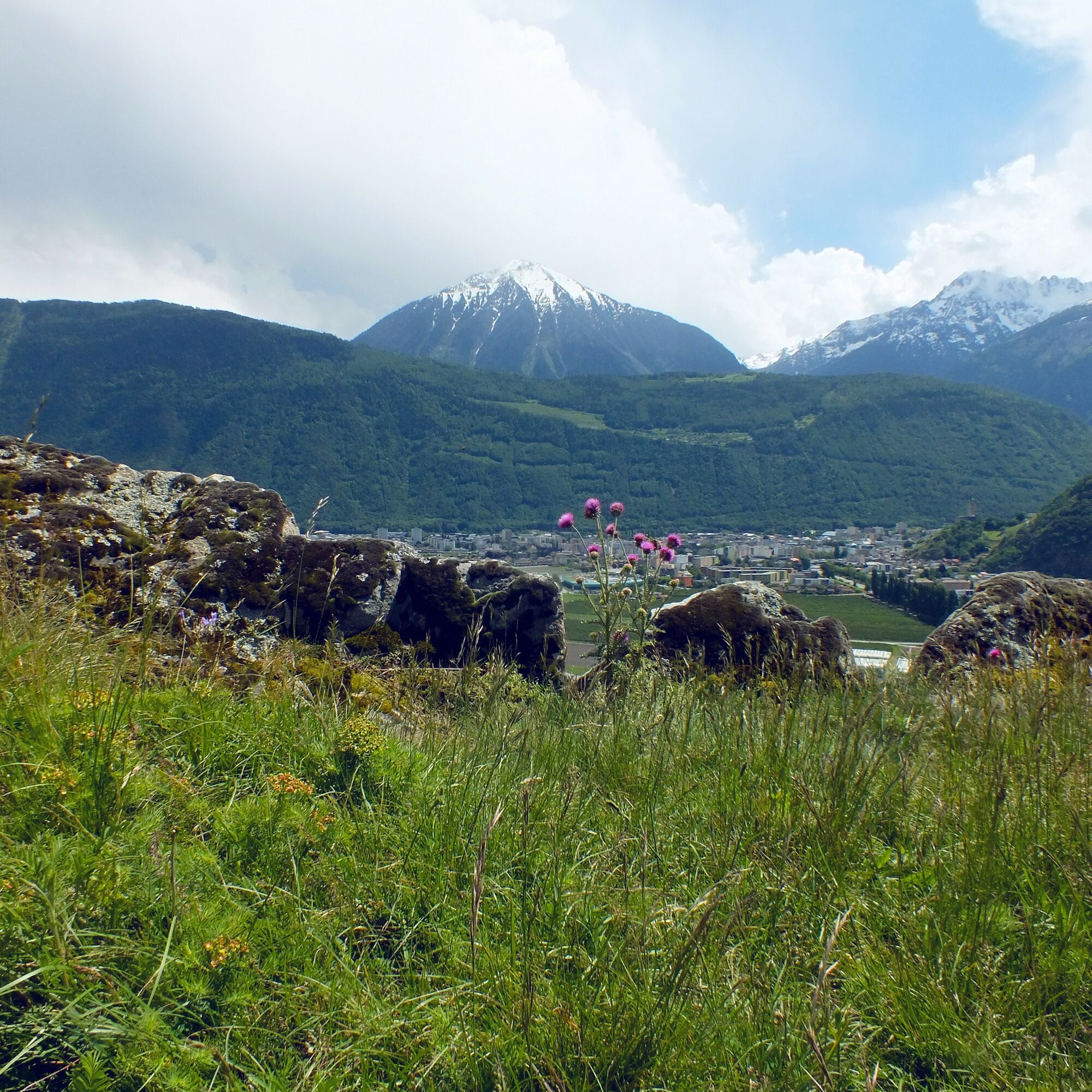
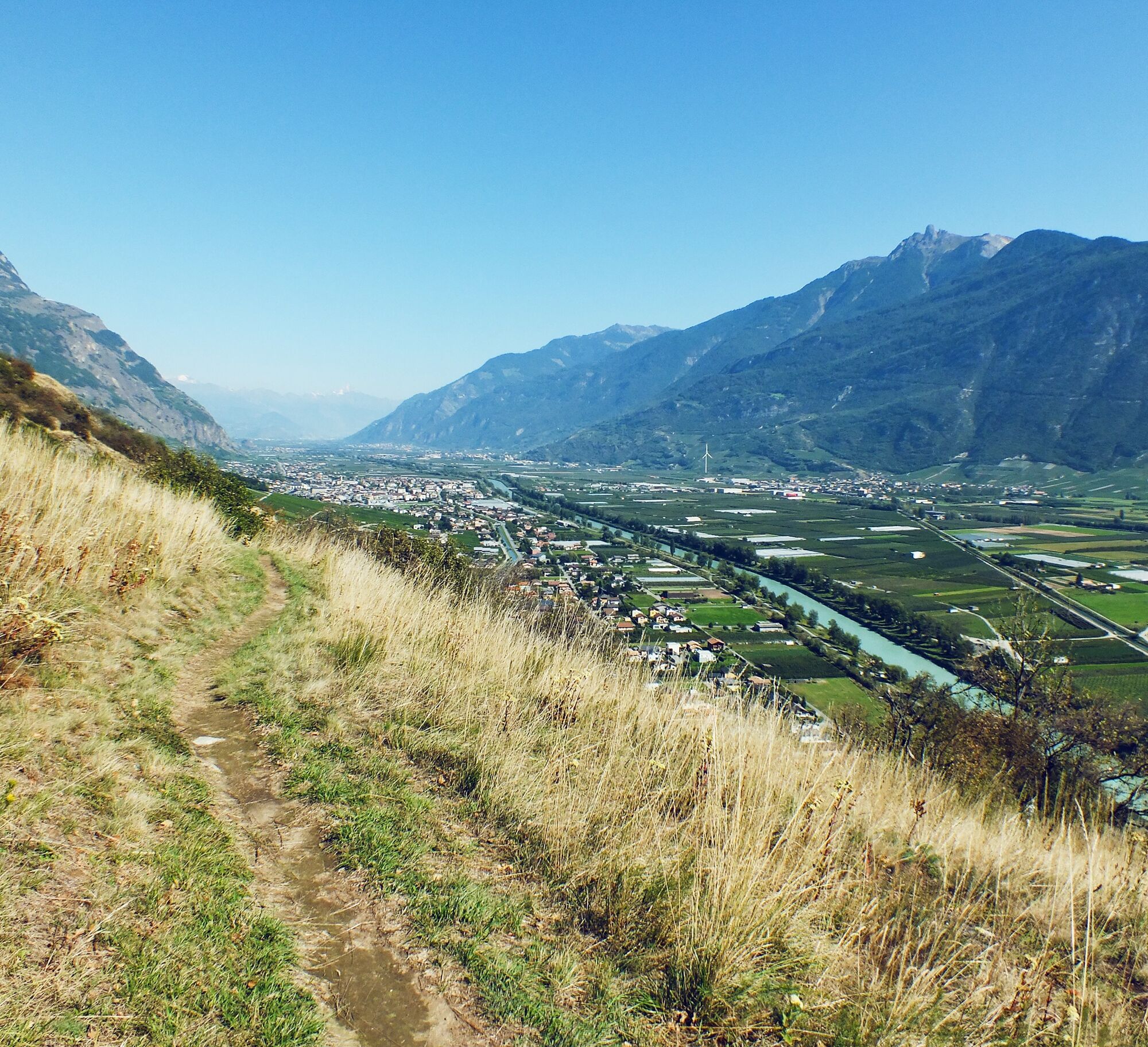
The hike begins with a mountain railway ride from Dorénaz to Champex d'Alesse. The path initially leads over a marshy plateau – watch out for orchids – before continuing over scree slopes, meadows, and through forests along the flank of Mont du Rosel. The closer you get to the "knee" of the valley, the drier the climate becomes. Here you are in the actual heart of the nature reserve.
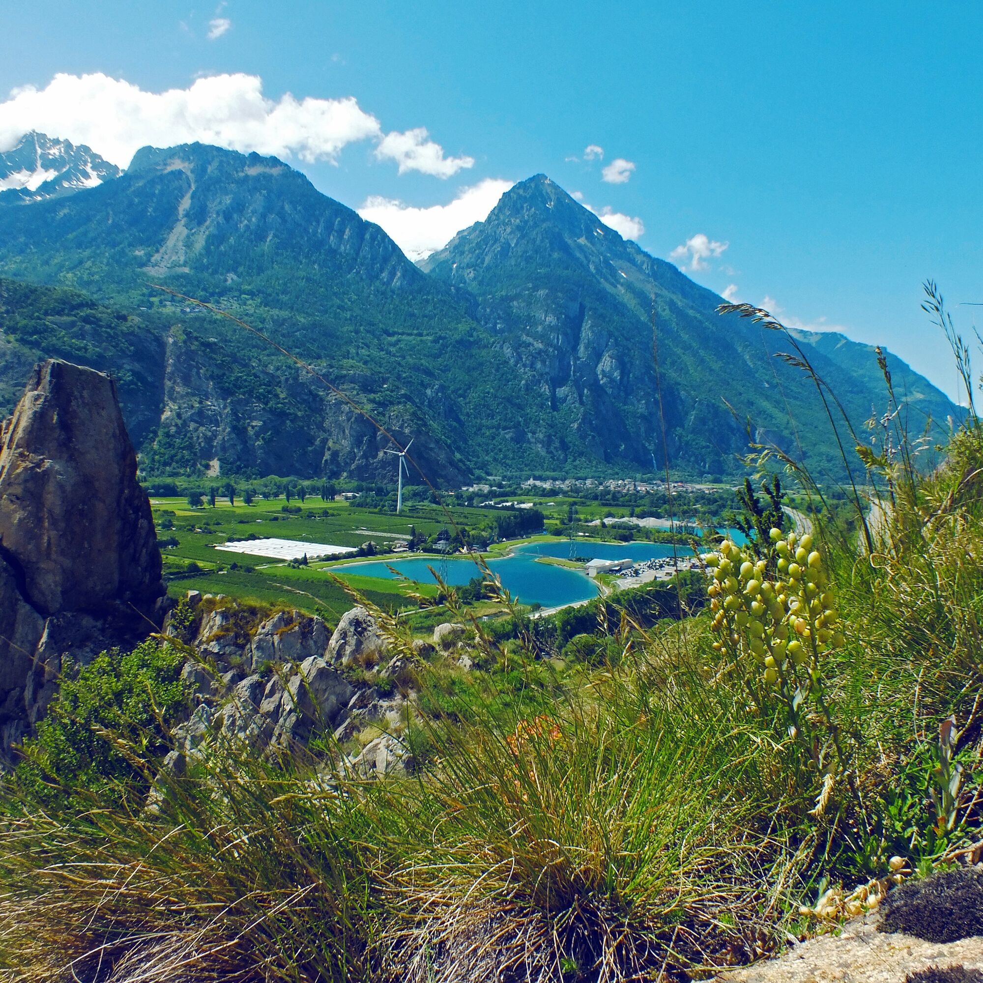
The hike then makes a 90-degree turn like the Rhône below and continues northeast. Through the Forêt de la Lui forest, you reach the hamlet of Tassonières and at the end of the route you walk through the terraced vineyards descending into the village of Vers-l'Église.
Igen
Igen
Igen
We recommend:
Good footwear Weather-dependent clothing: always carry a waterproof vest Headgear Sunscreen Water bottle Picnic Camera Binoculars (optional) Hiking poles (optional) Printout of the hiking trail (click "Print" to download)
For certain hikes:
Swimsuit
The mountains, a place of joy to share and respect. The mountain world is a place to meet and experience unforgettable moments together – whether by bike or on foot. For all users to benefit, it is essential to share this space with respect for nature and agriculture. Respectful behavior allows everyone to enjoy their leisure activities under the best conditions. Inform yourself about recommendations and rules. Assess your own skills and fitness well. Using the different routes is basically at your own risk.
For all hikes:
Carry a map with you. Download the complete description of the hiking trail with a large-scale map by clicking "Print" at the top right of the page. Use only marked hiking trails and observe all signposts and instructions - for your own safety, to protect grazing animals, and out of respect for wildlife. Close gates again after passing through. Be considerate of other trail users, plants, and animals.
For mountain hikes:
Carry additional sunscreen. UV rays at high altitude can be very strong, even in cloudy weather. Plan your hike carefully: consider the fitness level required of all participants, weather forecasts, and seasonal dependencies. Weather conditions can change very quickly and without warning in the mountains. Appropriate clothing and enough provisions (food and drink) are very important. In unstable weather, it's better to turn back early.
For high alpine hikes:
Inform your family about your hiking route. If possible, avoid going alone. Do not venture onto glaciers without a mountain guide. Observe warning signals indicating dangers at riverbanks, along watercourses below dams and reservoirs: water levels can rise quickly and without warning.
Access via the A9 motorway.
From the north/west: Exit 20 (St-Maurice), then head south via Evionnaz and Collonges to Dorénaz.
From the south/east: Exit 21 (Martigny-Fully). Follow the signs to Fully; just after the bridge over the Rhône, turn left towards Dorénaz.
Regular train connections to Martigny, then bus to Dorénaz. From the end of the hike, bus connections to Martigny or Sion. Train and bus timetables can be found at sbb.ch.
Parking at the mountain railway in Dorénaz. After the hike, return by bus (change in Martigny). Train and post bus timetables can be found at sbb.ch.
Watch out for blue- or red-winged grasshoppers, colorful butterflies, katydids, or praying mantises. Among the reptiles are emerald lizards or grass snakes. At higher altitudes, alpine choughs, peregrine falcons, ravens, and bearded vultures with a wingspan of up to 3 meters are native.
Népszerű túrák a környéken
-
5,0
From Saillon to Farinet footbridge
közepesKirándulás 7,86 km -
5,0
Sentier de Salanfe
közepesKirándulás 12,8 km -
5,0
Huts of Orny and Trient
nehézKirándulás 13,4 km -
Tour du Grand Chavalard
közepesKirándulás 14,9 km -
From Savoleyres to the mountain lake Lac des Vaux
közepesKirándulás 14,0 km -
Loutze
könnyűTéli kirándulás 6,83 km -
Via Farinetta
nehézVia ferrata 6,41 km -
Six blanc depuis Cabine
közepesSítúra 5,85 km -
5,0
Tour de La Seya hike
közepesKirándulás 8,09 km -
Wallis Velo Tour: Verbier - Champéry (Stage 8)
nehézBiciklizés 105,5 km
Túrázás & nyomkövetés


Ne maradjon le az ajánlatokról és az inspirációról a következő nyaralásához!
Az Ön e-mail címe hozzá lett adva a levelezőlistához.