


Huts of Orny and Trient


Experienced mountain hikers will love this challenging hike through wild and fascinating nature. Begin the ascent with the chairlift to La Breya, during which you can admire the wide panorama extending...
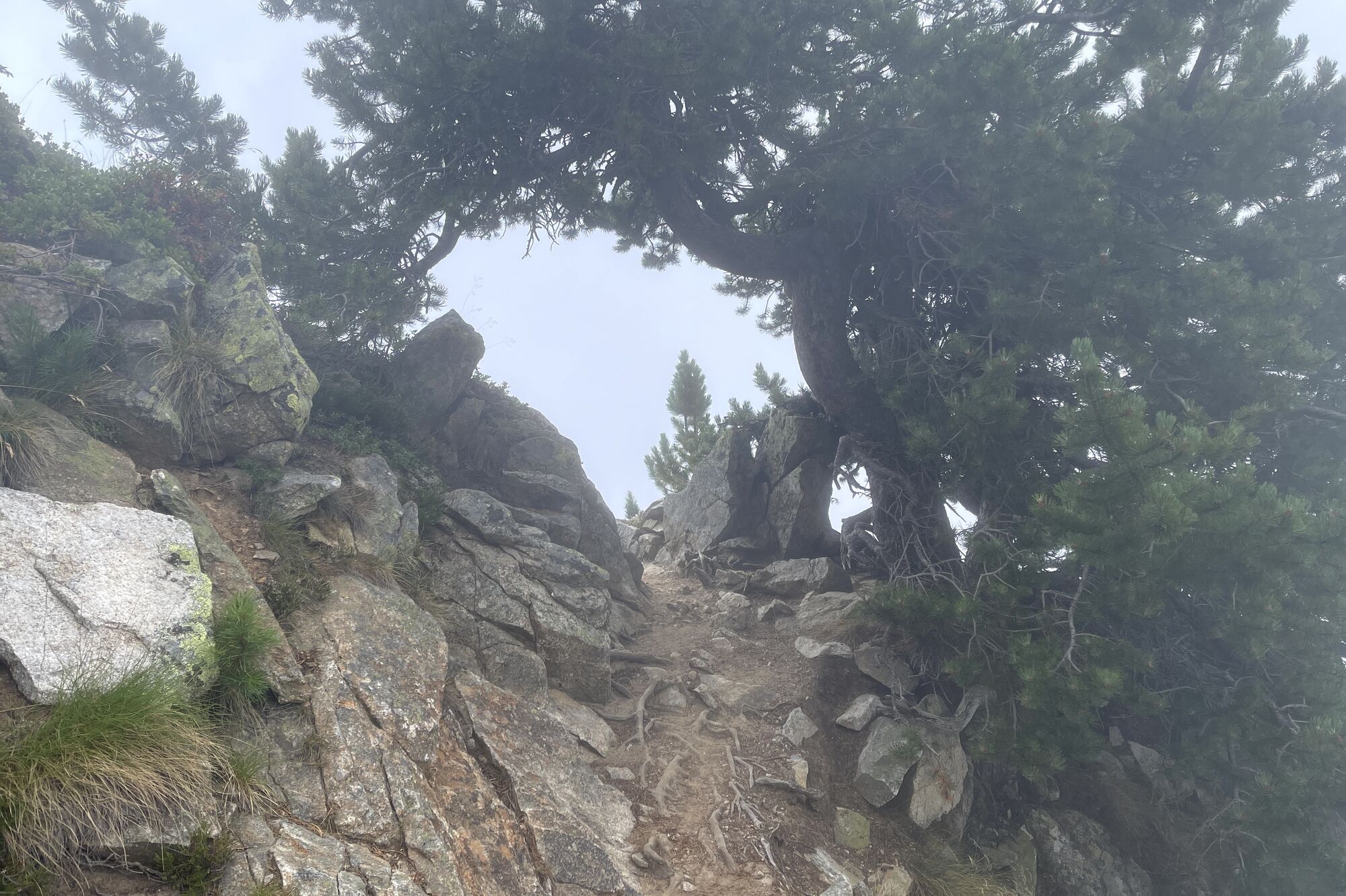
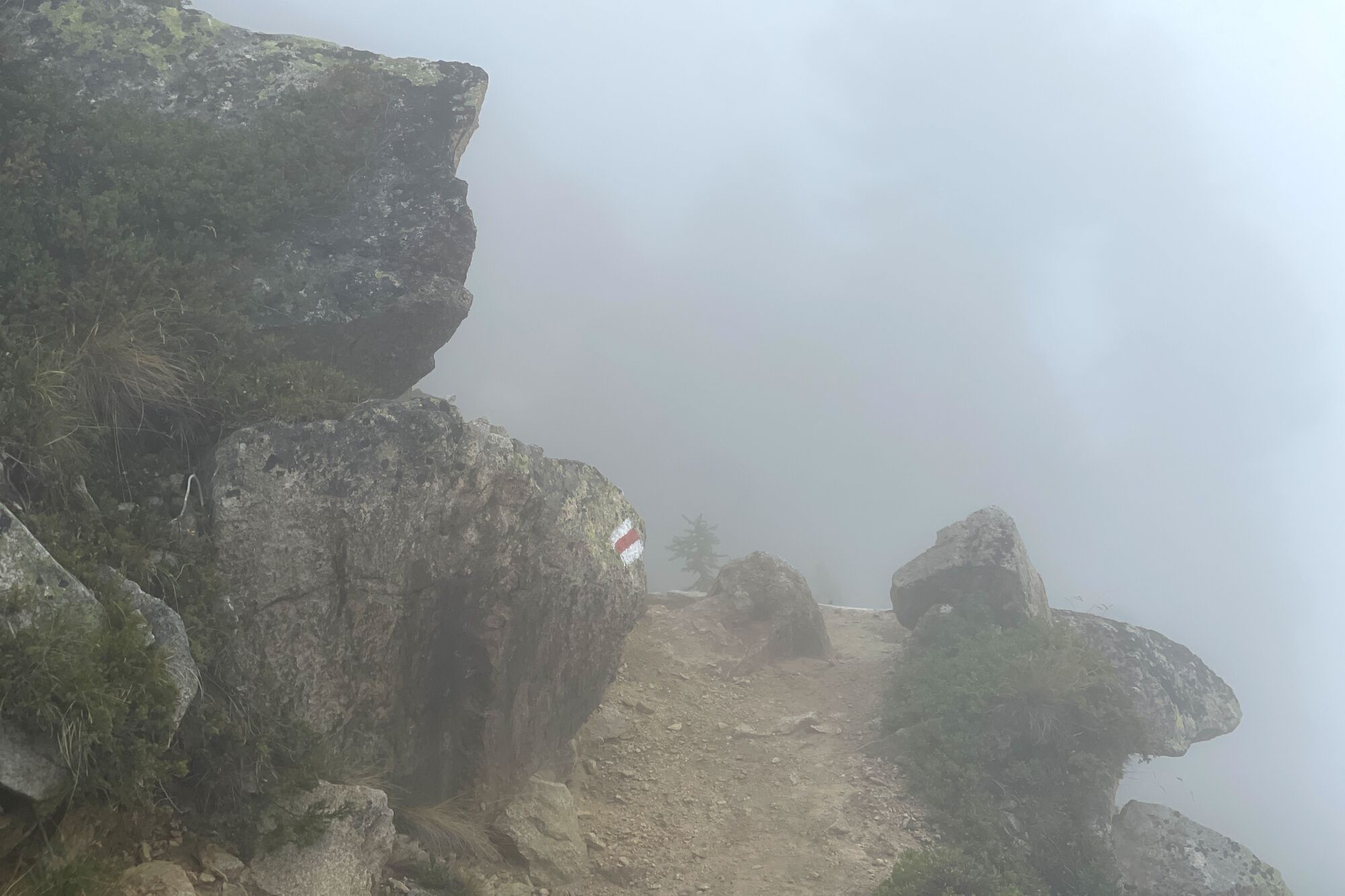
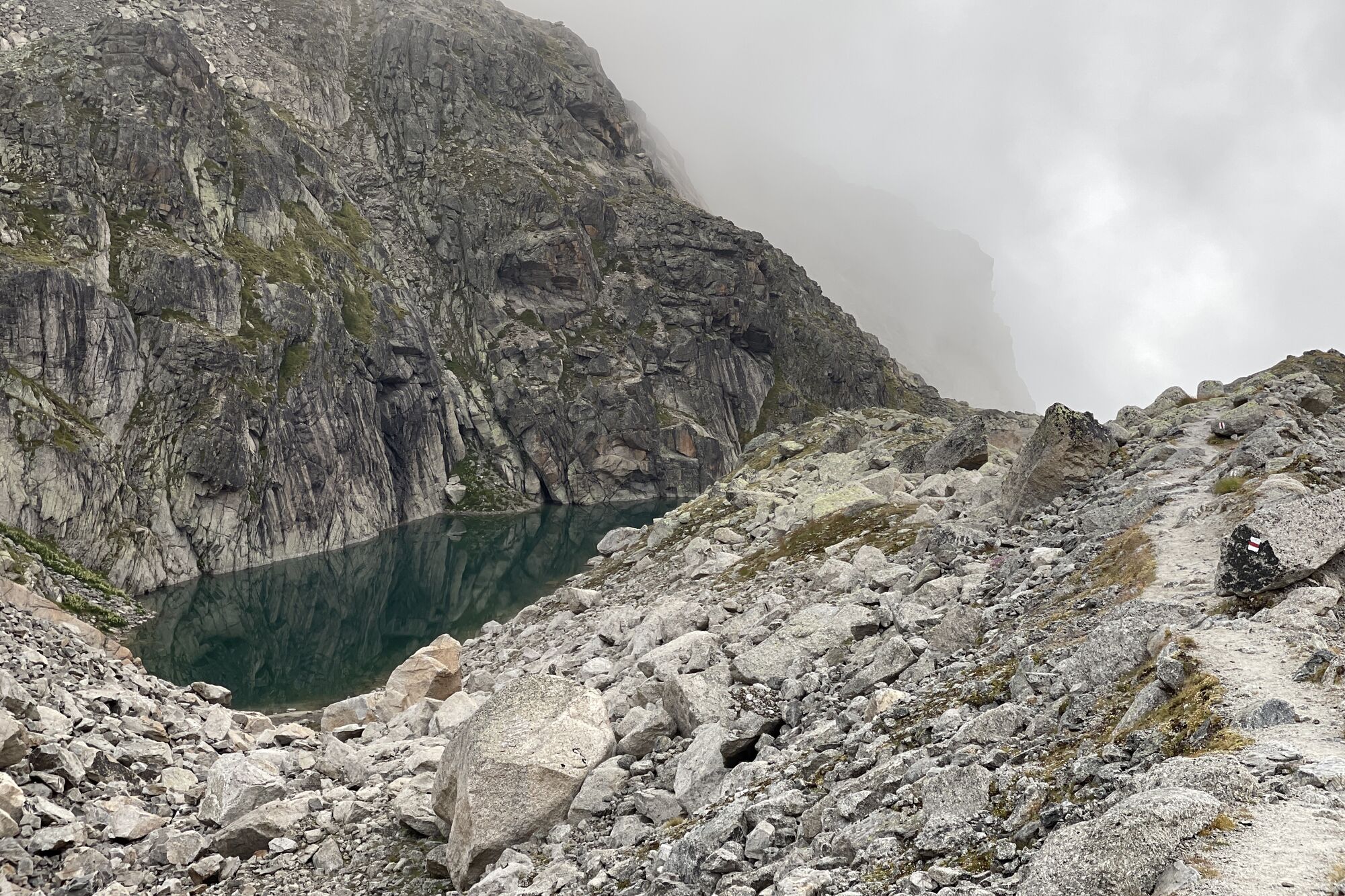
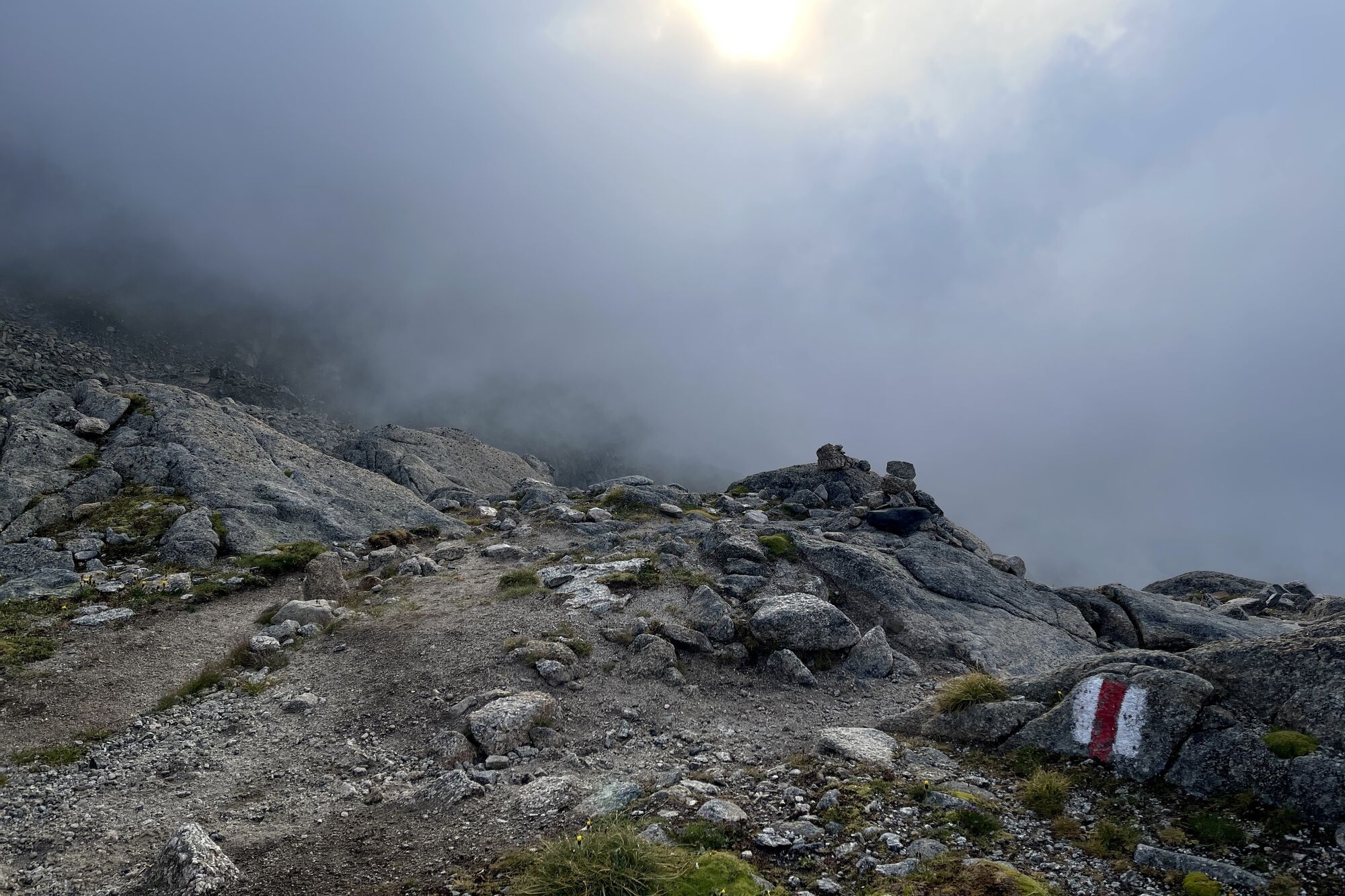
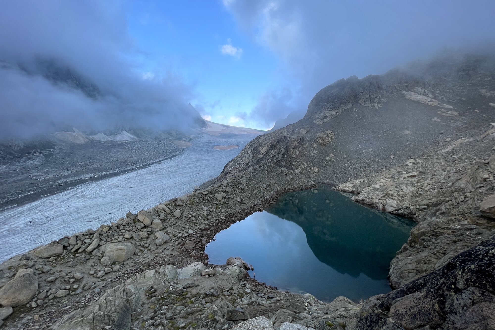
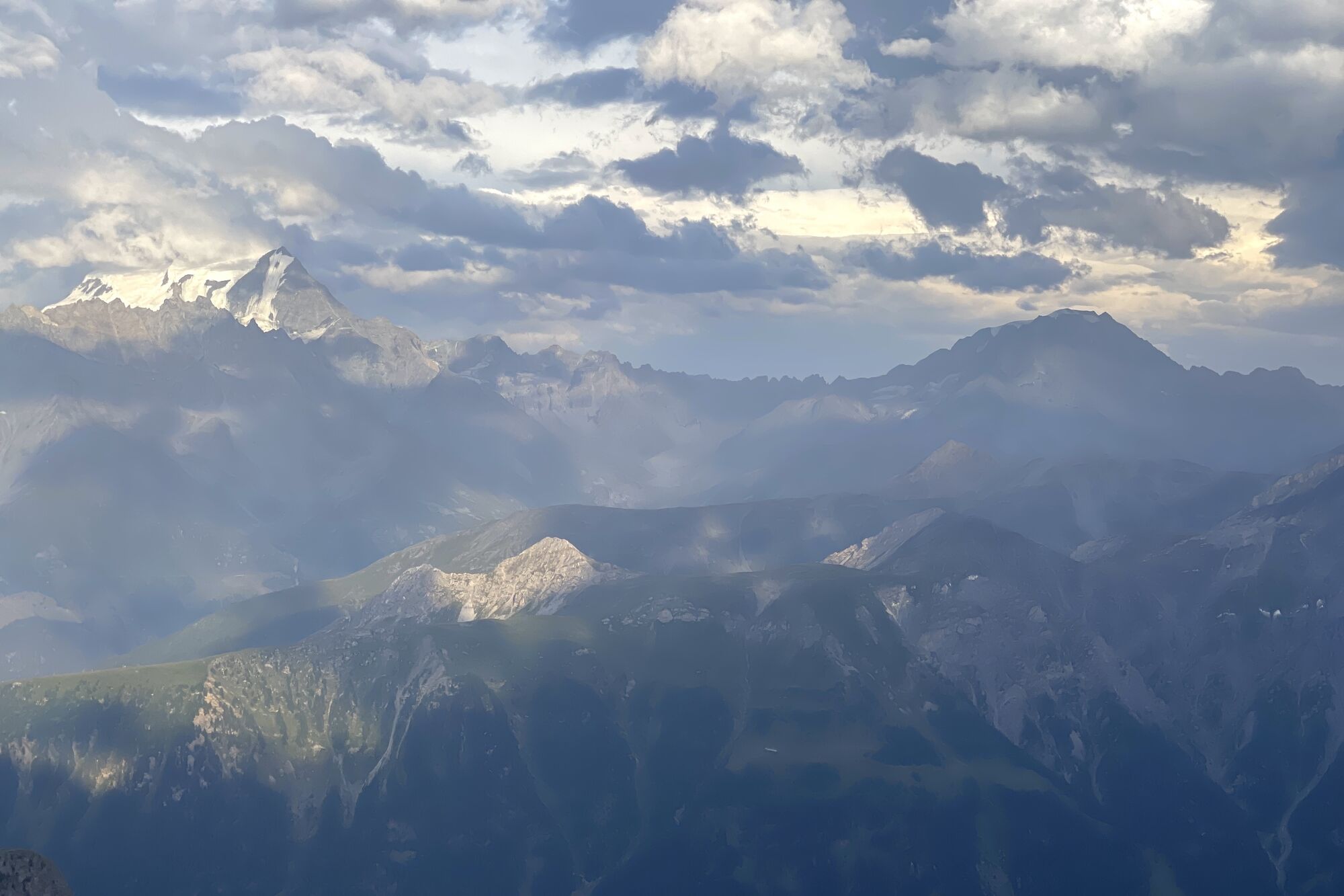
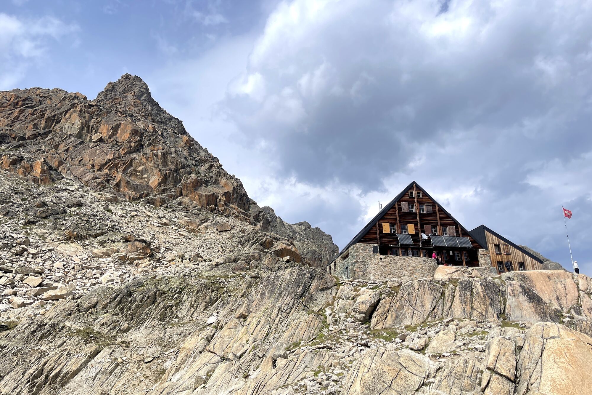
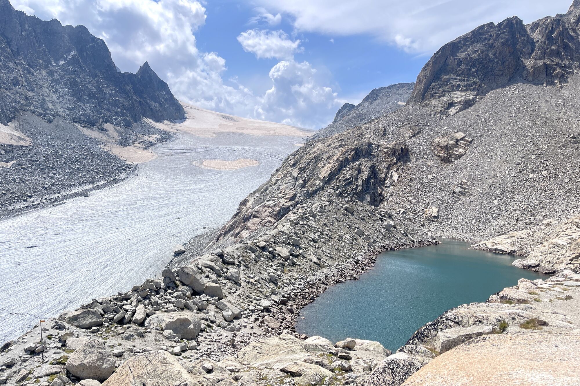
Experienced mountain hikers will love this challenging hike through wild and fascinating nature. Begin the ascent with the chairlift to La Breya, during which you can admire the wide panorama extending from Lake Geneva to the Grand-Combin. Then take the hiking trail, whose first part is narrow and airy, especially appreciated by those not afraid of heights. Continue along the moraine of the Orny glacier to the hut of the same name with the widely visible Swiss flag and the bronze ibex. The path continues through scree slopes and along the glacier before leading you in a zigzag through a relatively steep ascent to the Trient hut. The effort is rewarded with breathtaking views of the Trient plateau and the Mont-Blanc massif. The return is on the same path, with the possibility of walking through the Val d’Arpette or returning to La Breya. Those who wish can end the hike on foot instead of using the chairlift.

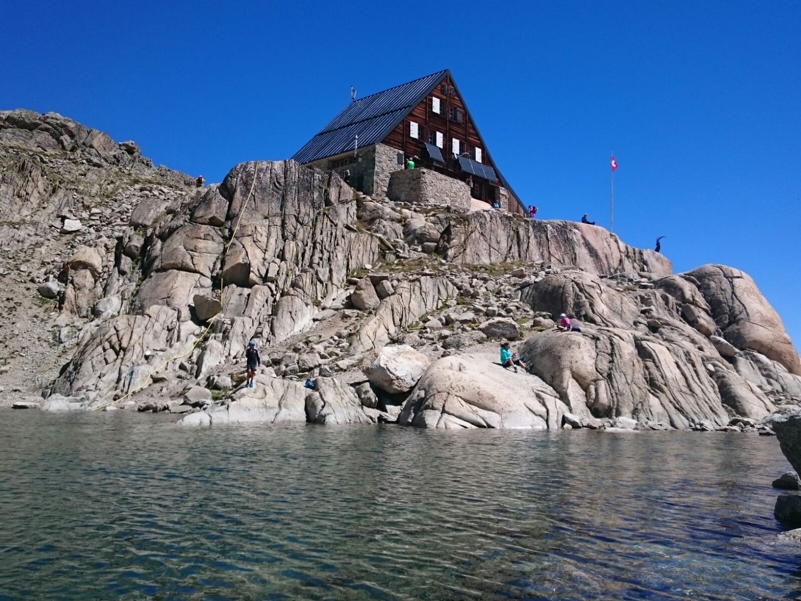

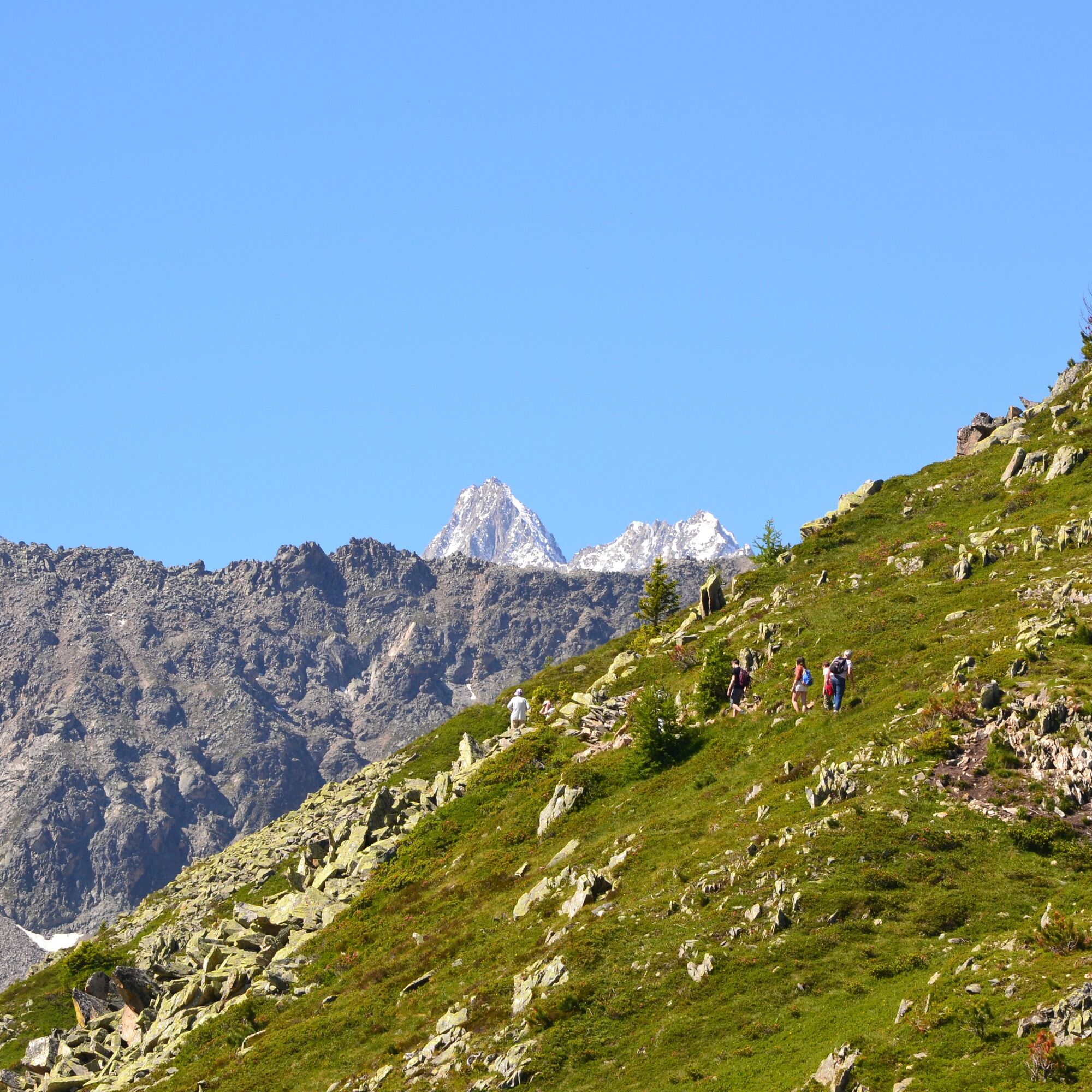
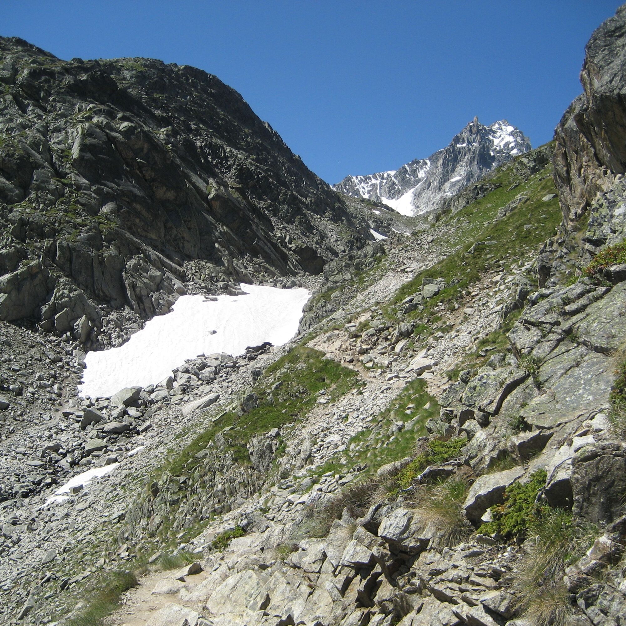

In Champex, take the chairlift from La Breya and follow the signs towards the Orny hut. The beginning of the hiking trail is relatively narrow and runs along a steep slope, but it becomes wider as you ascend to the ridge before crossing a wide slope above the Orny valley. Then continue along the moraines of the Orny glacier to the hut of the same name, where you can take a well-deserved first break. The path then continues through scree slopes and over the glacier. After the lake, descend to the firn of the Orny glacier and follow the signposts and the numerous tracks in the snow left by rope teams in the area. Do not leave the path under any circumstances, and if in doubt due to weather or glacier conditions, do not hesitate to turn back. Following the arrows painted on rocks and stones, you leave the firn and ascend to the foot of the Pointe d’Orny. After one final effort through a very steep slope, you reach the Trient hut, where the panorama from the terrace quickly makes you forget all your efforts. The entire route and reaching this second hut requires about four to five hours of walking time. For the return journey, take the same route or hike through the Val d’Arpette. Depending on the schedule, the operation of the La Breya chairlift may already be stopped, so the last part must be walked on foot.
Igen
Igen
Igen
Igen
We recommend:
Good footwear Weather-dependent clothing: always carry a waterproof vest Headgear Sunscreen Water bottle Picnic Camera Binoculars (optional) Hiking poles (optional) Printout of the hiking trail (click "Print" to download)
For certain hikes:
Swimsuit
The mountains, a place of joy for sharing and respecting. The mountain world is a place to meet and share unforgettable moments together—whether by bike or on foot. For everyone to benefit, it is essential to share this space with respect for nature and agriculture. Respectful behavior allows all to enjoy their leisure activities under the best conditions. Inform yourself about recommendations and rules. Assess your own skills and fitness well. Using the different routes is fundamentally at your own risk.
For all hikes:
Carry a map with you. Download the complete description of the hiking trail with a large-scale map by clicking "Print" at the top right of the page. Use only marked hiking trails and observe all signposts and instructions—for your safety, to protect grazing animals, and out of respect for wildlife. Close gates after passing. Behave considerately towards other trail users, plants, and animals.
For mountain hiking:
Carry additional sunscreen. UV rays at altitude can be very strong, even in cloudy weather. Plan your hike carefully: take into account the required fitness level of all participants, weather forecasts, and seasonal conditions. Weather conditions in the mountains can change very quickly and without warning. Appropriate clothing and sufficient provisions (food and drink) are very important. In uncertain weather, it is better to turn back early.
For high alpine hikes:
Inform your family about your hiking route. If possible, avoid hiking alone. Do not go on glaciers without a mountain guide. Observe warning signals indicating dangers at riverbanks, along waterways below dams and reservoirs: water levels can rise quickly and without warning.
Highway A9 towards Martigny, then E27 towards Gd-St-Bernard to Les Valettes, then direction "Champex".
By train to Orsières, then by bus to Champex, chairlift. The Breya chairlift is open daily from mid-June to mid-September.
Large parking lot at Breya chairlift
Further information about the destination: Champex-Lac
On the way back, dare to take the zip line at the La Breya mountain station. At 540 and 520 meters long, it is the longest zip line in western Switzerland.
Népszerű túrák a környéken
-
3,5
Lac d'Emosson - Gorge de la Veudale - Col de la Terrasse - Lac du Vieux Emosson zurück nach Lac d'Emosson
közepesKirándulás 14,3 km -
Geological hike to the Vieux-Emosson reservoir
nehézKirándulás 12,4 km -
Six blanc depuis Cabine
közepesSítúra 5,85 km -
5,0
Super mooi
nehézKirándulás 11,1 km -
Wallis Velo Tour: Verbier - Champéry (Stage 8)
nehézBiciklizés 105,5 km -
5,0
2nd half of the cross- completed
közepesTrailrunning 14,3 km -
4,5
Vineyard terrace hike in Martigny
könnyűKirándulás 6,36 km -
Great St. Bernard – Mythical Alpine passes
nehézBiciklizés 42,0 km -
Cabane Plan-du-Jeu / Bourg Saint-Pierre / lac des Toules
közepesKirándulás 13,9 km -
Tour through the Trient valley
nehézMountainbike 52,6 km
Túrázás & nyomkövetés


Ne maradjon le az ajánlatokról és az inspirációról a következő nyaralásához!
Az Ön e-mail címe hozzá lett adva a levelezőlistához.