


Route tip 100 (shortcut WE-WS) - 2nd Raderlebnistag Niederrhein 2025


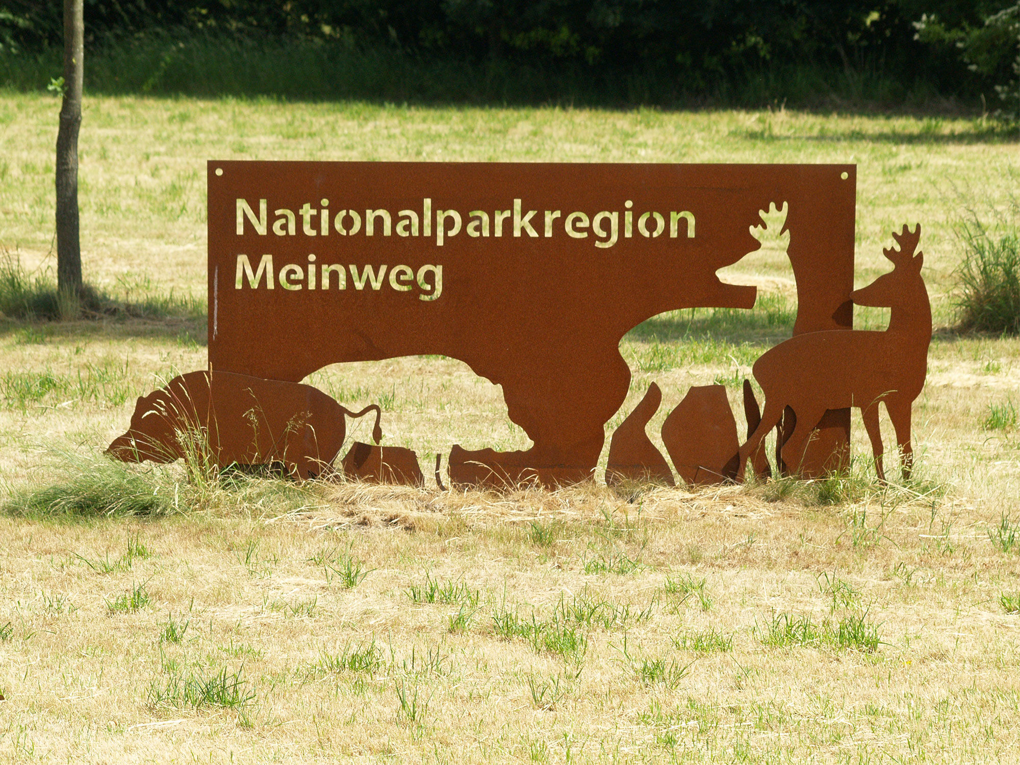
The tour from Wegberg goes via Tüschenbroich with its pond, castle, and two water mills to Wassenberg. Then you cycle through the forests of the Meinweg National Park region - past the motte "Alde Berg"...
The tour from Wegberg goes via Tüschenbroich with its pond, castle, and two water mills to Wassenberg. Then you cycle through the forests of the Meinweg National Park region - past the motte "Alde Berg" near Arsbeck - back to Wegberg.


The starting point chosen in this route description is Wegberg.
From the Wegberg information point (Wegberger Mühle, Rathausplatz 21, 41844 Wegberg) you cycle towards KP 72 through the valley of the Schwalm. The KPs 72, 73, 74 and 29 guide you to the edge of the Wassenberg Horst. Cycling downhill, follow the signs to KP 21 up to the corner of Pontorsonallee / Parkstraße. Into the latter, you cycle left towards KP 21, pass through Wassenberg’s old town, and reach KP 28 at Elsum Castle. Then head towards KP 27 and KP 75 uphill into the wooded Wassenberg Horst. From the junction 76 in Dalheim-Rödgen, the route leads to KP 77 in Arsbeck-Büch. Along a railway line, it goes back to Wegberg to KP 71. Shortly before this junction, you reach the information point, the Wegberger Mühle.
Points of interest on the route:
From Wegberg (Wegberger Mühle, Rathausplatz 21, 41844 Wegberg), you cycle to KP 72, crossing the Grenzlandring, which runs around Wegberg and was used for major car and motorcycle races for several years (from 1948 to 1952). One of the most serious accidents in international motor racing history abruptly ended motorsport on the ring.
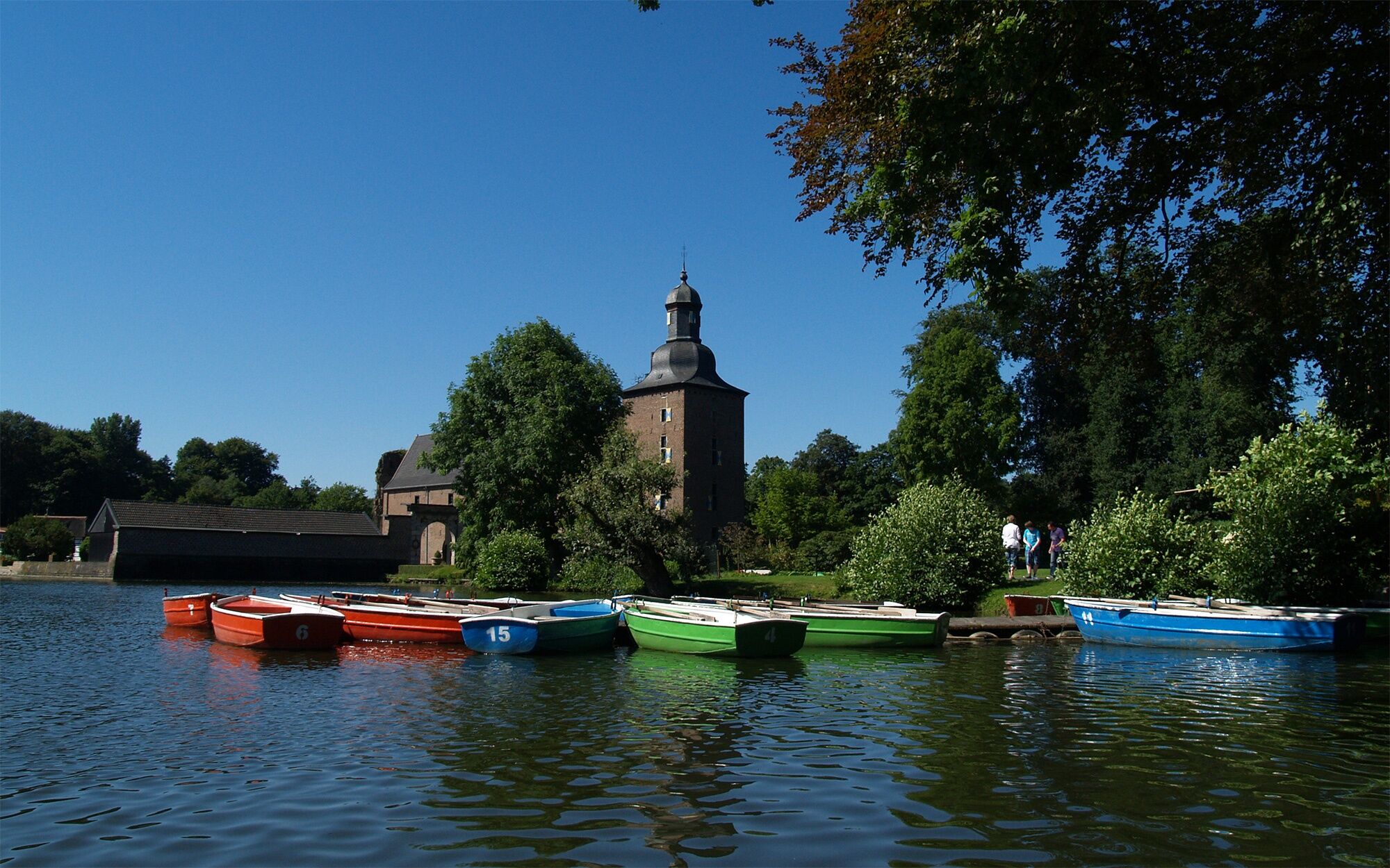
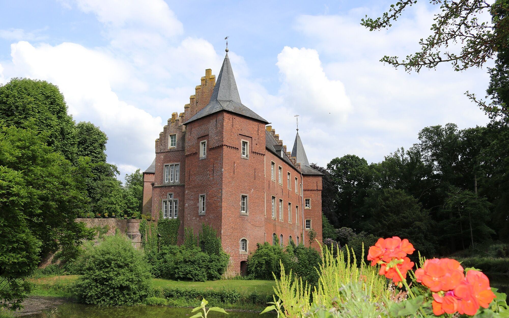
Along the Schwalm, the route passes several water mills – only some of which are still recognizable as such today – to KP 72 at Tüschenbroich Castle.
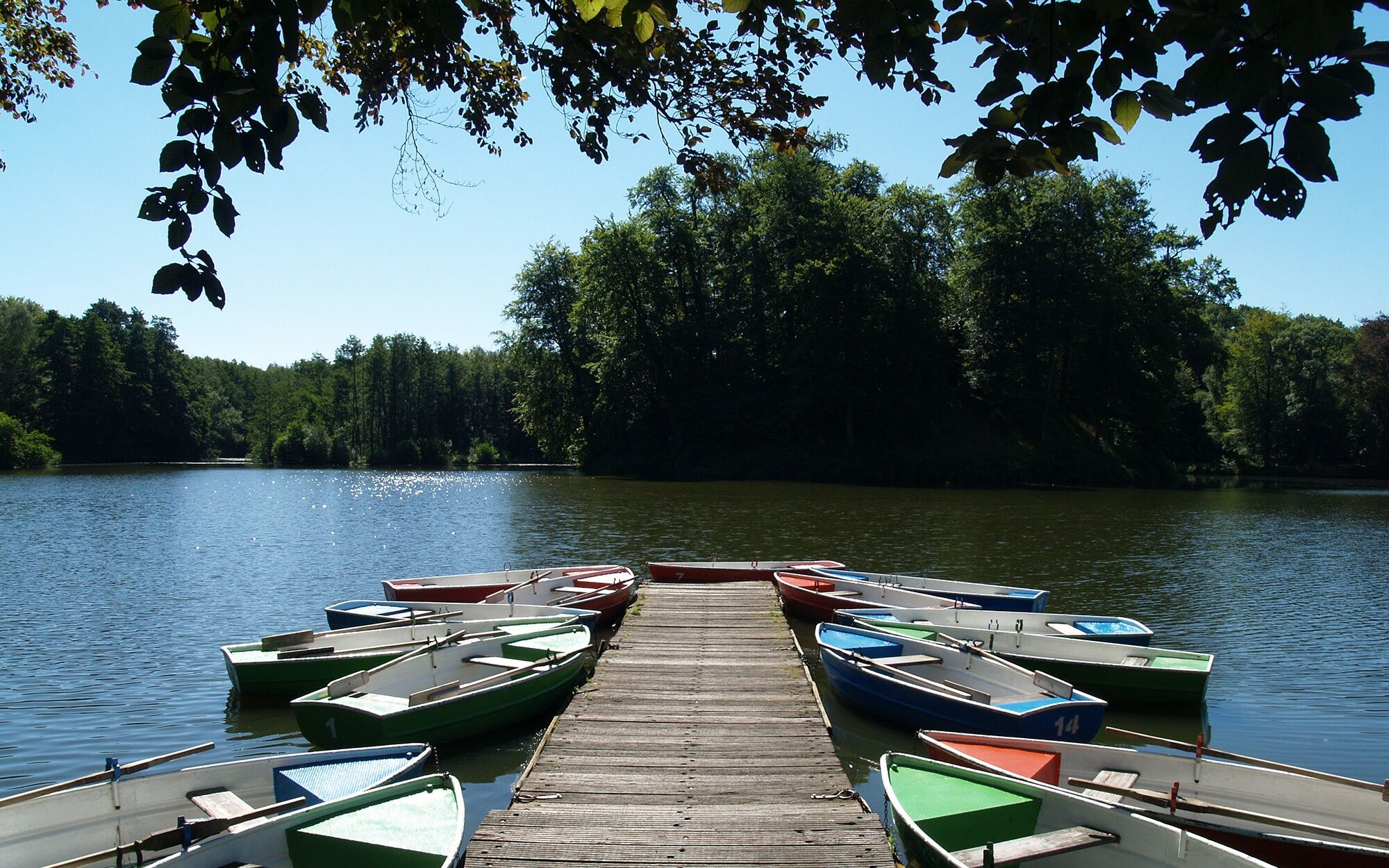
Since Carolingian times, there has been a castle here. Originally, there was a motte (an earthwork castle fortified with palisades) in the middle of the pond, first documented in 1172. These buildings burned down during the Thirty Years’ War. In 1624, Franz von Spiering bought the war-damaged Tüschenbroich for 24,200 Reichstaler. He had the current manor built as a water castle on the "mainland," with the main building—a 35-meter-long brick building with a tower—constructed. Work on the castle continued into the 18th century. It is privately owned and only viewable from the outside. Two mills lie on the lake’s shores; you can go boating or play a game of mini-golf.
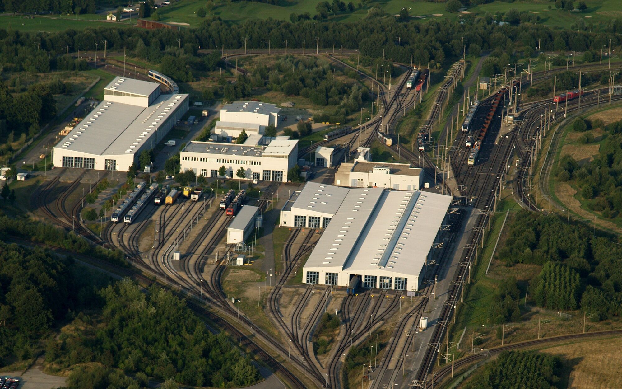
Then the route continues to KP 73 at the end of Tüschenbroich village and through the former Royal Air Force airfield, now the test center for rail vehicles, to KP 74.
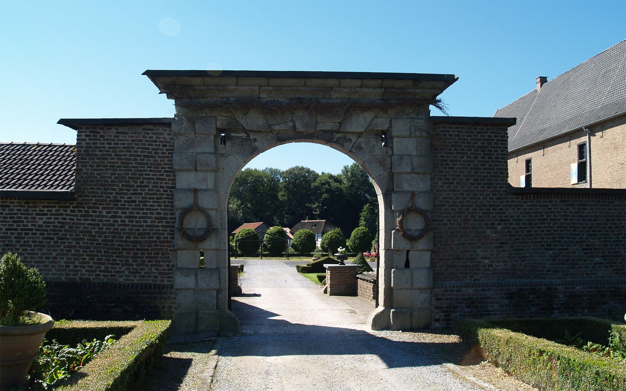
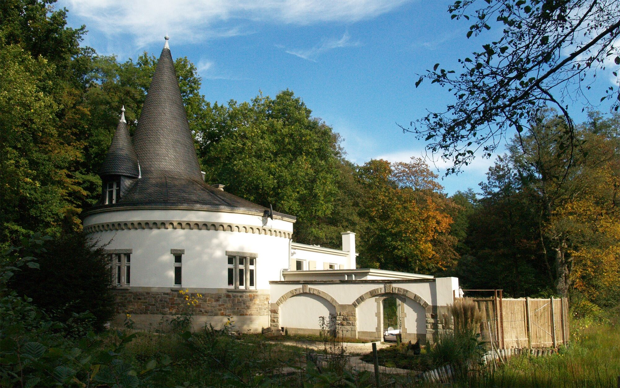
A short detour to the Haus Wildenrath nature conservation station is worthwhile here. Once a Franconian farm and later a knight’s estate, Haus Wildenrath was owned in the 12th century by the counts of Wassenberg. The current buildings date from the 17th century and were used as a farm until the 1960s. The listed farm complex now houses the Haus Wildenrath Nature Conservation Station. Ecological research is conducted here, and numerous nature-education programs are offered. These include landscape management and the keeping of endangered domestic and farm animal breeds.
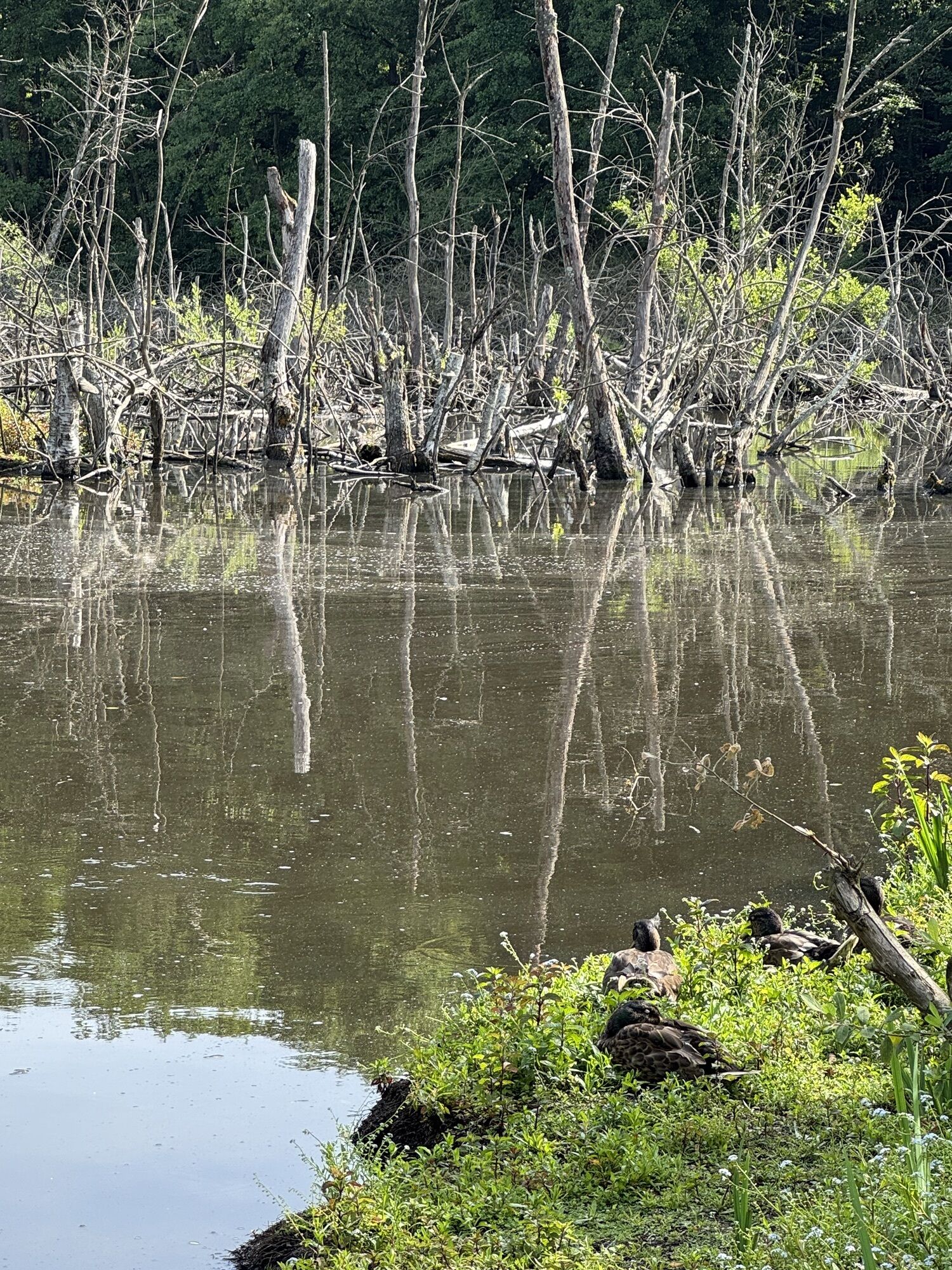
From Haus Wildenrath, narrow paths lead through the Schaagbachtal nature reserve—especially notable is the premium hiking trail "Birgeler Urwald."
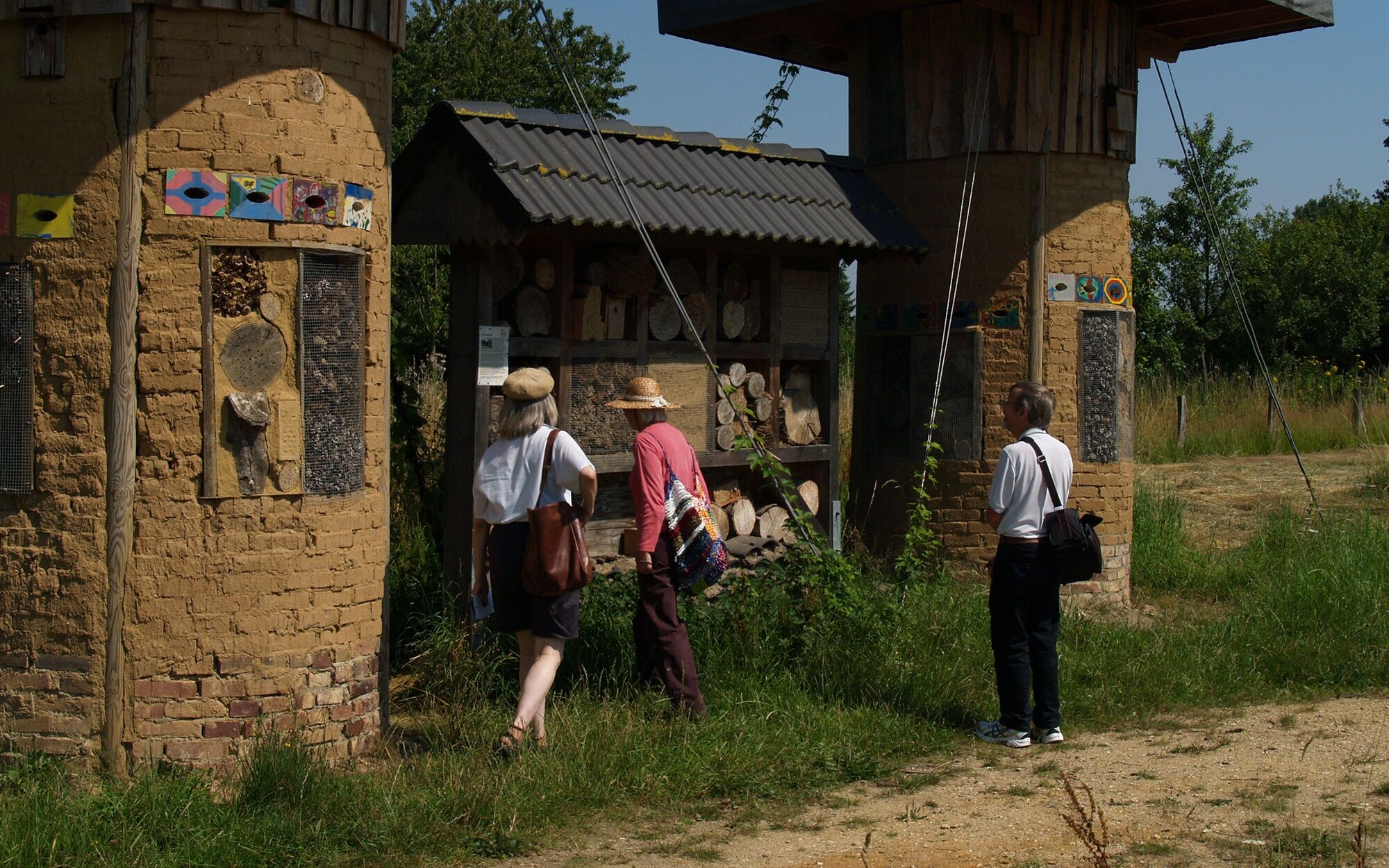
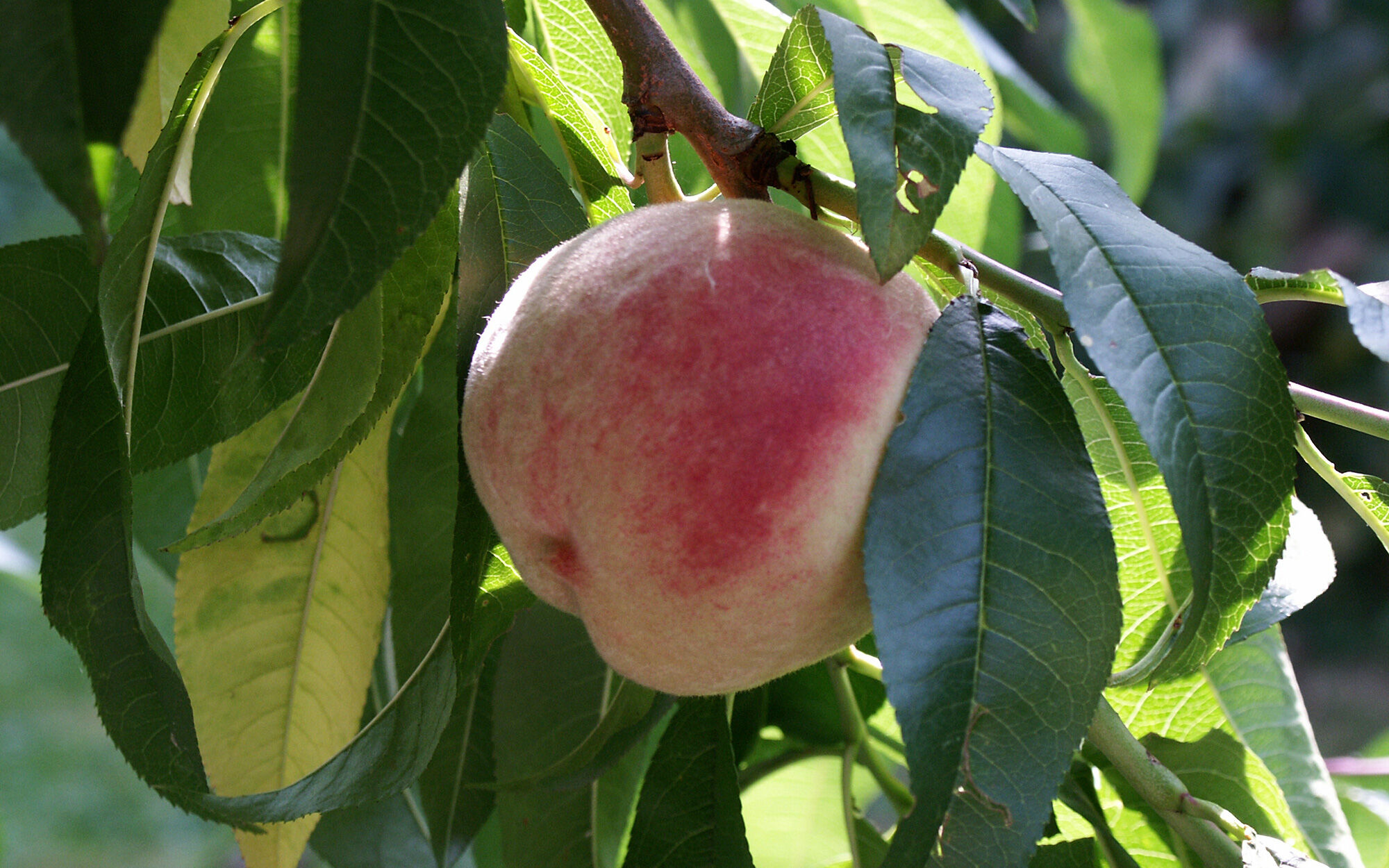
On the way to KP 29 in Myhl, on the right side, is the orchard garden, which is dedicated to preserving old fruit varieties. On the site of an old peach plantation between Wildenrath and Wassenberg on the B221, the Haus Wildenrath Nature Conservation Station, supported by the Rhineland Landscape Association (LVR), has been developing the orchard garden since 2009.
Now you descend into the valley of the Rur, heading towards KP 21 in Wassenberg. You cycle past the Wingertsmühle, which served as an oil mill since the 16th century and burned down at the beginning of the 19th century. The mill was repeatedly rebuilt and now stands – without wings – among tall trees. The narrow path leads straight to Pontorsonallee, which you cycle uphill to the Wassenberg information point (Nature Park Gateway, Pontorsonallee 16, 41849 Wassenberg). Back to the corner of Pontorsonallee / Parkstraße, you cycle right into the latter and follow the signs to KP 21.
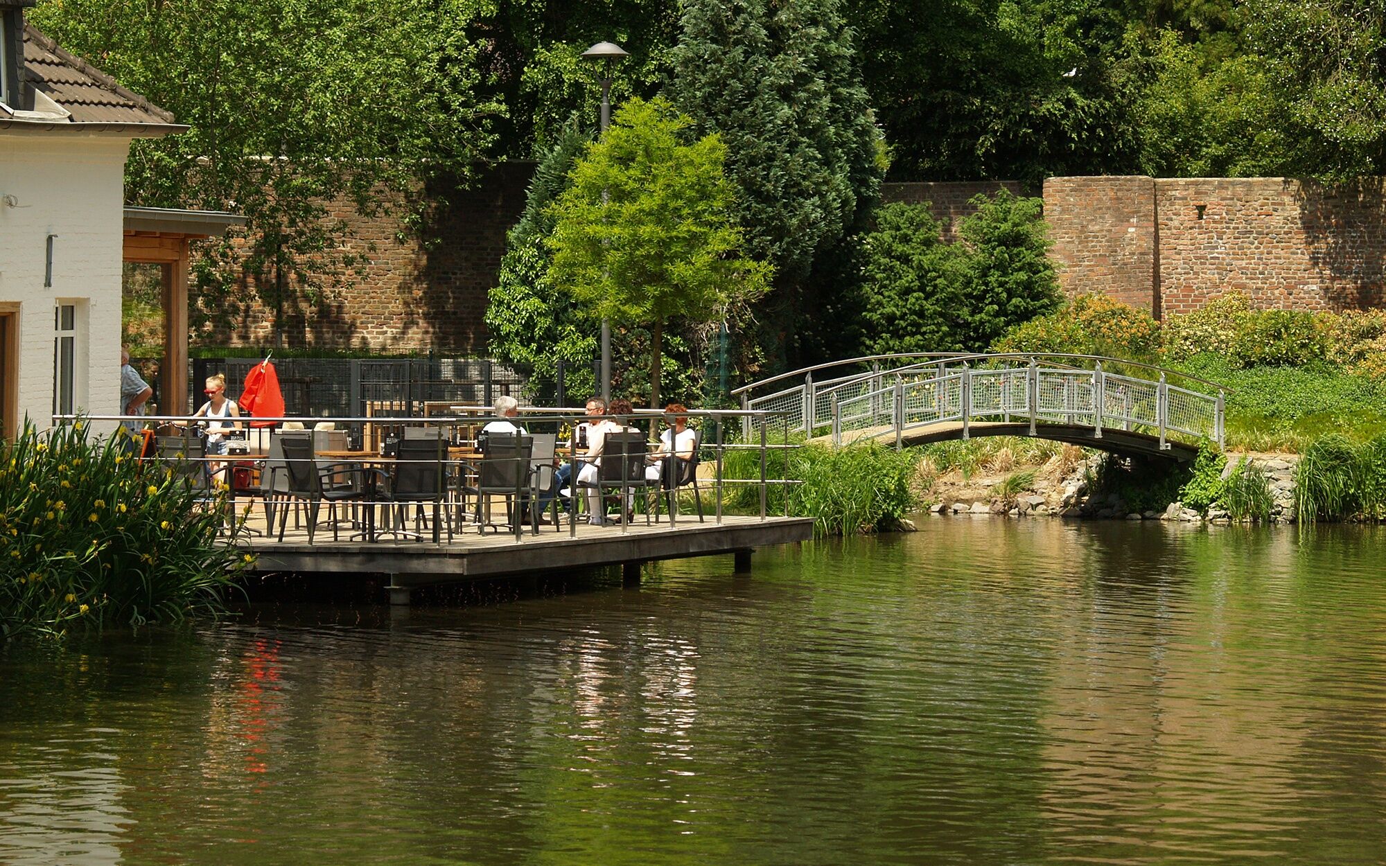
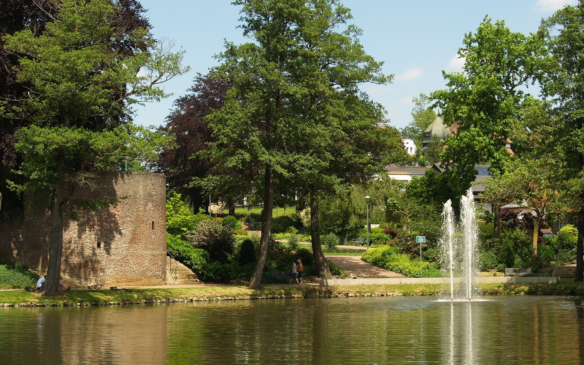
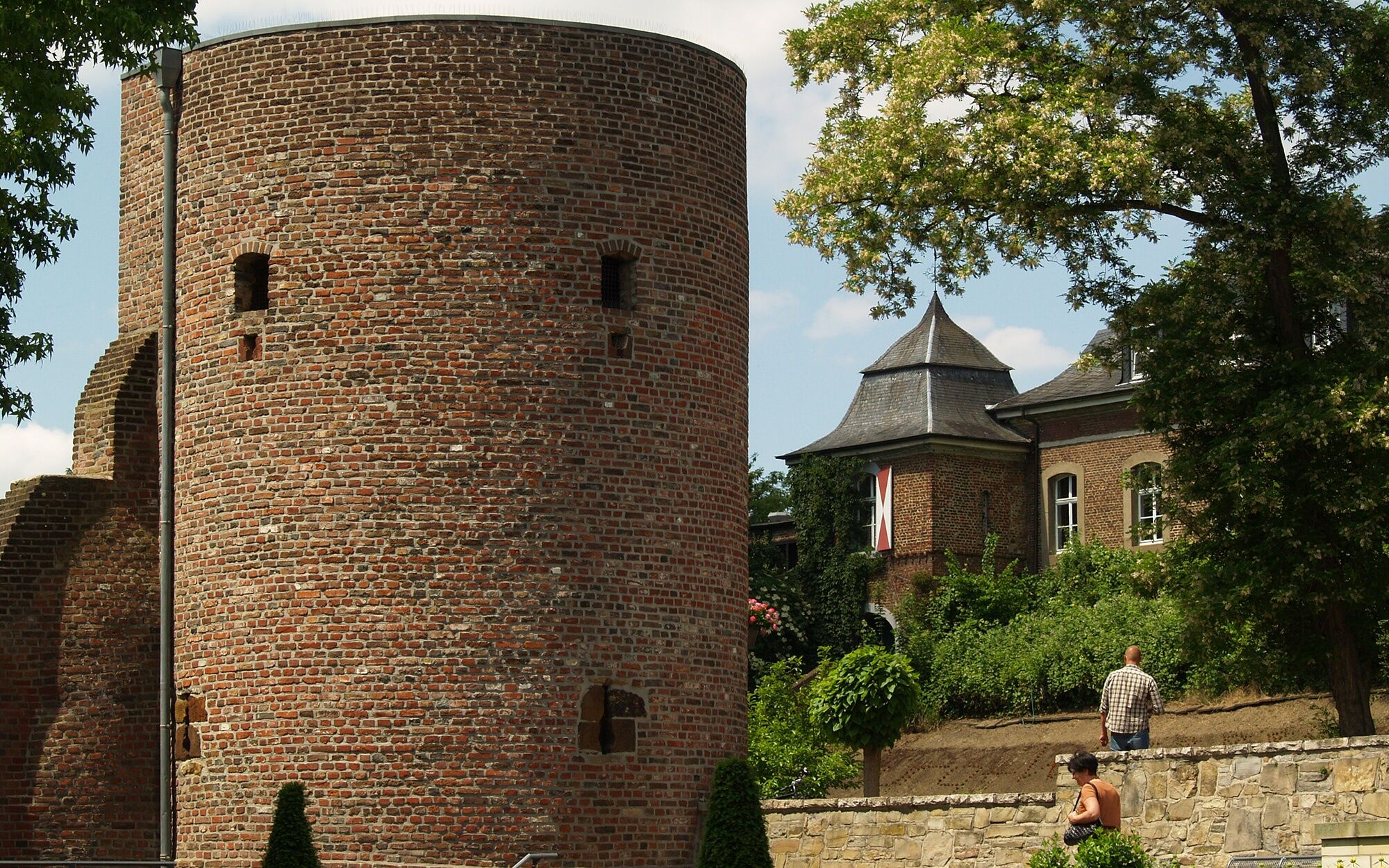
On this route, you pass the Wassenberg Gondelweiher, the Verlorenenturm (where people sentenced to death in the Middle Ages were imprisoned before execution – hence the name), through small alleys to Rosstorplatz with its medieval gate fortifications and the old town hall to the Roßtor.
From here, follow the signs to KP 28 and cycle through the open Rur valley, where the Rhine and Maas flowed alternately hundreds of thousands of years ago, depositing sand and gravel, which are still mined here. From the open fields, you have a beautiful view of the wooded heights of the Wassenberg Horst with many small stream valleys that drain rainwater into the Rur.
At KP 28 lies Elsum Castle, a small water-surrounded complex. The castle is a two-part building consisting of the core castle, built at the beginning of the 16th century, and the outer bailey, which was built at the beginning of the 17th century. The core castle stands on an irregularly rectangular artificial island surrounded by walls. It is accessible from the outer bailey via a bridge. The manor house has three towers. Also on the island next to the manor house is the castle chapel, built in 1860 in the Neo-Gothic style. (The castle is still privately owned and not open to visitors.)
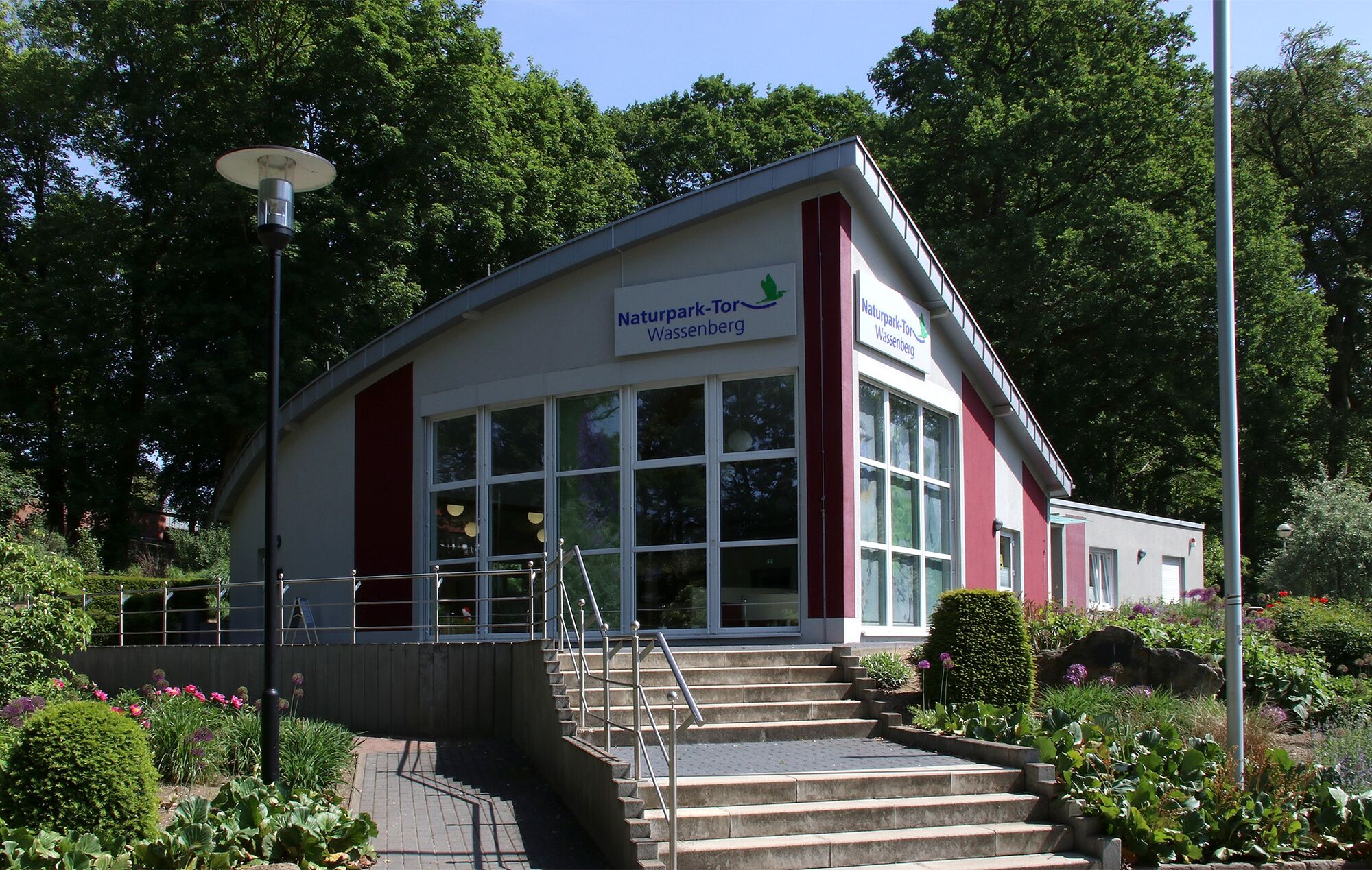
Through Birgelen, the route climbs to KP 27 — a height difference of about 50 meters must be overcome. On the way to KP 75, you cross the Schaagbachtal nature reserve. The entire town area of Wassenberg belongs to the Maas-Schwalm-Nette Nature Park due to its rich nature and plant world. You can obtain information at the Nature Park Gateway Wassenberg information point (Pontorsonplatz, Wassenberg). Since 2024, Wassenberg has been allowed to bear the title "climatic spa."
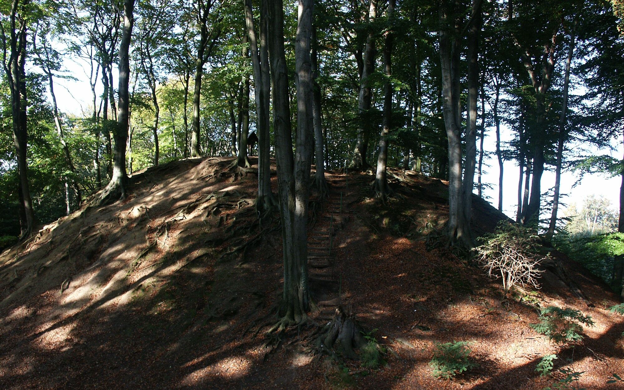
KP 76 is located in Dalheim-Rödgen; now follow the signs towards KP 77. Stop at the ponds on "Anton-Raky-Straße" and take a short trip to the motte "Alde Berg" behind the water surface. The motte is a tower hill castle from the high and late Middle Ages and is located in the Helpensteiner Bachtal. The site consisted of a massive hill and a large outer bailey. Beeches grow on the site today. Little is known about the early history of the motte. It is assumed to have been built in the late 12th century.
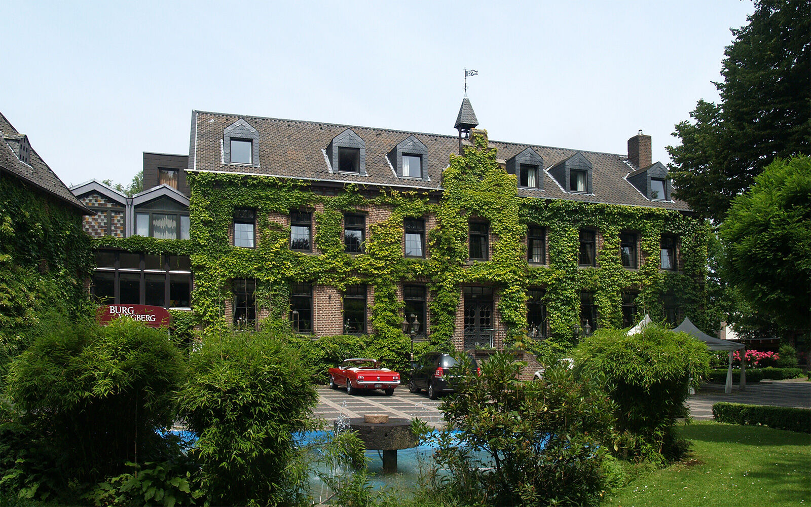
The path leads along a railway line from KP 77 further towards KP 71. Shortly before reaching this, you cycle past Wegberg Castle and then arrive back at the starting point, the Wegberger Mühle.
Igen
Igen
To participate in the Raderlebnistag competition, you need a smartphone to scan QR codes. This involves questions that can only be solved and entered at the starting points. Photos can also be uploaded and posted. Registration is voluntary; you can also ride along without it. The former central tombola has been replaced by an online competition. Three high-quality prizes await. Starter cards are no longer available.
Additionally, you should be well equipped for the tour with weather-appropriate clothing, enough water, and some provisions.
Please observe cycling traffic rules and be considerate of others.
By bike
Whether you arrive from Germany or the Netherlands, thanks to its junctions, the cycling network in Heinsberger Land is seamlessly connected to all cycling networks of neighbouring regions, so you can easily "ride in" from all directions. Overregional cycling routes leading into the region include the RurUfer cycle path, the Lower Rhine route, and the Green route. If you travel by car/train/bus and bike, you will find a convenient entry point to the route network from every station or every tourist destination.
By car
Heinsberger Land is accessible via the federal motorways A 52 (north), A 46 (east), and A 44 (south), as well as the Dutch A 2 (west). The cities Aachen, Cologne, Düsseldorf, Duisburg, and Mönchengladbach, as well as Maastricht and Eindhoven on the Dutch side, are all within 60 kilometres.
The main federal roads running north-south are the B 221 and B 57; east-west run the B 56 and B 56n, which connects the A 46 and the Dutch A 2. A dense network of state, district, and municipal roads is available for regional traffic. Pay attention to the tourist signposting on site. It will surely lead you to your tourist destinations.
By plane
The internationally important airports Düsseldorf International and Cologne-Bonn Airport can be reached by car in 45 and 60 minutes respectively. Airport Weeze at the northern Lower Rhine and the Eindhoven Airport and Aachen-Maastricht Airport on the Dutch side are also about an hour’s drive away.
By train
Heinsberger Land is connected to the German rail network by three rail lines. The Aachen – (Heinsberg) – Düsseldorf rail line allows access via the stations Übach-Palenberg, Geilenkirchen, Lindern, Brachelen, Baal, and Erkelenz. From Lindern, it goes to Heinsberg (HS) via the stations HS-Randerath, HS-Horst, HS-Porselen, HS-Dremmen, HS-Oberbruch, HS-Kreishaus. The greater Wegberg area is accessible via the Dalheim – Rheydt/Mönchengladbach line (stations: Dalheim, Arsbeck, Wegberg). Additionally, the Aachen – Eindhoven line connects to the Dutch stations Roermond and Sittard.
You can join this tour at the stations of Wegberg and Arsbeck.
www.bahn.de
By bus
The bus network in Heinsberger Land is operated by WestVerkehr GmbH and is connected to the Aachen Transport Association (AVV). The AVV tariffs apply. For information and timetable: www.avv.de Additionally, the so-called MultiBus is available district-wide. It is a demand-responsive service by WestVerkehr GmbH. Passengers simply call about 60 minutes before the planned departure and receive information when the MultiBus will pick them up at the next MultiBus stop (Tel.: +49 2431 886688).
More info: www.west-verkehr.de
Train & bike
Generally, traveling by train with a bicycle is possible without problems. The Deutsche Bahn timetable shows which trains carry bicycle wagons. Since space for bicycles is limited, groups should register in advance with the railway. www.bahn.de
Bus & bike
On the buses in Heinsberger Land, bicycle transport is possible from Monday to Friday after 7 p.m., Saturdays after 3 p.m., and all day on Sundays and holidays. A maximum of two bicycles are carried per vehicle.
By bus and bike through Heinsberger Land – the "Fahrradbus Region Heinsberg"
During the season, the "Fahrradbus Region Heinsberg" on all Saturdays and Sundays/holidays transports excursionists with and without bikes to the respective starting point of their tour and picks them up again afterwards. While you sit comfortably in a West-MultiBus, your bicycle is transported safely in the accompanying bike trailer. The buses have seating for 7 persons. The bike trailer can carry up to 16 bikes. By the way, if you arrive by train, the bike bus will pick you up directly at the railway stations in Heinsberger Land.
The bike buses run between 9:00 a.m. and 8:00 p.m. and serve many stops. They follow no fixed route or schedule, but you can pre-order the bike bus at the MultiBus central office to the desired time at the desired stop. For your desired date, book a seat on the WestBikeBus via the MultiBus hotline 02431/886688 (at least one day before the tour). Whether cycling tour or hiking trip, with the bike bus you can easily reach the most beautiful routes in Heinsberger Land and enjoy a relaxed start or finish to your tour.
A tariff overview and special offers for groups can be found at www.west-verkehr.de
The Selfkantbahn,
the only and last narrow-gauge steam railway in North Rhine-Westphalia, is not only a popular excursion destination, but still serves as a means of transport: passengers and their bicycles are gladly taken along. It usually runs from Easter to the end of September on Sundays and holidays between the stations Gangelt-Schierwaldenrath and Geilenkirchen-Gillrath.
www.selfkantbahn.de
Wegberg: parking at Wegberger Mühle (paid) or parking on Venloer Straße
Wassenberg: parking at Naturpark-Tor, Pontorsonallee 16, 41849 Wassenberg
WFG for the district of Heinsberg mbH
Heinsberger Land
Tel.: +49 2452 131415 Fax: 131419
Email: info@heinsberger-land.de
Website: www.heinsberger-land.de
Stroll through the center of Wegberg after completing the route.
Népszerű túrák a környéken
-
4,8
Premium-Wanderweg Birgeler Urwald - Wasser.Wander.Welt.
közepesKirándulás 14,2 km -
The RurUfer cycle path in Heinsberger Land
könnyűBiciklizés 27,9 km -
Meinweg
könnyűKirándulás 16,2 km -
4,0
Traumweg Wildes Schaagbachtal
könnyűKirándulás 8,92 km -
4,5
2 Seen Tour Hariksee und Borner See #LL2ROM V05
könnyűKirándulás 7,74 km -
4,0
Premium-Wanderweg Schwalmbruch - Wasser.Wander.Welt.
közepesKirándulás 15,0 km -
5,0
Route tip 106 - 2nd Raderlebnistag Niederrhein 2025
közepesBiciklizés 45,8 km -
4,0
Routentipp 103 - 2. Raderlebnistag Niederrhein 2025
közepesBiciklizés 40,0 km -
Right and left of the Rur in Heinsberg Land - change is the only constant
közepesBiciklizés 49,2 km -
Cross-border asparagus route in Heinsberger Land
könnyűBiciklizés 35,2 km
Túrázás & nyomkövetés


Ne maradjon le az ajánlatokról és az inspirációról a következő nyaralásához!
Az Ön e-mail címe hozzá lett adva a levelezőlistához.